Sussex_administrative_map_1832.png

Size of this preview:
800 × 343 pixels
.
Other resolutions:
320 × 137 pixels
|
640 × 275 pixels
|
1,024 × 440 pixels
|
1,280 × 549 pixels
|
2,500 × 1,073 pixels
.
Summary
| Description |
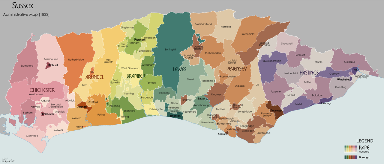
English:
Administrative map of the ancient county of Sussex in 1832. Showing Rapes, Hundreds, Boroughs. Source data on parish boundaries - Kain, R.J.P., and Oliver, R.R. (2001) "Historic parishes of England and Wales: Electronic Map - Gazetteer - Metadata", Colchester: History Data Service.
ISBN
0 9540032 0 9
. Source data for Boroughs: H.M.S.O. Boundary Commission Report 1832 (courtesy of www.visionofbritain.org).
|
| Date | |
| Source | Own work |
| Author | XrysD |
Licensing
I, the copyright holder of this work, hereby publish it under the following licenses:
This file is licensed under the
Creative Commons
Attribution-Share Alike 3.0 Unported
license.
-
You are free:
- to share – to copy, distribute and transmit the work
- to remix – to adapt the work
-
Under the following conditions:
- attribution – You must give appropriate credit, provide a link to the license, and indicate if changes were made. You may do so in any reasonable manner, but not in any way that suggests the licensor endorses you or your use.
- share alike – If you remix, transform, or build upon the material, you must distribute your contributions under the same or compatible license as the original.

|
Permission is granted to copy, distribute and/or modify this document under the terms of the GNU Free Documentation License , Version 1.2 or any later version published by the Free Software Foundation ; with no Invariant Sections, no Front-Cover Texts, and no Back-Cover Texts. A copy of the license is included in the section entitled GNU Free Documentation License . |
You may select the license of your choice.