Sutherland_Flow_Country.jpg
No higher resolution available.
| Description |
English:
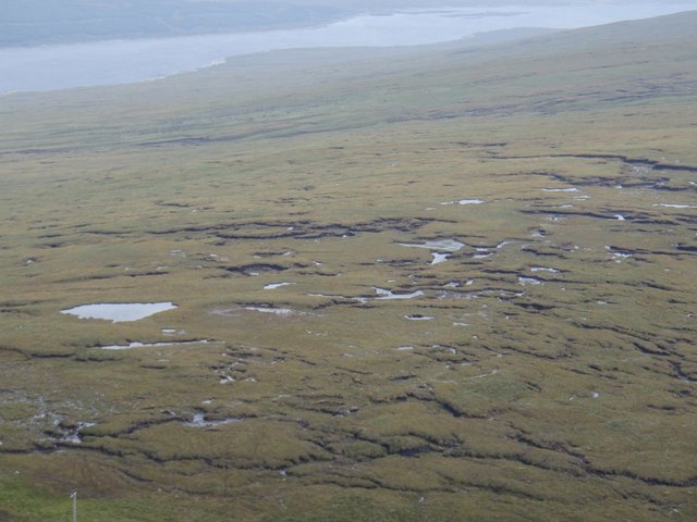
The
en:Flow Country
in
en:Sutherland
. A very small part of the 4000 sq km blanket bog in Sutherland and Caithness taken from near the top of Maovally. The drizzle encourages the feeling of total saturation! The lochans seems to follow the line of the watershed. The ridges seem to be bog "stretch marks" as it flows down the slope in the foreground to Glen Cassley and in the background to Loch Shin.
|
| Date | |
| Source | From geograph.org.uk |
| Author | Graeme Smith |
|
Permission
( Reusing this file ) |
Creative Commons Attribution Share-alike license 2.0 |
|
Attribution
( required by the license ) |
Graeme Smith / Sutherland Flow Country / |
| Camera location |
|
View this and other nearby images on: OpenStreetMap |
|
|---|

|
This image was taken from the
Geograph project
collection. See
this photograph's page
on the Geograph website for the photographer's contact details. The copyright on this image is owned by
Graeme Smith
and is licensed for reuse under the
Creative Commons
Attribution-ShareAlike 2.0 license.
|
This file is licensed under the
Creative Commons
Attribution-Share Alike 2.0 Generic
license.
Attribution:
Graeme Smith
-
You are free:
- to share – to copy, distribute and transmit the work
- to remix – to adapt the work
-
Under the following conditions:
- attribution – You must give appropriate credit, provide a link to the license, and indicate if changes were made. You may do so in any reasonable manner, but not in any way that suggests the licensor endorses you or your use.
- share alike – If you remix, transform, or build upon the material, you must distribute your contributions under the same or compatible license as the original.