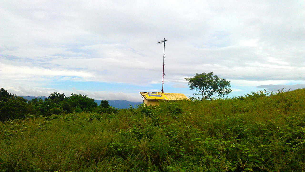
Taal_Volcano_Remote_Monitoring_Station.jpg


Summary

Description
English: A solar-powered remote monitoring station located at Taal Volcano island. It sends data to its base station at the Taal Volcano Observatory at Talisay, Batangas 6.7 kilometers away at 358 degrees bearing.
Date
Source Own work
Author Ervin Malicdem
Permission
( Reusing this file )
I, the copyright holder of this work, hereby publish it under the following licenses:
GNU head Permission is granted to copy, distribute and/or modify this document under the terms of the GNU Free Documentation License , Version 1.2 or any later version published by the Free Software Foundation ; with no Invariant Sections, no Front-Cover Texts, and no Back-Cover Texts. A copy of the license is included in the section entitled GNU Free Documentation License .
w:en:Creative Commons
attribution share alike
You are free:
  • to share – to copy, distribute and transmit the work
  • to remix – to adapt the work
Under the following conditions:
  • attribution – You must give appropriate credit, provide a link to the license, and indicate if changes were made. You may do so in any reasonable manner, but not in any way that suggests the licensor endorses you or your use.
  • share alike – If you remix, transform, or build upon the material, you must distribute your contributions under the same or compatible license as the original.
You may select the license of your choice.
Creative Commons Share-alike Attribution If you choose to use this work under the Creative Commons license stated above, the author, Ervin Malicdem ( schadow1 ) , would like you to attribute the work to him (among other requirements such as indicating that the work is licensed under the Creative Commons) with the following text or similar:
© Ervin Malicdem , 2012.

His name should be a link to his Wikimedia Commons userpage . If a link is not possible, then the url should be placed in parentheses after the name. If the work has been substantially altered by other people (see the File history section below), then this particular attribution requirement is waived, which means you can attribute the work in any reasonable manner.


This attribution requirement is provided pursuant to the Creative Commons Attribution-ShareAlike mechanism where "you must attribute the work in the manner specified by the author or licensor (but not in any way that suggests that they endorse you or your use of the work.) And if you remix the work, it must be distributed with the same license." (See "Attribution" in the Creative Commons website.)
Camera location 14° 01′ 16.57″ N, 120° 59′ 56.33″ E Heading=3.2° Kartographer map based on OpenStreetMap. View this and other nearby images on: OpenStreetMap info

Initially published at Schadow1 Expeditions article http://www.s1expeditions.com/2012/12/taal-volcano-island-220masl.html

Captions

Add a one-line explanation of what this file represents

Items portrayed in this file

depicts

14°1'16.57"N, 120°59'56.33"E

heading : 3.2 degree

27 October 2012

image/jpeg