Tegucigalpa_Map_5.png
Size of this preview:
641 × 599 pixels
.
Other resolutions:
257 × 240 pixels
|
513 × 480 pixels
|
821 × 768 pixels
|
1,216 × 1,137 pixels
.
Summary
| Description |
English:
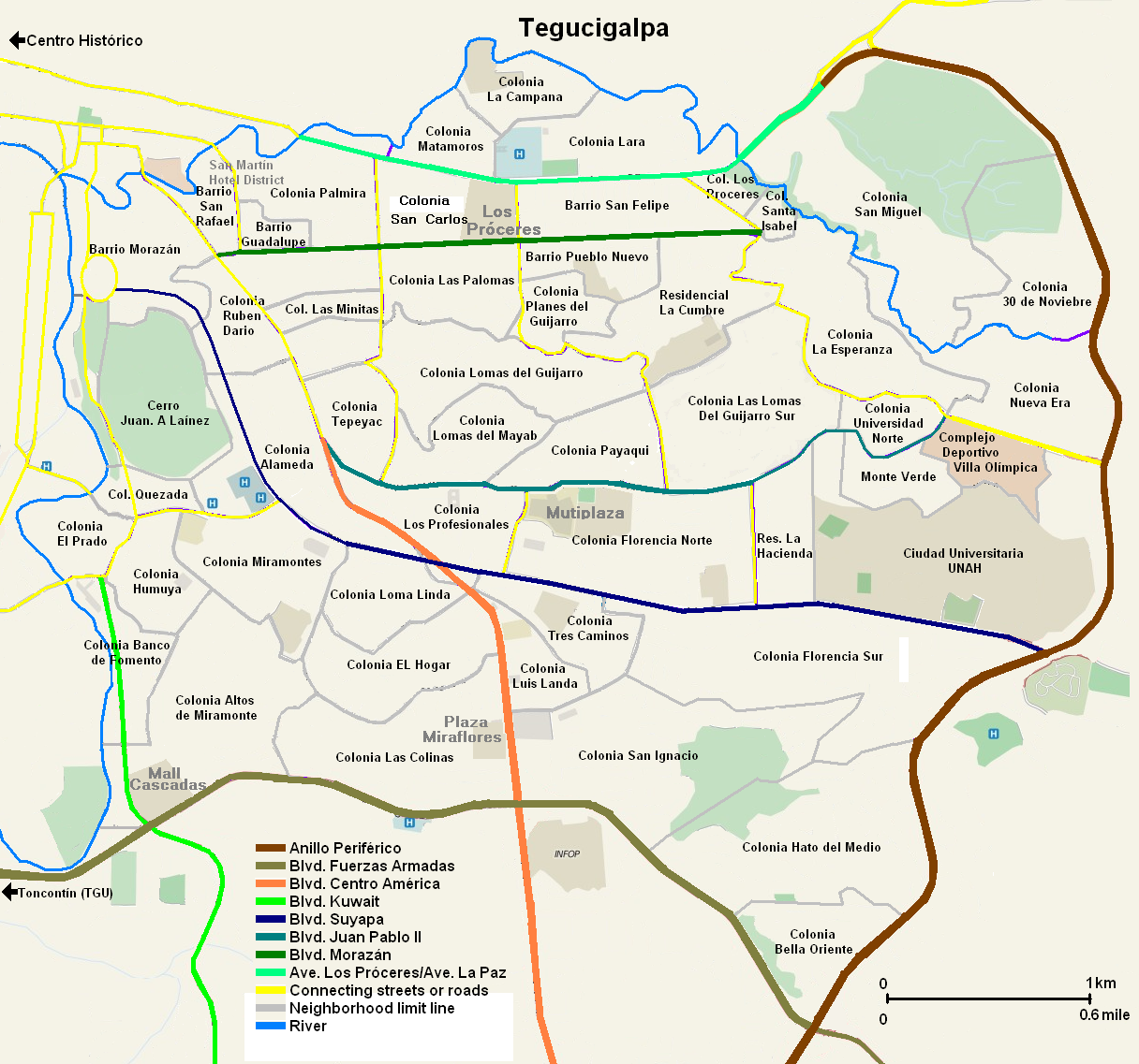
Map of the contemporary area of
Tegucigalpa
, M.D.C., the capital of
Honduras
.
Español:
Mapa de la zona contemporánea de Tegucigalpa, M.D.C., la capital de Honduras.
|
| Date | |
| Source | Own work |
| Author | Jaetguz |
This map was created using Microsoft graphics painting program based on actual mapping data provided by NASA satellite imaging and demographic data provided from the government of Honduras. Graphic is released to the public domain.
Licensing
I, the copyright holder of this work, hereby publish it under the following license:
This file is licensed under the
Creative Commons
Attribution-Share Alike 3.0 Unported
license.
-
You are free:
- to share – to copy, distribute and transmit the work
- to remix – to adapt the work
-
Under the following conditions:
- attribution – You must give appropriate credit, provide a link to the license, and indicate if changes were made. You may do so in any reasonable manner, but not in any way that suggests the licensor endorses you or your use.
- share alike – If you remix, transform, or build upon the material, you must distribute your contributions under the same or compatible license as the original.