The_Finnish_war_map1.svg

Size of this PNG preview of this SVG file:
555 × 600 pixels
.
Other resolutions:
222 × 240 pixels
|
444 × 480 pixels
|
711 × 768 pixels
|
948 × 1,024 pixels
|
1,895 × 2,048 pixels
|
1,329 × 1,436 pixels
.
Summary
| Description |
English:
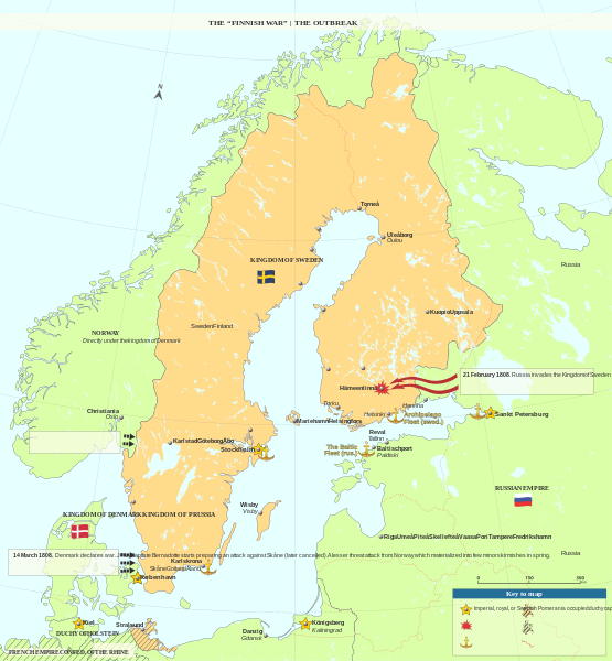
This is the first out of a 5 map series, visualizing the events of the war between Sweden and Russia. This map visualizes the outbreak of the war -occurred in February 1808- at a large scale (the whole of the Scandinavian peninsula)
|
| Date | |
| Source | Own work |
| Author | Geopsis |
This .svg file works perfectly when clicked as a "full resolution" file, though .png rendering and thumbnail doesn't. Feel free to fix the -probably font- problem and upload a fixed svg. Please try to keep the font format (italics, kerning, etc)
Licensing
I, the copyright holder of this work, hereby publish it under the following license:
This file is licensed under the
Creative Commons
Attribution-Share Alike 3.0 Unported
license.
-
You are free:
- to share – to copy, distribute and transmit the work
- to remix – to adapt the work
-
Under the following conditions:
- attribution – You must give appropriate credit, provide a link to the license, and indicate if changes were made. You may do so in any reasonable manner, but not in any way that suggests the licensor endorses you or your use.
- share alike – If you remix, transform, or build upon the material, you must distribute your contributions under the same or compatible license as the original.