The_Mid-Atlantic_States.png

Size of this preview:
800 × 520 pixels
.
Other resolutions:
320 × 208 pixels
|
640 × 416 pixels
|
1,024 × 665 pixels
|
1,513 × 983 pixels
.
Summary
| Description |
English:
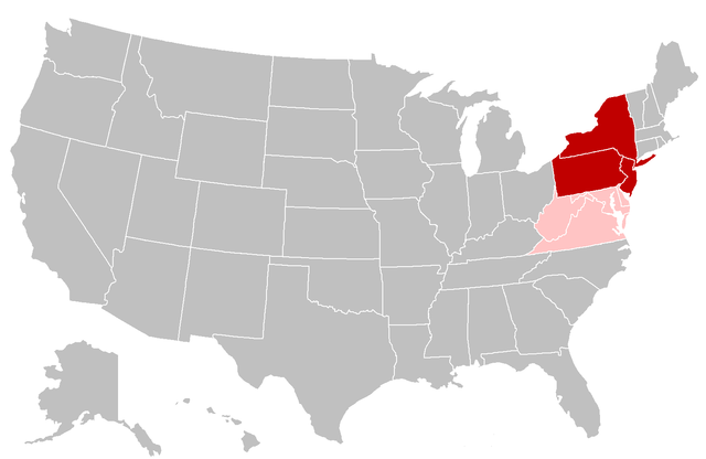
Map of the Mid-Atlantic United States. Red shading indicates the states most commonly defined as the Mid-Atlantic in their entirety (i.e. the southern portion of the Northeast) by public sector agencies and private organizations. Pink shading indicates states that are grouped in the region less frequently.
|
| Date | |
| Source | Modified from: File:BlankMap-USA-states.PNG |
| Author | Grayshi , Roke , Maher-shalal-hashbaz |
Licensing
This file is licensed under the
Creative Commons
Attribution-Share Alike 3.0 Unported
license.
-
You are free:
- to share – to copy, distribute and transmit the work
- to remix – to adapt the work
-
Under the following conditions:
- attribution – You must give appropriate credit, provide a link to the license, and indicate if changes were made. You may do so in any reasonable manner, but not in any way that suggests the licensor endorses you or your use.
- share alike – If you remix, transform, or build upon the material, you must distribute your contributions under the same or compatible license as the original.