The_maximum_extent_of_the_Safavid_Empire_under_Shah_Abbas_I.png
No higher resolution available.
Summary
| Description |
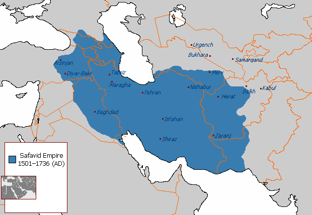
English:
The maximum extent of the Safavid Empire under Shah Abbas I.
فارسی:
حداکثر وسعت امپراتوری صفوی در زمان شاه عباس یکم.
|
||
| Source | File:Safavid_Empire_1501_1722_AD.png | ||
| Author | Arab_Hafez, edited by HistoryofIran (me). | ||
| Other versions |
|

Licensing
|
|
This map is
ineligible for
copyright
and therefore in the
public domain
, because it consists entirely of information that is common property and contains no original authorship. For more information, see
Commons:Threshold of originality § Maps
.
|