Timezoneswest.PNG
Size of this preview:
720 × 599 pixels
.
Other resolutions:
288 × 240 pixels
|
577 × 480 pixels
|
923 × 768 pixels
|
1,230 × 1,024 pixels
|
1,337 × 1,113 pixels
.
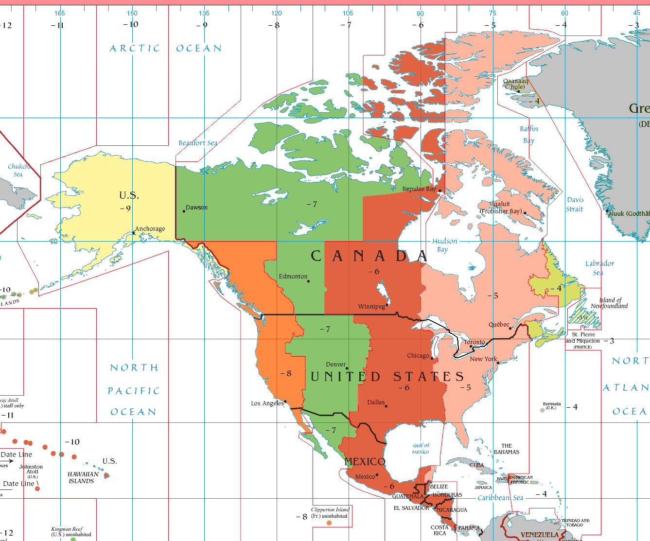
Summary
| Description |
English
(en):
Map showing the Standard Time Zones of the North America
UTC-9
UTC-8
UTC-7
UTC-6
UTC-5
UTC-4
Outside of North America
|
| Source |
Source:
CIA World Factbook
, uncopyrighted.
PDF version |
| Author | CIA World Factbook |

|
This
map
image could be re-created
using
vector graphics
as an
SVG
file
. This has several advantages; see
Commons:Media for cleanup
for more information. If an SVG form of this image is available, please upload it and afterwards replace this template with
{{

vector version available

|

new image name

}}
.
It is recommended to name the SVG file “Timezoneswest.svg”—then the template Vector version available (or Vva ) does not need the new image name parameter. |
Licensing
|
|
This image is in the
public domain
because it contains materials that originally came from the United States
Central Intelligence Agency
's
World Factbook
.
|

|