Tobago_parishes.svg

Size of this PNG preview of this SVG file:
800 × 550 pixels
.
Other resolutions:
320 × 220 pixels
|
640 × 440 pixels
|
1,024 × 703 pixels
|
1,280 × 879 pixels
|
2,560 × 1,759 pixels
|
872 × 599 pixels
.
Summary
| Description |
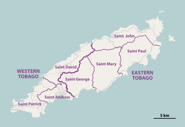
Deutsch:
Karte der
parishes
von
Tobago
English:
Map of the parishes of
Tobago
|
||||||||||||
| Date | |||||||||||||
| Source | http://tobagoborn.com/tobago/census/tobago_introv2.html | ||||||||||||
| Author | NordNordWest | ||||||||||||
|
Permission
( Reusing this file ) |
|
||||||||||||
| SVG development |
This
map
was created with
Adobe Illustrator
by NordNordWest.
|

|
This map has been made or improved in the German
Kartenwerkstatt
(Map Lab)
. You can
propose maps
to improve as well.
|