Topographical_map_of_the_Antipodes_Islands_in_English.svg

Size of this PNG preview of this SVG file:
760 × 600 pixels
.
Other resolutions:
304 × 240 pixels
|
608 × 480 pixels
|
973 × 768 pixels
|
1,280 × 1,010 pixels
|
2,560 × 2,020 pixels
|
1,242 × 980 pixels
.
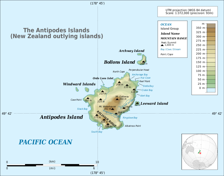
Summary
| Description |
English:
Detailed map of large dimensions. For superior viewing, click on the link of the image above.
Topographic map in English of the
Antipodes Islands
near
New Zealand
.
|
|||
| Date | (UTC) | |||
| Source |
Own work
This
vector image
includes elements that have been taken or adapted from this file:
|
|||
| Author | Matthewedwards | |||
|
Permission
( Reusing this file ) |
I, the copyright holder of this work, hereby publish it under the following license:
|
|||
| Other versions |
|
|||
| SVG development |


_2.svg)