Trails_of_Tears_en.png

Size of this preview:
785 × 600 pixels
.
Other resolutions:
314 × 240 pixels
|
628 × 480 pixels
|
1,005 × 768 pixels
|
1,280 × 978 pixels
|
2,025 × 1,547 pixels
.
Summary
| Description |
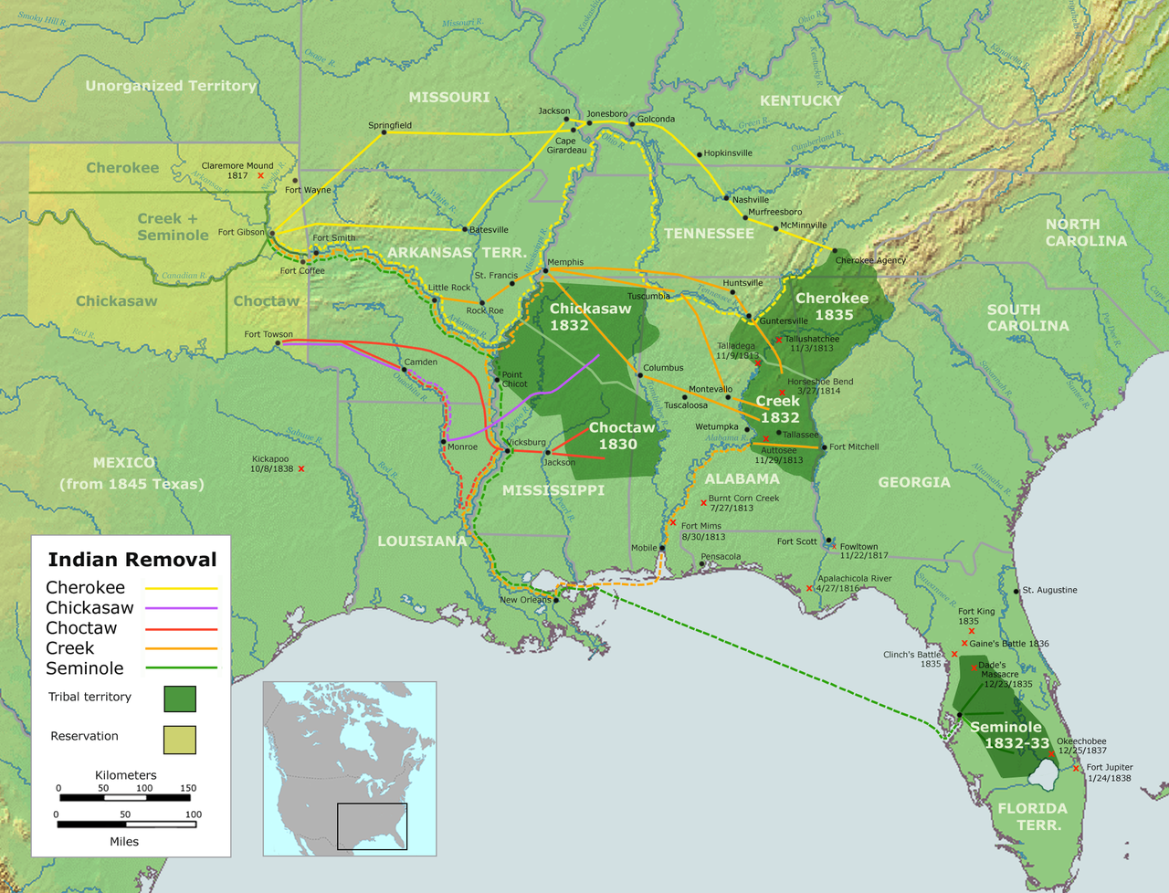
English:
Map of the route of the
Trails of Tears
— depicting the route taken to relocate Native Americans from the Southeastern United States between 1836 and 1839.
|
||||
| Date | |||||
| Source |
Own work using::
|
||||
| Author | User:Nikater | ||||
|
Permission
( Reusing this file ) |
|
||||
| Other versions |
|
