Trinity_Test_Fireball_16ms.jpg
Size of this preview:
800 × 539 pixels
.
Other resolutions:
320 × 216 pixels
|
640 × 432 pixels
|
1,024 × 690 pixels
|
1,483 × 1,000 pixels
.
|
|
This is an image of a place or building that is listed on the
National Register of Historic Places
in the
United States of America
. Its reference number is
66000493
.
|
|
Summary
| Description |
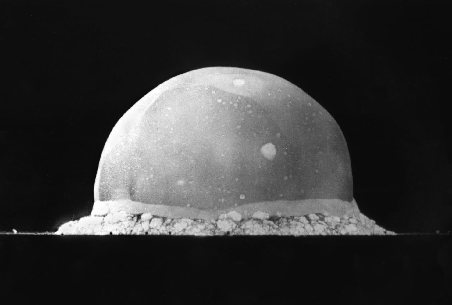
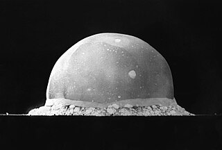
English:
PA-98-0520 —
Trinity Site explosion
, 0.016 second after explosion, July 16, 1945. The viewed hemisphere's highest point in this image is about 200 meters high.
Türkçe:
16 Temmuz 1945 yılında
New Mexico
'daki Socorro'nın 56 km kadar güneydoğusunda şu an üzerinde komuta merkezi Alamogordo'da bulunan White Sands Missile Range'in bulunduğu yerde yapılmış
Trinity patlamasının
, infilak anından 0,016 sn sonra çekilmiş görüntüsüdür. Görüntülenen yarım kürenin en yüksek noktası yaklaşık 200 metre yüksekliğindedir.
Deutsch:
Foto des
Trinity-Tests
, 16ms nach der Zündung am 16. Juli 1945. Die im Bild sichtbaren Feuerblase hat zu diesem Zeitpunkt eine Höhe von ca. 200 Metern.
|
||||||
| Date | |||||||
| Source | http://www.lanl.gov/orgs/pa/photos/images/PA-98-0520.jpeg | ||||||
| Author | Berlyn Brixner / Los Alamos National Laboratory | ||||||
|
Permission
( Reusing this file ) |
|
||||||

| Camera location |
|
View this and other nearby images on: OpenStreetMap |
|
|---|