TsunamiAftermathNorthofPhuket_NASA.jpg

Size of this preview:
647 × 599 pixels
.
Other resolutions:
259 × 240 pixels
|
518 × 480 pixels
|
829 × 768 pixels
|
1,106 × 1,024 pixels
|
1,987 × 1,840 pixels
.
Summary
| Description |
English:
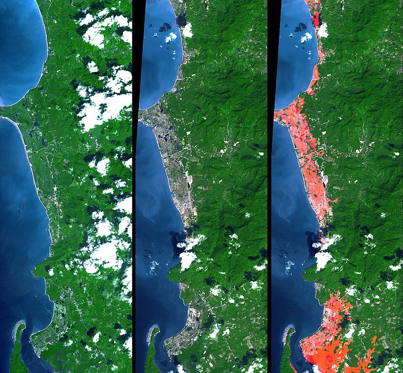
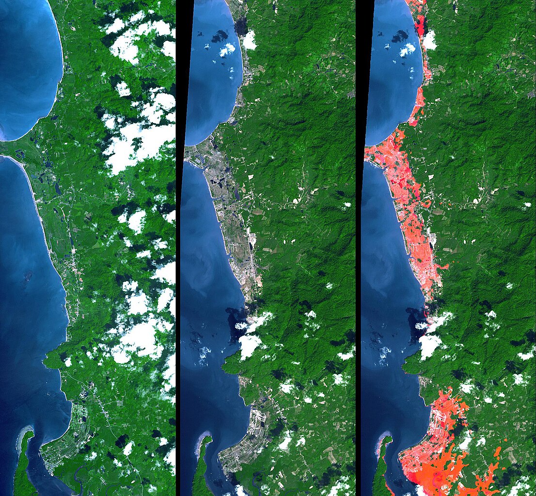
Simulated natural color images of a 27 kilometer long stretch of coast north of the Phuket Airport in the Khao Lak, Thailand on December 31 (middle) and two years earlier (left), showing changes to the coast caused by a tsunami. The image on the right is the image in the middle with red highlights of the changes.
Additional details can be found at the source link. |
| Date | November 15, 2002 and December 31, 2004 (ASTER), February 2000 (SRTM). See the source link for information about the individual photos |
| Source | NASA Photojournal - http://photojournal.jpl.nasa.gov/catalog/PIA06671 |
| Author |
ASTER: NASA/GSFC/METI/ERSDAC/JAROS, and U.S./Japan ASTER Science Team
|
Licensing
|
|
This file is in the public domain in the United States because it was solely created by NASA . NASA copyright policy states that "NASA material is not protected by copyright unless noted ". (See Template:PD-USGov , NASA copyright policy page or JPL Image Use Policy .) |
|

|
Warnings:
|
Original upload log
The original description page was
here
. All following user names refer to en.wikipedia.
- 2005-04-16 17:22 SeanMack 1987×1840× (737390 bytes) PIA06671: Tsunami Inundation, North of Phuket, Thailand ASTER Images and SRTM Elevation Model NASA