UNIFIL_Deployment_February_2018.pdf

Size of this JPG preview of this PDF file:
800 × 566 pixels
.
Other resolutions:
320 × 226 pixels
|
640 × 453 pixels
|
1,024 × 725 pixels
|
1,280 × 906 pixels
|
1,754 × 1,241 pixels
.
Summary
| Description |
English:
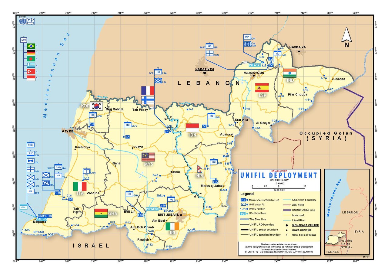
A map showing the deployment of UNIFIL forces as of February 2018
|
| Date | |
| Source | United Nations Department of Field Support - Source |
| Author | United Nations Department of Field Support, Geospatial Information Section |
| Other versions |
.jpg)
Licensing
|
|
This image is a map derived from a
United Nations
map.
Unless stated otherwise, UN maps are to be considered in the public domain. This applies worldwide.
UN maps are, in principle, open source material and you can use them in your work or for making your own map. UN requests however that you delete the UN name, logo and reference number upon any modification to the map. Content of your map will be your responsibility. You can state in your publication, if you wish, something like: based on UN map … (map name, map number, revision number and date). See: Geospatial Information Section . And: Geospatial, location data for a better world . |

|