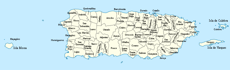
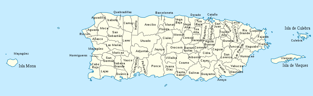
USA_Puerto_Rico_labeled.svg

Size of this PNG preview of this SVG file:
800 × 246 pixels
.
Other resolutions:
320 × 98 pixels
|
640 × 197 pixels
|
1,024 × 315 pixels
|
1,280 × 393 pixels
|
2,560 × 786 pixels
|
1,058 × 325 pixels
.
Summary


.svg)


_(Paris_zoom).svg)
.svg)
,_administrative_divisions_-_de_-_colored_(multizoom).svg)
_-_colored.svg)
.svg)
,_administrative_divisions_-_Nmbrs_(multizoom).svg)
,_administrative_divisions_-_de_-_colored.svg)
_-_de_-_colored.svg)

.svg)

.svg)
I, the copyright holder of this work, hereby publish it under the following license:
This file is licensed under the
Creative Commons
Attribution-Share Alike 3.0 Unported
license.
-
You are free:
- to share – to copy, distribute and transmit the work
- to remix – to adapt the work
-
Under the following conditions:
- attribution – You must give appropriate credit, provide a link to the license, and indicate if changes were made. You may do so in any reasonable manner, but not in any way that suggests the licensor endorses you or your use.
- share alike – If you remix, transform, or build upon the material, you must distribute your contributions under the same or compatible license as the original.
Original upload log
This image is a derivative work of the following images:
-
USA Puerto Rico location map.svg
licensed with Cc-by-sa-3.0
- 2009-06-19T07:13:05Z NordNordWest 1058x595 (117123 Bytes) Based on the raster image: [[:Image:Feather.jpg]] * {{Français}} Plume * {{English}} Feather * {{Español}} Pluma == Licensing == {{GFDL-self}} [[Category:Icons]] resizeresizeresizeresizeresizeresizeresizeresizeresize••••
Uploaded with derivativeFX