US_Court_of_Appeals_and_District_Court_map.svg

Size of this PNG preview of this SVG file:
620 × 402 pixels
.
Other resolutions:
320 × 207 pixels
|
640 × 415 pixels
|
1,024 × 664 pixels
|
1,280 × 830 pixels
|
2,560 × 1,660 pixels
.
Summary
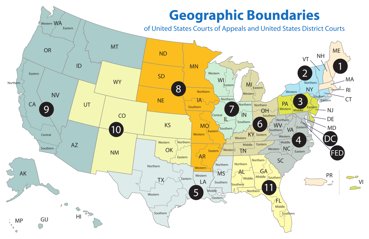
| Description | Map of the geographic boundaries of the various United States courts of appeals and United States district courts . |
| Date | |
| Source | http://www.uscourts.gov/uscourts/images/CircuitMap.pdf |
| Author | PDF by the US Government, converted using Texterity's FreeSVG , tweaked using en:Inkscape by Tintazul |
| Other versions |
|


Licensing
This work is licensed by the creator under the following conditions:
This file is licensed under the
Creative Commons
Attribution-Share Alike 2.5 Generic
license.
-
You are free:
- to share – to copy, distribute and transmit the work
- to remix – to adapt the work
-
Under the following conditions:
- attribution – You must give appropriate credit, provide a link to the license, and indicate if changes were made. You may do so in any reasonable manner, but not in any way that suggests the licensor endorses you or your use.
- share alike – If you remix, transform, or build upon the material, you must distribute your contributions under the same or compatible license as the original.
The original work from which this is derived is in the public domain for the following reason:
|
|
This image is a work of a
United States Department of Justice
employee, taken or made as part of that person's official duties. As a
work of the U.S. federal government
, the image is in the
public domain
(17 U.S.C. § 101 and 105).
|

|