United_Kingdom_AV_referendum_area_results.svg

Size of this PNG preview of this SVG file:
405 × 599 pixels
.
Other resolutions:
162 × 240 pixels
|
324 × 480 pixels
|
519 × 768 pixels
|
692 × 1,024 pixels
|
1,384 × 2,048 pixels
|
871 × 1,289 pixels
.
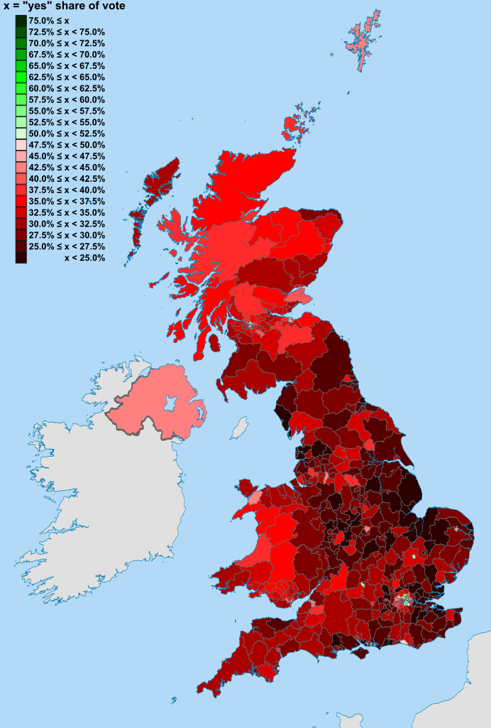
| Description | Map of the United Kingdom showing the voting areas for the Alternative Vote referendum, 2011 . The voting areas are the 326 districts of England , 73 Scottish Parliament constituencies , 40 Welsh Assembly constituencies and Northern Ireland (a total of 440 areas). |
| Date | |
| Source |
National Geospatial-Intelligence Agency
|
| Author |
Nilfanion
, created using Ordnance Survey data
Jolly Janner for shading |
|
Permission
( Reusing this file ) |
This file is licensed under the
Creative Commons
Attribution-Share Alike 3.0 Unported
license.
|