United_Kingdom_EU_referendum_2016_area_results_(Northern_Ireland).svg

Size of this PNG preview of this SVG file:
705 × 599 pixels
.
Other resolutions:
282 × 240 pixels
|
565 × 480 pixels
|
903 × 768 pixels
|
1,205 × 1,024 pixels
|
2,409 × 2,048 pixels
|
1,208 × 1,027 pixels
.
Summary
| Description |
English:
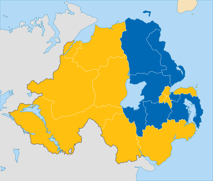
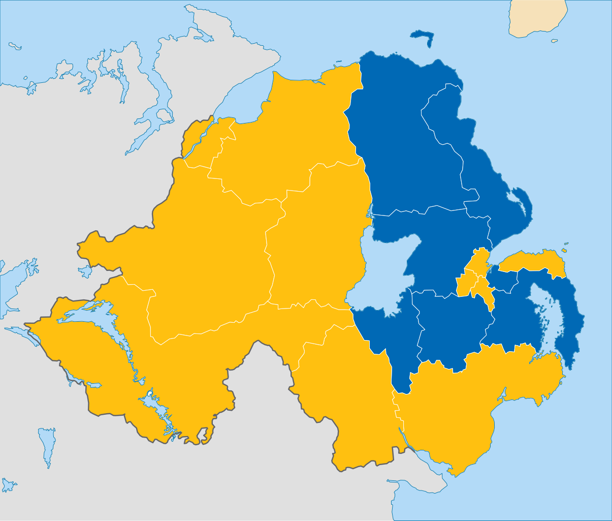
Results of the European Union membership referendum, 2016 in the Northern Ireland region.
Remain
Leave
|
||
| Date | |||
| Source | This work is derived from File:Northern Ireland location map.svg by NordNordWest (which contains United States National Imagery and Mapping Agency data). The style of the map is adapded to that of the other referendum results maps | ||
| Author | Furfur | ||
|
Permission
( Reusing this file ) |
I, the copyright holder of this work, hereby publish it under the following licenses:
This file is licensed under the
Creative Commons
Attribution-Share Alike 4.0 International
license.
You may select the license of your choice.
|
