United_States_of_Indonesia_Map_-_English.jpg
Size of this preview:
800 × 366 pixels
.
Other resolutions:
320 × 146 pixels
|
640 × 293 pixels
|
1,024 × 468 pixels
|
2,000 × 915 pixels
.

|
File:Map of the United States of Indonesia.svg
is a vector version of this file. It should be used in place of this JPG file when not inferior.
File:United States of Indonesia Map - English.jpg →
File:Map of the United States of Indonesia.svg
For more information, see
Help:SVG
.
|

|
Summary
| Description |
English:
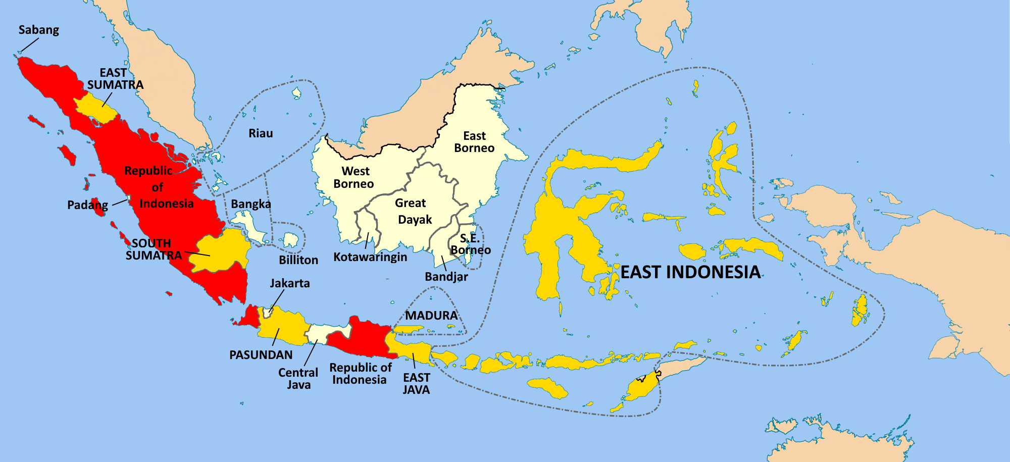
Map of the United States of Indonesia (1949-1950). Republic of Indonesia is in red, constituent states are gold, other regions are white
|
| Date | |
| Source |
Own work Base map is Image:Indonesia blank map.svg created by en:User:Indon . Information for borders: George McTurnan Kahin (1952), 'Nationalism and Revolution in Indonesia' Cornell University Press p435 and Robert Cribb, (1996) 'Democracy, self-determination and the Indonesian revolution' Democracy, self-determination and the Indonesian revolution' , in Jane Drakard and John Legge, eds., 'Indonesian Independence Fifty Years On: 1945-1995.' Annual Indonesia Lecture Series No. 20, Clayton VIC: Monash Asia Institute, p12. |
| Author | Davidelit |
Licensing
I, the copyright holder of this work, hereby publish it under the following license:
This file is licensed under the
Creative Commons
Attribution-Share Alike 4.0 International
license.
-
You are free:
- to share – to copy, distribute and transmit the work
- to remix – to adapt the work
-
Under the following conditions:
- attribution – You must give appropriate credit, provide a link to the license, and indicate if changes were made. You may do so in any reasonable manner, but not in any way that suggests the licensor endorses you or your use.
- share alike – If you remix, transform, or build upon the material, you must distribute your contributions under the same or compatible license as the original.