Uraltopomap-1.jpg
Size of this preview:
759 × 600 pixels
.
Other resolutions:
304 × 240 pixels
|
608 × 480 pixels
|
972 × 768 pixels
|
1,280 × 1,011 pixels
|
1,916 × 1,514 pixels
.
Summary
| Description |
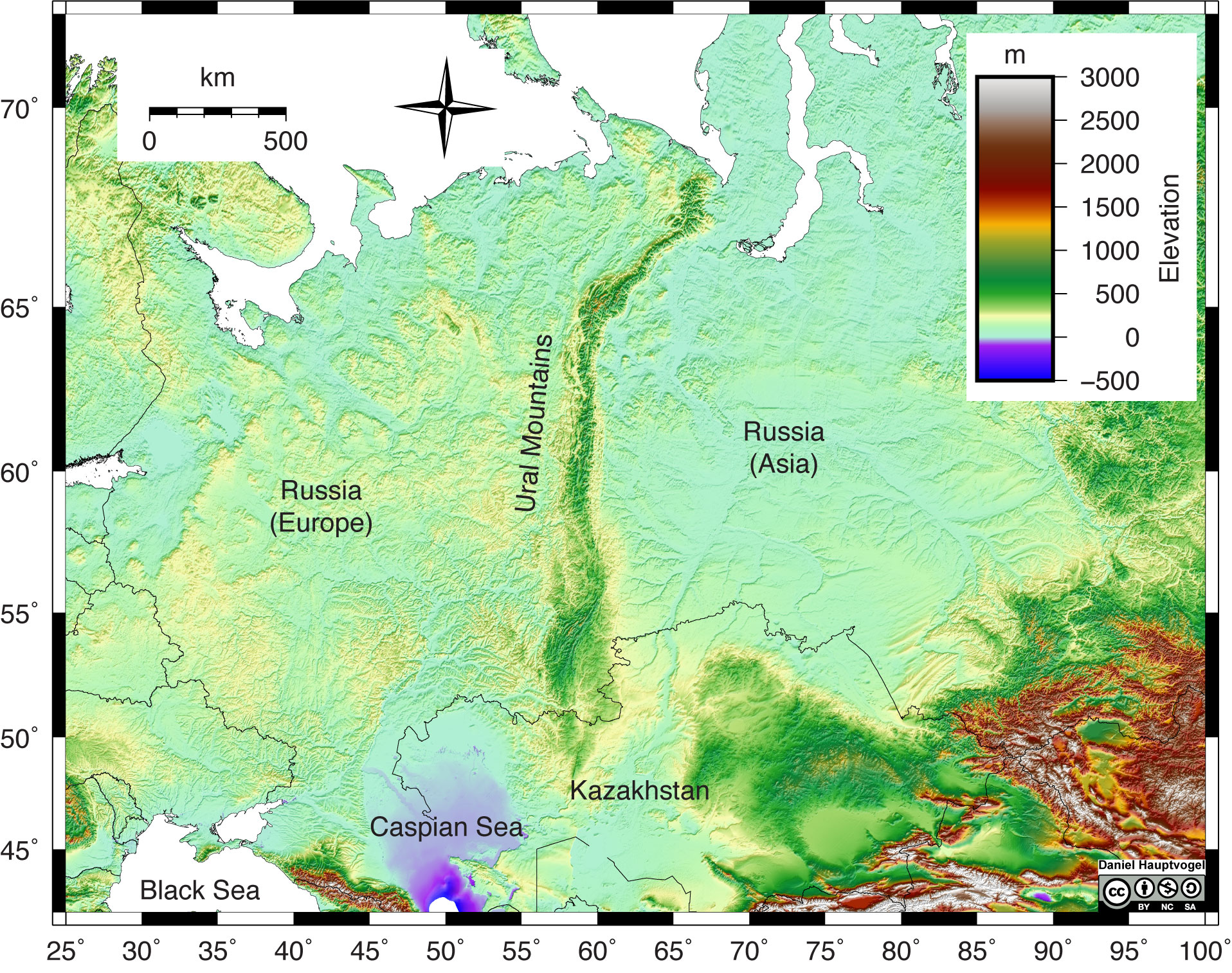
English:
Shaded relief map of the Ural Mountains in Russia. Red and white colors represent high elevations, greens and yellow represent lower elevation, and purple and blue represent areas below sea level. The Ural Mountains are a narrow, linear chain of mountains that trend north-south through Russia. Map scale reference is 60° latitude.
|
| Date | |
| Source | https://uhlibraries.pressbooks.pub/historicalgeologylab/ |
| Author | Daniel Hauptvogel and Virginia Sisson, CC BY-NC-SA |
Licensing
This file is licensed under the
Creative Commons
Attribution-Share Alike 4.0 International
license.
-
You are free:
- to share – to copy, distribute and transmit the work
- to remix – to adapt the work
-
Under the following conditions:
- attribution – You must give appropriate credit, provide a link to the license, and indicate if changes were made. You may do so in any reasonable manner, but not in any way that suggests the licensor endorses you or your use.
- share alike – If you remix, transform, or build upon the material, you must distribute your contributions under the same or compatible license as the original.