View_towards_Y_Lliwedd_from_the_summit_of_Yr_Wyddfa-Snowdon_-_geograph.org.uk_-_702192.jpg
No higher resolution available.
Summary
| Description |
English:
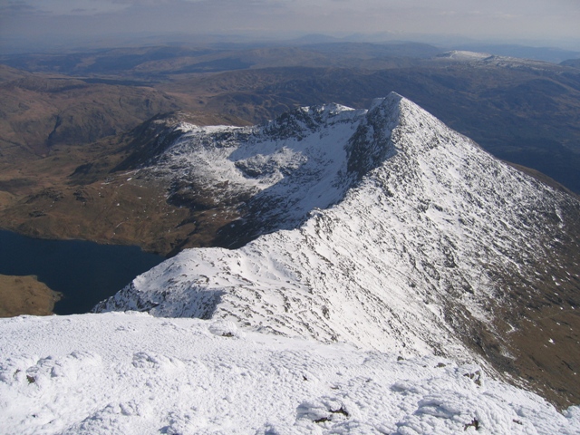
View towards Y Lliwedd from the summit of Yr Wyddfa/Snowdon Taken from the highest part of Yr Wyddfa looking along the ridge towards Y Lliwedd. The Watkin Path follows the ridge on the south side (right) and then turns south for lower ground as the path starts to rise towards Y Lliwedd. Llyn Llydaw is far below to the left.
|
| Date | |
| Source | From geograph.org.uk |
| Author | John S Turner |
|
Attribution
( required by the license ) |
John S Turner / View towards Y Lliwedd from the summit of Yr Wyddfa/Snowdon / |
| Camera location |
|
View this and other nearby images on: OpenStreetMap |
|
|---|
_heading:135.00&language=en)
| Object location |
|
View this and other nearby images on: OpenStreetMap |
|
|---|
_heading:135.00&language=en)
Licensing

|
This image was taken from the
Geograph project
collection. See
this photograph's page
on the Geograph website for the photographer's contact details. The copyright on this image is owned by
John S Turner
and is licensed for reuse under the
Creative Commons
Attribution-ShareAlike 2.0 license.
|
This file is licensed under the
Creative Commons
Attribution-Share Alike 2.0 Generic
license.
Attribution:
John S Turner
-
You are free:
- to share – to copy, distribute and transmit the work
- to remix – to adapt the work
-
Under the following conditions:
- attribution – You must give appropriate credit, provide a link to the license, and indicate if changes were made. You may do so in any reasonable manner, but not in any way that suggests the licensor endorses you or your use.
- share alike – If you remix, transform, or build upon the material, you must distribute your contributions under the same or compatible license as the original.