WVirginiaCo.png

Size of this preview:
703 × 599 pixels
.
Other resolutions:
282 × 240 pixels
|
563 × 480 pixels
|
901 × 768 pixels
|
1,201 × 1,024 pixels
|
2,307 × 1,967 pixels
.
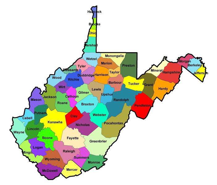
Summary
| Description |
English:
Map of the
Counties in West Virginia
.
|
| Date | 22 April 2008 (original upload date) |
| Source | Own work ( Original text: self-made ) |
| Author | Jm0371 ( talk ) / Jm0371 at English Wikipedia |
Licensing
|
|
This work has been released into the
public domain
by its author,
Jm0371
at
English Wikipedia
. This applies worldwide.
In some countries this may not be legally possible; if so: Jm0371 grants anyone the right to use this work for any purpose , without any conditions, unless such conditions are required by law. |
Original upload log
Transferred from en.wikipedia to Commons by C messier using CommonsHelper .
The original description page was
here
. All following user names refer to en.wikipedia.
- 2008-04-22 19:23 Jm0371 2307×1967× (1953697 bytes) {{Information |Description= |Source=self-made |Date= |Author=~~~ |other_versions= }}