Washington_national_airport.jpg
Size of this preview:
449 × 599 pixels
.
Other resolutions:
180 × 240 pixels
|
533 × 711 pixels
.
Summary
| Description |
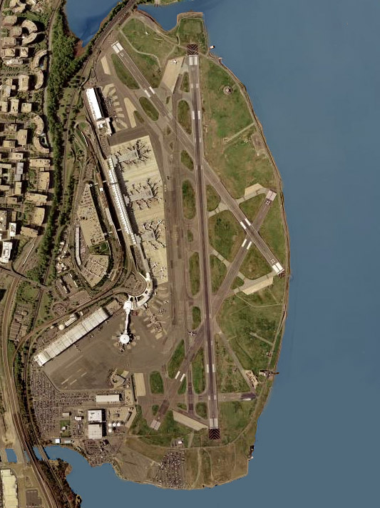
English:
Aerial photo of
Ronald Reagan Washington National Airport
in Arlington County, Virginia, United States.
|
| Date | Taken on 26 April 2002 |
| Source | USGS The National Map , via MSR Maps: Image , Interactive map |
| Author | United States Geological Survey (USGS) |
|
Permission
( Reusing this file ) |
Public domain |
Licensing
|
|
This image is in the
public domain
in the United States because it only contains materials that originally came from the
United States Geological Survey
, an agency of the
United States Department of the Interior
. For more information, see
the official USGS copyright policy
.
|
|