Waterloo_Campaign_map-alt3.svg

Size of this PNG preview of this SVG file:
527 × 599 pixels
.
Other resolutions:
211 × 240 pixels
|
422 × 480 pixels
|
675 × 768 pixels
|
900 × 1,024 pixels
|
1,801 × 2,048 pixels
|
1,500 × 1,706 pixels
.
|
| Camera location |
|
View this and other nearby images on: OpenStreetMap |
|
|---|
Summary
| Description |
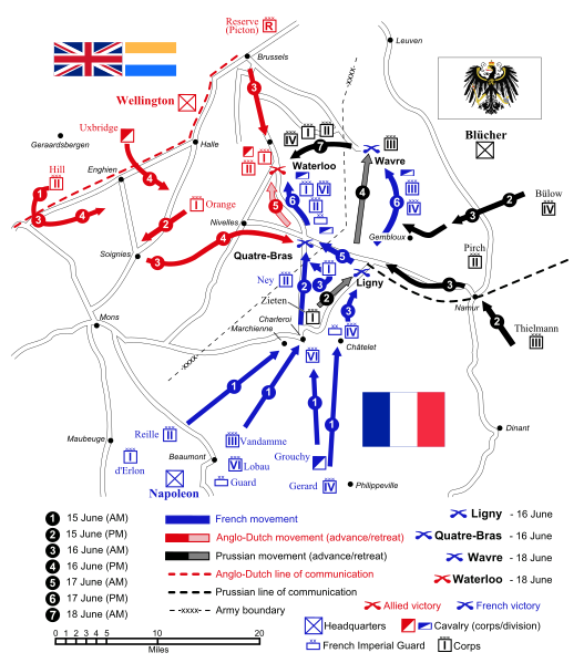
English:
Map of force movements and major engagements during the
Waterloo Campaign
, June 15-18, 1815.
Català:
Mapa dels moviments i dels principals enfrontaments durant la Campanya de Waterloo, 15-18 de juny, 1815.
|
||||||||
| Date | |||||||||
| Source |
Own work
(
Original text:
Self-made. Vectorized from raster image
|
||||||||
| Author | Ipankonin | ||||||||
|
Permission
( Reusing this file ) |
I, the copyright holder of this work, hereby publish it under the following licenses:
This file is licensed under the
Creative Commons
Attribution-Share Alike
2.5 Generic
,
2.0 Generic
and
1.0 Generic
license.
You may select the license of your choice.
|
||||||||
| Other versions |


|
||||||||
| SVG development | |||||||||
| SVG development |


