West_Mansfield_Friends_Church.jpg

Size of this preview:
800 × 600 pixels
.
Other resolutions:
320 × 240 pixels
|
640 × 480 pixels
|
1,024 × 768 pixels
|
1,280 × 960 pixels
|
2,560 × 1,920 pixels
|
2,816 × 2,112 pixels
.
| Camera location |
|
View this and other nearby images on: OpenStreetMap |
|
|---|
| Description |
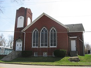
English:
West Mansfield
Friends Church
, located on the southwestern corner of Center (County Road 8) and Dean Streets in
West Mansfield
,
Ohio
,
United States
. It was built in 1912.
|
||
| Date | Taken on 5 April 2010 | ||
| Source | Own work | ||
| Author | Nyttend | ||
|
Permission
( Reusing this file ) |
|
||
| Other versions | None |