West_facade_of_Petit_Trianon_002.JPG

Size of this preview:
800 × 571 pixels
.
Other resolutions:
320 × 228 pixels
|
640 × 457 pixels
|
1,024 × 731 pixels
|
1,280 × 913 pixels
|
2,560 × 1,827 pixels
|
2,946 × 2,102 pixels
.
Summary
| Camera location |
|
View this and other nearby images on: OpenStreetMap |
|
|---|
| Description |
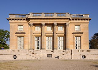
English:
West facade of
Petit Trianon
at
Château de Versailles
in
Versailles
, department of
Yvelines
in
France
.
Français :
Façade ouest de
Petit Trianon
dans le
Château de Versailles
à
Versailles
, département des
Yvelines
en
France
.
|
||
| Date | |||
| Source | Own work | ||
| Author | Moonik |
Licensing
I, the copyright holder of this work, hereby publish it under the following license:
This file is licensed under the
Creative Commons
Attribution-Share Alike 3.0 Unported
license.
-
You are free:
- to share – to copy, distribute and transmit the work
- to remix – to adapt the work
-
Under the following conditions:
- attribution – You must give appropriate credit, provide a link to the license, and indicate if changes were made. You may do so in any reasonable manner, but not in any way that suggests the licensor endorses you or your use.
- share alike – If you remix, transform, or build upon the material, you must distribute your contributions under the same or compatible license as the original.

|
This image was uploaded as part of
Wiki Loves Monuments 2012
.
|
|
|
|
This image has been assessed using the
Quality image guidelines
and is considered a
Quality image
.
|