Western_Rail_Approach_to_Heathrow.png
Size of this preview:
800 × 517 pixels
.
Other resolutions:
320 × 207 pixels
|
640 × 413 pixels
|
1,024 × 661 pixels
|
1,280 × 827 pixels
|
1,748 × 1,129 pixels
.
Summary
| Description |
English:
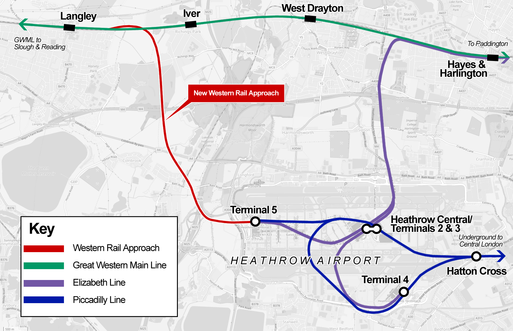
The proposed Western Rail linkto Heathrow (shown in red) which would allow eastbound trains to run from the Great Western Mainline into Heathrow Airport on their way into London. Route information sourced from
Network Rail
|
||
| Date | |||
| Source | Own work | ||
| Author | Cnbrb | ||
| Other versions |
|

| Description |
This map was created from
OpenStreetMap
project data, collected by the community.
This map may be incomplete, and may contain errors. Don't rely solely on it for navigation.
|
|||
| Date | (see file history) | |||
| Source | openstreetmap.org | |||
| Creator |
OpenStreetMap contributors
|
|||
|
Permission
( Reusing this file ) |
OpenStreetMap data is available under the Open Database License ( details ). Map tiles are licensed under the Creative Commons Attribution-ShareAlike 2.0 license (CC-BY-SA 2.0).
This file is licensed under the
Creative Commons
Attribution-Share Alike 2.0 Generic
license.
|
|||
| Georeferencing | If inappropriate please set warp_status = skip to hide. |
Licensing
I, the copyright holder of this work, hereby publish it under the following license:
|
|
This file is made available under the Creative Commons CC0 1.0 Universal Public Domain Dedication . |
|
The person who associated a work with this deed has dedicated the work to the
public domain
by waiving all of their rights to the work worldwide under copyright law, including all related and neighboring rights, to the extent allowed by law. You can copy, modify, distribute and perform the work, even for commercial purposes, all without asking permission.
|