Westgate_Water_Tower.jpg
Summary
| Description |
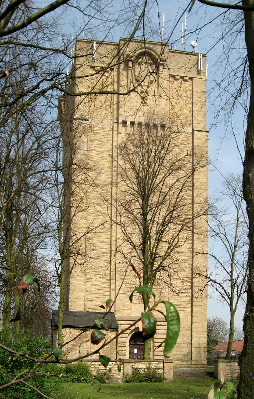
Between November 1904 and April 1905, 1006 people in Lincoln contracted typhoid and of these 113 died. It was Lincoln's biggest peacetime tragedy. The outbreak of the disease was caused by a polluted supply of drinking water, which at the time was taken from a reservoir at Hartsholme (on the edge of the city) and from the River Witham. Despite heavy chlorination of the water public faith in the supply dwindled and many resorted to drawing water from ancient wells. Faced with a crisis situation, city officials and the Water Board realised that the provision of clean water and proper sanitation would be the only way to curb the disease and restore the residents' faith in the public water supply. The first step was to find a suitable source clean water, this was located over the county border at Elkesley in Nottinghamshire where bore holes were sunk through the limestone. (The cores from the boreholes can be seen in this shot taken in The Arboretum in Lincoln). A 22-mile long main was laid from Elksley to Lincoln, where the construction of the Westgate Water Tower was Commissioned by the Lincoln Corporation. The architect, Sir Reginald Blomfield (1856-1942), designed the tower to resemble a medieval keep so as to give a sense of continuity with the city's castle and cathedral. On its completion the Westgate Water Tower had an immediate impact on the city. The local paper "The Lincolnshire Echo" recorded an "air of excitement in the city in anticipation of a new supply of drinking water". This mammoth project was not completed until 1911. Still in use today and a principle source of water for uphill Lincoln the tower, holding some 330,000 gallons (1,356,000 ltrs), remains an imposing landmark visible from miles away. Some facts & figures for the tower:
Some facts & figures for the tank:
|
| Date | |
| Source | The Water Tower, Westgate, Lincoln |
| Author | Brian from UK |
| Camera location |
|
View this and other nearby images on: OpenStreetMap |
|
|---|
Licensing
-
You are free:
- to share – to copy, distribute and transmit the work
- to remix – to adapt the work
-
Under the following conditions:
- attribution – You must give appropriate credit, provide a link to the license, and indicate if changes were made. You may do so in any reasonable manner, but not in any way that suggests the licensor endorses you or your use.
- share alike – If you remix, transform, or build upon the material, you must distribute your contributions under the same or compatible license as the original.
|
|
This image was originally posted to Flickr by Lincolnian at https://www.flickr.com/photos/79727841@N00/465315481 . It was reviewed on 7 May 2008 by FlickreviewR and was confirmed to be licensed under the terms of the cc-by-sa-2.0. |