Wfm_db_forth_bridges.jpg

Size of this preview:
800 × 553 pixels
.
Other resolutions:
320 × 221 pixels
|
640 × 442 pixels
|
955 × 660 pixels
.
Summary
| Description |
English:
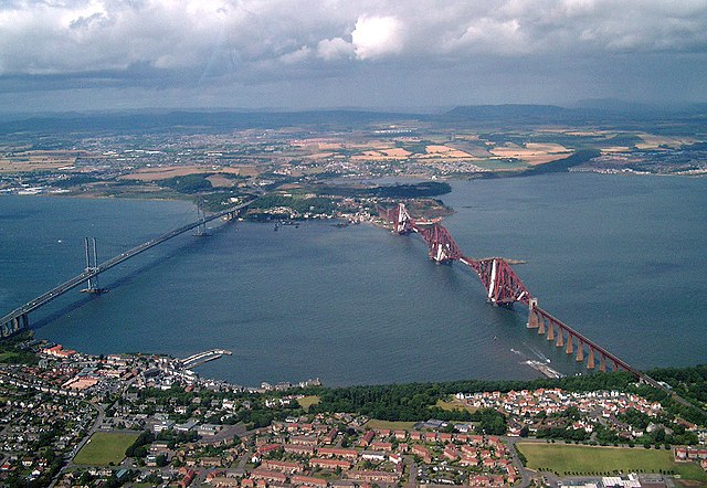
Aerial photograph of both bridges across the
River Forth
in Scotland. The
Forth Road Bridge
is to the left, the
Forth Rail Bridge
to the right. Taken from a helicopter south of Queensferry, looking north into Fife.
|
| Date | |
| Source | Presumably Finlay McWalter obtained this file from the author, Derek Bathgate, along with the permission below. |
| Author | Geograph.co.uk user Derek Bathgate |
|
Permission
( Reusing this file ) |
Mr Bathgate graciously consents to licencing this image under the terms of the GFDL. |
| Other versions |
|

| Camera location |
|
View this and other nearby images on: OpenStreetMap |
|
|---|
Licensing

|
Permission is granted to copy, distribute and/or modify this document under the terms of the GNU Free Documentation License , Version 1.2 or any later version published by the Free Software Foundation ; with no Invariant Sections, no Front-Cover Texts, and no Back-Cover Texts. A copy of the license is included in the section entitled GNU Free Documentation License . |
|
|
This file is licensed under the Creative Commons Attribution-Share Alike 3.0 Unported license. | |
|
||
| This licensing tag was added to this file as part of the GFDL licensing update . |