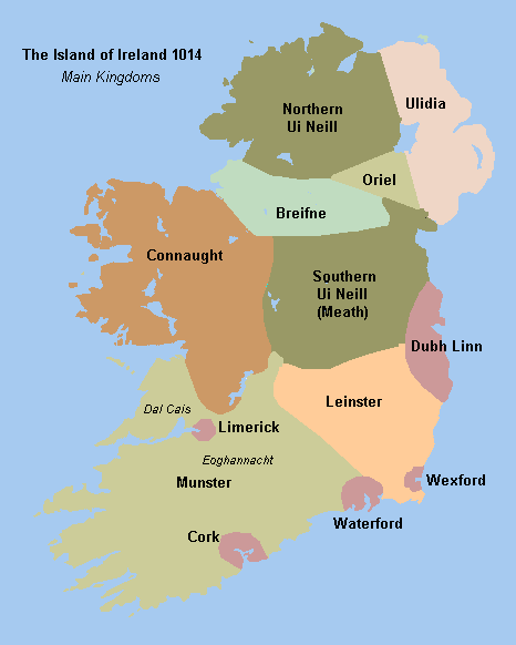
Www.wesleyjohnston.com-users-ireland-maps-historical-map1014.gif
No higher resolution available.
Summary
Historical map of Ireland circa 1014 from http://www.wesleyjohnston.com/users/ireland/maps/historical/map1014.gif

|
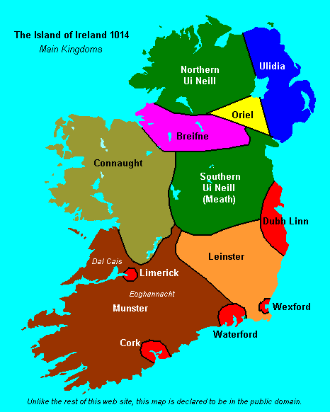
File:Www.wesleyjohnston.com-users-ireland-maps-historical-map1014-es.svg
is a vector version of this file. It should be used in place of this GIF file when not inferior.
File:Www.wesleyjohnston.com-users-ireland-maps-historical-map1014.gif →
File:Www.wesleyjohnston.com-users-ireland-maps-historical-map1014-es.svg
For more information, see
Help:SVG
.
|

|

Licensing

|
The copyright holder of this file, The Ireland Story , allows anyone to use it for any purpose, provided that the copyright holder is properly attributed. Redistribution, derivative work, commercial use, and all other use is permitted. |
|
Attribution:
The Ireland Story
|