ZIP_Code_zones.svg

Size of this PNG preview of this SVG file:
800 × 548 pixels
.
Other resolutions:
320 × 219 pixels
|
640 × 438 pixels
|
1,024 × 701 pixels
|
1,280 × 876 pixels
|
2,560 × 1,753 pixels
.
| Description |
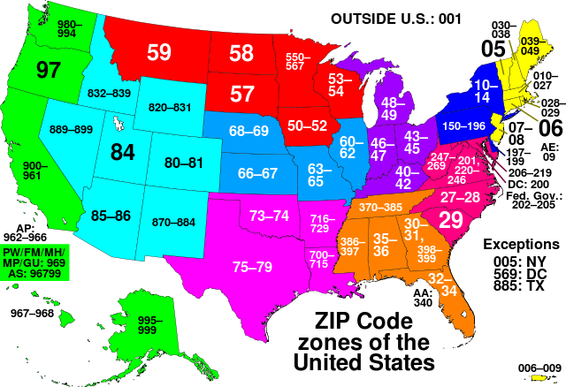
This map of the United States divides the country into ZIP code zones. All states with a common colour use ZIP codes starting with the same digit. Each string of digits, whether two or three digits in length, refers to an allocation which reflects all existing ZIP codes starting with those two or three digits.
Nederlands:
ZIP code gebieden in de Verenigde Staten
|
||
| Date | |||
| Source | Own work, based on Image:ZIP_code_zones.png | ||
| Author | Denelson83 | ||
|
Permission
( Reusing this file ) |
|
||
| Other versions | Image:ZIP_code_zones.png |