Zoneamento_da_Cidade_do_Rio_de_Janeiro.svg

Size of this PNG preview of this SVG file:
789 × 421 pixels
.
Other resolutions:
320 × 171 pixels
|
640 × 341 pixels
|
1,024 × 546 pixels
|
1,280 × 683 pixels
|
2,560 × 1,366 pixels
.
Summary
| Description |
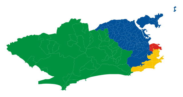
Português:
Mapa com a delimitação das zonas oeste, norte, sul e central da cidade do Rio de Janeiro.
Deutsch:
Karte der Verwaltungszonen von
Rio de Janeiro
(Zona Oeste, Zona Norte, Zona Sul, Zona Central) mit Grenzen der Bairros.
|
| Date | |
| Source | Own work |
| Author | Nossedotti |
Licensing
I, the copyright holder of this work, hereby publish it under the following license:
This file is licensed under the
Creative Commons
Attribution-Share Alike 3.0 Unported
license.
-
You are free:
- to share – to copy, distribute and transmit the work
- to remix – to adapt the work
-
Under the following conditions:
- attribution – You must give appropriate credit, provide a link to the license, and indicate if changes were made. You may do so in any reasonable manner, but not in any way that suggests the licensor endorses you or your use.
- share alike – If you remix, transform, or build upon the material, you must distribute your contributions under the same or compatible license as the original.