Śląsk.png

Size of this preview:
660 × 600 pixels
.
Other resolutions:
264 × 240 pixels
|
528 × 480 pixels
|
846 × 768 pixels
|
1,127 × 1,024 pixels
|
1,932 × 1,755 pixels
.
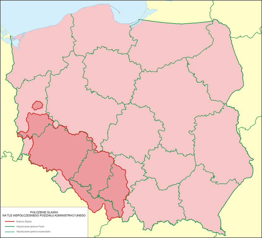
| Description | Położenie Śląska na tle współczesnego podziału administracyjnego |
| Date | |
| Source | własna praca na podstawie: Kazimierz Orzechowski, Historia Ustroju Śląska 1202-1740, Wrocław 2005 r., s. 147, ISBN 83-229-2654-5 |
| Author | Poznaniak |
|
Permission
( Reusing this file ) |
I, the copyright holder of this work, hereby publish it under the following license:
This file is licensed under the
Creative Commons
Attribution-Share Alike 3.0 Unported
license.
|
Mapa nie odzwierciedla historycznej Dzielnicy Śląskiej Królestwa Polskeigo, pomijając ziemie śląskie, które pozostały w I Rzeczypospolitej, tj. Księstwo Oświęcimsko-Zatorskie i Księswto Żywieckie (późniejszy Powiat Śląski Królestwa Polskiego) oraz Księstwo Siewierskie.