Grade_II*_listed_buildings_in_Bath_and_North_East_Somerset
Bath and North East Somerset (commonly referred to as BANES or B&NES) is a unitary authority created on 1 April 1996, following the abolition of the County of Avon, which had existed since 1974.[1] Part of the ceremonial county of Somerset, Bath and North East Somerset occupies an area of 220 square miles (570 km2), two-thirds of which is green belt.[2] It stretches from the outskirts of Bristol, south into the Mendip Hills and east to the southern Cotswold Hills and Wiltshire border.[2] The city of Bath is the principal settlement in the district, but BANES also covers Keynsham, Midsomer Norton, Radstock and the Chew Valley. The area has a population of 170,000, about half of whom live in Bath, making it 12 times more densely populated than the rest of the area.[2]
In the United Kingdom, the term listed building refers to a building or other structure officially designated as being of special architectural, historical, or cultural significance; Grade II* structures are those considered to be "particularly significant buildings of more than local interest".[3] Listing was begun by a provision in the Town and Country Planning Act 1947. Once listed, strict limitations are imposed on the modifications allowed to a building's structure or fittings. In England, the authority for listing under the Planning (Listed Buildings and Conservation Areas) Act 1990[4] rests with Historic England, a non-departmental public body sponsored by the Department for Digital, Culture, Media and Sport; local authorities have a responsibility to regulate and enforce the planning regulations.
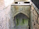
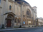
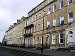
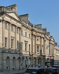
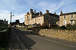
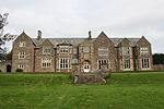
Bath and North East Somerset has 212 Grade II* listed buildings.
Download coordinates as:
Bath
North East Somerset
Listed buildings in North East Somerset, outside Bath:
- The date given is the date used by Historic England as significant for the initial building or that of an important part in the structure's description.
- Sometimes known as OSGB36, the grid reference is based on the British national grid reference system used by the Ordnance Survey.
- The "List Entry Number" is a unique number assigned to each listed building and scheduled monument by Historic England.
- "The Avon (Structural Change) Order 1995". Her Majesty's Stationery Office (HMSO). Archived from the original on 30 January 2008. Retrieved 9 December 2007.
- "About the area". Bath and North East Somerset Council. Archived from the original on 4 November 2007. Retrieved 30 December 2007.
- "Listed Buildings". Historic England. Retrieved 23 August 2017.
- "Planning (Listed Buildings and Conservation Areas) Act 1990 (c. 9)". Ministry of Justice. Archived from the original on 18 April 2010. Retrieved 17 December 2007.
- Historic England. "Archway on Street at The Entrance to Park House (1384632)". National Heritage List for England. Retrieved 3 April 2015.
- Historic England. "Barn, to north east of St Catherine's Court (1277073)". National Heritage List for England. Retrieved 6 July 2015.
- Historic England. "Barn to south west of Court Farmhouse (1288592)". National Heritage List for England. Retrieved 3 April 2015.
- Historic England. "Batheaston House (1320532)". National Heritage List for England. Retrieved 3 April 2015.
- Historic England. "Bridge over River Chew (1129649)". National Heritage List for England. Retrieved 3 April 2015.
- Historic England. "Chapel Farmhouse (1288604)". National Heritage List for England. Retrieved 3 April 2015.
- Historic England. "Chew Court (1320739)". National Heritage List for England. Retrieved 3 April 2015.
- Historic England. "Church of All Saints (1135797)". National Heritage List for England. Retrieved 3 April 2015.
- Historic England. "Church of All Saints (1136439)". National Heritage List for England. Retrieved 3 April 2015.
- Historic England. "Church of St Andrew (1129632)". National Heritage List for England. Retrieved 3 April 2015.
- Historic England. "Church of St Augustine (1320766)". National Heritage List for England. Retrieved 3 April 2015.
- Historic England. "Church of St Catherine (1277121)". National Heritage List for England. Retrieved 3 April 2015.
- Historic England. "Church of St James (1277046)". National Heritage List for England. Retrieved 3 April 2015.
- Historic England. "Church of St John The Baptist (1136127)". National Heritage List for England. Retrieved 3 April 2015.
- Historic England. "Church of St John the Baptist (1384628)". National Heritage List for England. Retrieved 3 April 2015.
- Historic England. "Church of St Laurence (1312831)". National Heritage List for England. Retrieved 3 April 2015.
- Historic England. "Church of St Lawrence (1129527)". National Heritage List for England. Retrieved 3 April 2015.
- Historic England. "Church of St Leonard (1320735)". National Heritage List for England. Retrieved 3 April 2015.
- Historic England. "Church of St Margaret (1115380)". National Heritage List for England. Retrieved 3 April 2015.
- Historic England. "Church of St Martin (1215229)". National Heritage List for England. Retrieved 3 April 2015.
- Historic England. "Church of St Mary (1214255)". National Heritage List for England. Retrieved 3 April 2015.
- Historic England. "Church of St Mary (1320443)". National Heritage List for England. Retrieved 3 April 2015.
- Historic England. "Church of St Mary (1136164)". National Heritage List for England. Retrieved 3 April 2015.
- Historic England. "Church of St Mary (1136209)". National Heritage List for England. Retrieved 3 April 2015.
- Historic England. "Church of St Mary (1232679)". National Heritage List for England. Retrieved 3 April 2015.
- Historic England. "Church of St Mary (1312706)". National Heritage List for England. Retrieved 3 April 2015.
- Historic England. "Church of St Mary The Virgin (1129594)". National Heritage List for England. Retrieved 3 April 2015.
- Historic England. "Church of St Nicholas (1136442)". National Heritage List for England. Retrieved 3 April 2015.
- Historic England. "Church of St Peter (1320777)". National Heritage List for England. Retrieved 3 April 2015.
- Historic England. "Church of St Thomas a Becket (1136393)". National Heritage List for England. Retrieved 3 April 2015.
- Historic England. "Church of The Holy Ghost (1115202)". National Heritage List for England. Retrieved 3 April 2015.
- Historic England. "Church of the Holy Trinity (1129501)". National Heritage List for England. Retrieved 3 April 2015.
- Historic England. "Church of the Holy Trinity (1320745)". National Heritage List for England. Retrieved 3 April 2015.
- Historic England. "Council Offices (1115164)". National Heritage List for England. Retrieved 3 April 2015.
- Historic England. "Court Farmhouse (1214263)". National Heritage List for England. Retrieved 3 April 2015.
- Historic England. "Dovecot to Manor Farm, with Terrace Walling (1394117)". National Heritage List for England. Retrieved 3 April 2015.
- "Dovecote, 100 Yards to Rear of Manor House". National heritage list for England. English Heritage. Retrieved 14 July 2013.
- Historic England. "Dovecote, to South West of St Nicholas' Church (1288368)". National Heritage List for England. Retrieved 6 July 2015.
- Historic England. "Eagle House and the Old Maltings (1115272)". National Heritage List for England. Retrieved 3 April 2015.
- "Eagle House including balustrade 2 yards in front of south elevation". National heritage list for England. English Heritage. Retrieved 28 August 2013.
- Historic England. "Freshford Manor (1115308)". National Heritage List for England. Retrieved 3 April 2015.
- "Garden building, 100 yards to south of Bathampton Lodge". National heritage list for England. English Heritage. Retrieved 28 August 2013.
- Historic England. "Gournay Court (1129581)". National Heritage List for England. Retrieved 3 April 2015.
- Historic England. "Hinton House (1136140)". National Heritage List for England. Retrieved 3 April 2015.
- Historic England. "Iford Bridge (1115316)". National Heritage List for England. Retrieved 3 April 2015.
- Historic England. "Lyons Court Farmhouse (1136453)". National Heritage List for England. Retrieved 3 April 2015.
- Historic England. "Manor Farmhouse (1312963)". National Heritage List for England. Retrieved 3 April 2015.
- Historic England. "Manor House (1115381)". National Heritage List for England. Retrieved 3 April 2015.
- Historic England. "Manor House (1158529)". National Heritage List for England. Retrieved 3 April 2015.
- Historic England. "Manorthorpe and Gardenthorpe (1158028)". National Heritage List for England. Retrieved 3 April 2015.
- Historic England. "No. 39 Bailbrook House (1394890)". National Heritage List for England. Retrieved 3 April 2015.
- Historic England. "Old Brass Mill (1384676)". National Heritage List for England. Retrieved 3 April 2015.
- Historic England. "Old School Room (1135935)". National Heritage List for England. Retrieved 3 April 2015.
- Historic England. "Parish Church of St John The Baptist (1320501)". National Heritage List for England. Retrieved 3 April 2015.
- Historic England. "Parish Church of St John The Baptist (1320561)". National Heritage List for England. Retrieved 3 April 2015.
- Historic England. "Parish Church of St Nicholas (1320551)". National Heritage List for England. Retrieved 3 April 2015.
- Historic England. "Church of St Peter (1115302)". National Heritage List for England. Retrieved 3 April 2015.
- Historic England. "Parish's House (1135909)". National Heritage List for England. Retrieved 6 July 2015.
- Historic England. "Pine House (1137651)". National Heritage List for England. Retrieved 3 April 2015.
- Historic England. "Rectory Farmhouse (1129645)". National Heritage List for England. Retrieved 3 April 2015.
- Historic England. "Rock House (1138297)". National Heritage List for England. Retrieved 3 April 2015.
- Historic England. "Saltford Manor House (1384672)". National Heritage List for England. Retrieved 3 April 2015.
- Historic England. "Sham Castle (1312449)". National Heritage List for England. Retrieved 3 April 2015.
- Historic England. "Stable Block and Coach House (1129477)". National Heritage List for England. Retrieved 3 April 2015.
- Historic England. "Sutton Court (1129576)". National Heritage List for England. Retrieved 3 April 2015.
- Historic England. "The Beeches (1129620)". National Heritage List for England. Retrieved 3 April 2015.
- Historic England. "The Court (1136188)". National Heritage List for England. Retrieved 3 April 2015.
- Historic England. "The Grey House (1277076)". National Heritage List for England. Retrieved 3 April 2015.
- Historic England. "The Old Parsonage (1136471)". National Heritage List for England. Retrieved 3 April 2015.
- Historic England. "The Priory (1115160)". National Heritage List for England. Retrieved 3 April 2015.
- Historic England. "The Rectory (1320747)". National Heritage List for England. Retrieved 3 April 2015.
- Historic England. "Warleigh Manor School (1157904)". National Heritage List for England. Retrieved 3 April 2015.
- Historic England. "Watercress Cottage (1115367)". National Heritage List for England. Retrieved 3 April 2015.
- Historic England. "Welton Manor House (1136842)". National Heritage List for England. Retrieved 3 April 2015.
- Historic England. "Whitehaven (1137983)". National Heritage List for England. Retrieved 3 April 2015.
- Historic England. "108 and 110, Northend (1115244)". National Heritage List for England. Retrieved 3 April 2015.
- Historic England. "15, The Batch (1312374)". National Heritage List for England. Retrieved 3 April 2015.
- Historic England. "37, Priory Close (1115178)". National Heritage List for England. Retrieved 3 April 2015.
![]() Media related to Grade II* listed buildings in Bath and North East Somerset District at Wikimedia Commons
Media related to Grade II* listed buildings in Bath and North East Somerset District at Wikimedia Commons


