Grand_Avenue–Newtown_station
Grand Avenue–Newtown station
New York City Subway station in Queens
The Grand Avenue–Newtown station is a local station on the IND Queens Boulevard Line of the New York City Subway. Located under private property at the northeast corner of the intersection of Grand Avenue, Broadway, and Queens Boulevard in the neighborhood of Elmhurst, Queens, it is served by the M train on weekdays, the R train at all times except nights, and the E and F trains at night.
Grand Avenue–Newtown | ||||||||||||||||||||||||||||||||||||||||||||||||||||||||||||||||||||
|---|---|---|---|---|---|---|---|---|---|---|---|---|---|---|---|---|---|---|---|---|---|---|---|---|---|---|---|---|---|---|---|---|---|---|---|---|---|---|---|---|---|---|---|---|---|---|---|---|---|---|---|---|---|---|---|---|---|---|---|---|---|---|---|---|---|---|---|---|
 View of northbound platform | ||||||||||||||||||||||||||||||||||||||||||||||||||||||||||||||||||||
| Station statistics | ||||||||||||||||||||||||||||||||||||||||||||||||||||||||||||||||||||
| Address | Grand Avenue, Broadway & Queens Boulevard Elmhurst, NY 11373[1] | |||||||||||||||||||||||||||||||||||||||||||||||||||||||||||||||||||
| Borough | Queens | |||||||||||||||||||||||||||||||||||||||||||||||||||||||||||||||||||
| Locale | Elmhurst | |||||||||||||||||||||||||||||||||||||||||||||||||||||||||||||||||||
| Coordinates | 40.73695°N 73.877521°W / 40.73695; -73.877521 | |||||||||||||||||||||||||||||||||||||||||||||||||||||||||||||||||||
| Division | B (IND)[2] | |||||||||||||||||||||||||||||||||||||||||||||||||||||||||||||||||||
| Line | IND Queens Boulevard Line | |||||||||||||||||||||||||||||||||||||||||||||||||||||||||||||||||||
| Services | E F M R | |||||||||||||||||||||||||||||||||||||||||||||||||||||||||||||||||||
| Transit | ||||||||||||||||||||||||||||||||||||||||||||||||||||||||||||||||||||
| Structure | Underground | |||||||||||||||||||||||||||||||||||||||||||||||||||||||||||||||||||
| Platforms | 2 side platforms | |||||||||||||||||||||||||||||||||||||||||||||||||||||||||||||||||||
| Tracks | 4 | |||||||||||||||||||||||||||||||||||||||||||||||||||||||||||||||||||
| Other information | ||||||||||||||||||||||||||||||||||||||||||||||||||||||||||||||||||||
| Opened | December 31, 1936; 87 years ago (1936-12-31) | |||||||||||||||||||||||||||||||||||||||||||||||||||||||||||||||||||
| Opposite- direction transfer | Yes | |||||||||||||||||||||||||||||||||||||||||||||||||||||||||||||||||||
| Traffic | ||||||||||||||||||||||||||||||||||||||||||||||||||||||||||||||||||||
| 2022 | 3,588,300[3] | |||||||||||||||||||||||||||||||||||||||||||||||||||||||||||||||||||
| Rank | 73 out of 423[3] | |||||||||||||||||||||||||||||||||||||||||||||||||||||||||||||||||||
| ||||||||||||||||||||||||||||||||||||||||||||||||||||||||||||||||||||
| ||||||||||||||||||||||||||||||||||||||||||||||||||||||||||||||||||||
| ||||||||||||||||||||||||||||||||||||||||||||||||||||||||||||||||||||
| ||||||||||||||||||||||||||||||||||||||||||||||||||||||||||||||||||||
| ||||||||||||||||||||||||||||||||||||||||||||||||||||||||||||||||||||


The station opened on December 31, 1936 as part of the Independent Subway System's Queens Boulevard Line. The opening of the station brought significant growth to Elmhurst.
The Queens Boulevard Line was one of the first built by the city-owned Independent Subway System (IND), and was planned to stretch between the IND Eighth Avenue Line in Manhattan and 178th Street and Hillside Avenue in Jamaica, Queens, with a stop at Grand Avenue.[4][5] The line was first proposed in 1925.[6] Construction of the line was approved by the New York City Board of Estimate on October 4, 1928.[7] The line was constructed using the cut-and-cover tunneling method, and to allow pedestrians to cross, temporary bridges were built over the trenches.[8]
The first section of the line opened on August 19, 1933 from the connection to the Eighth Avenue Line at 50th Street to Roosevelt Avenue in Jackson Heights.[9] Later that year, a $23 million loan was approved to finance the remainder of the line, along with other IND lines.[10] The remainder of the line was built by the Public Works Administration.[11][12] In 1934 and 1935, construction of the extension to Jamaica was suspended for 15 months and was halted by strikes.[13] Construction was further delayed due to a strike in 1935, instigated by electricians opposing wages paid by the General Railway Signal Company.[14]
In August 1936, tracks were installed all the way to 178th Street, and the stations to Union Turnpike were completed.[13] On December 31, 1936, the IND Queens Boulevard Line was extended by eight stops, and 3.5 miles (5.6 km), from its previous terminus at Roosevelt Avenue to Union Turnpike.[15][16][17] The E train, which initially served all stops on the new extension, began making express stops in April 1937,[18] and local GG trains began serving the extension at the time.[19]
In Elmhurst, almost all of the century-old buildings in the heart of the village were destroyed for the construction of the subway. Land was taken on the west side of the Broadway to avoid the demolition of St. James Episcopal Church and the Reformed Church of Newtown.[20]: 145 [21]: 23 An easement was granted so the line could pass under the old St. James Church building at the southwest corner of Broadway and 51st Avenue.[22][23] Many nineteenth century residences and the Wandowenock Fire Company buildings had to be torn down. To allow the subway line to curve into Queens Boulevard from Broadway, the northeast corner of the two streets was removed, in addition to some stores. New buildings were built behind a new curb line once the subway was completed, bringing a new face to Elmhurst. The introduction of the subway stimulated local growth in Elmhurst. Commercial buildings and apartment houses replaced existing structures.[20]: 145 [21]: 23
| Ground | Street level | Exit/entrance |
| Mezzanine | Fare control, station agent, MetroCard machines | |
| Platform level | Side platform | |
| Southbound local | ← ← ← ← | |
| Southbound express | ← | |
| Northbound express | → | |
| Northbound local | → → → → | |
| Side platform | ||
There are four tracks and two side platforms;[24] the two center express tracks are used by the E and F trains at all times except late nights.[25] The E and F trains serve the station at night,[26][27] the M train serves the station on weekdays during the day,[28] and the R train serves the station at all times except late nights.[29] The station is between Elmhurst Avenue to the west and Woodhaven Boulevard to the east.[30]
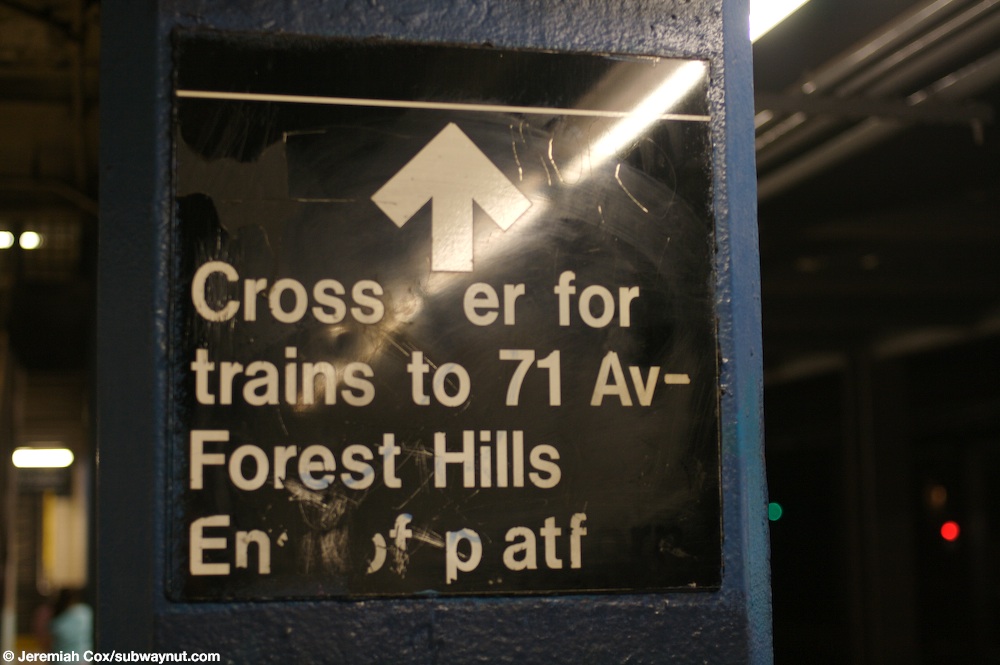
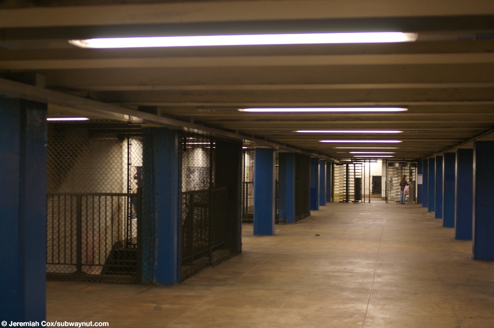
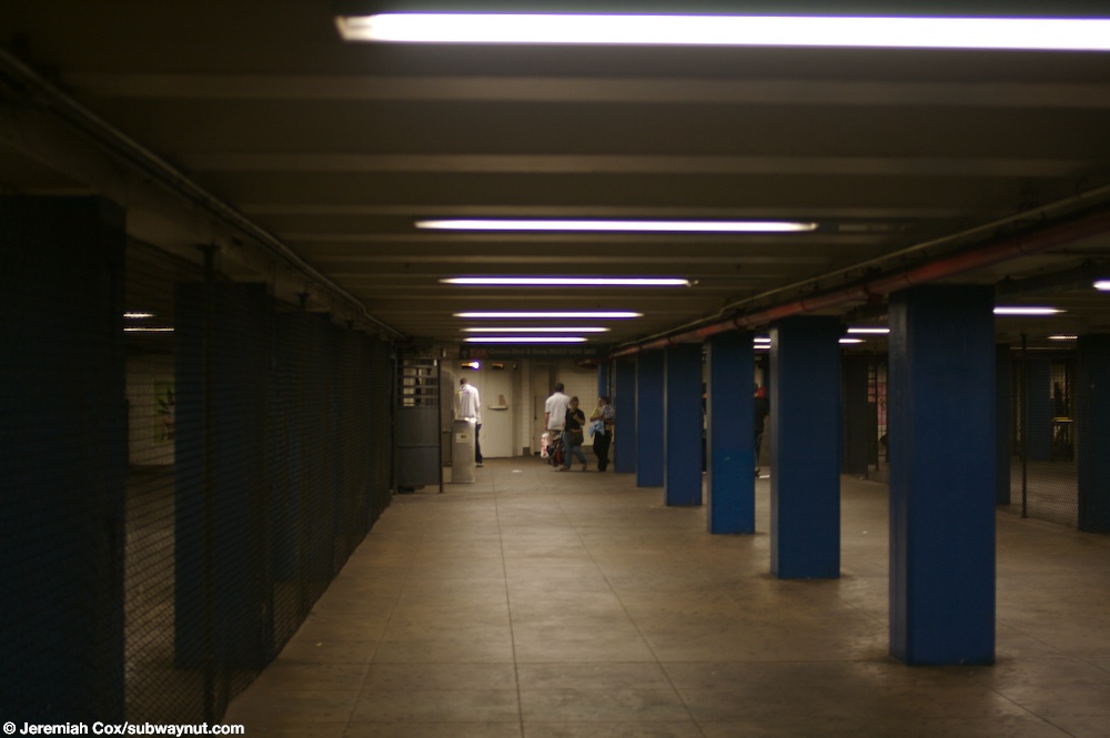
In between the local tracks and the express tracks, there are trackway walls.[31] The station has a full length mezzanine, but as the fare control and booth area are at the center of the mezzanine, crossover is available only at the easternmost staircase.[32][33]
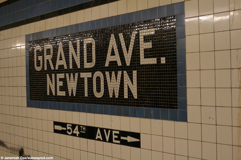
Both platforms have a medium Cerulean blue tile band with a black border and mosaic name tablets reading "GRAND AVE. – NEWTOWN" broken onto two lines in white sans serif lettering on a black background and Cerulean blue border.[34] The tile band was part of a color-coded tile system used throughout the IND.[35] The tile colors were designed to facilitate navigation for travelers going away from Lower Manhattan. As such, the blue tiles used at the Grand Avenue station are also used at Jackson Heights–Roosevelt Avenue, the next express station to the west, while a different tile color is used at Forest Hills–71st Avenue, the next express station to the east. Blue tiles are similarly used at the other local stations between Roosevelt Avenue and 71st Avenue.[36][37] Small tile captions reading "GRAND" in white lettering on black run below the trim line, and directional signs in the same style are present below some of the name tablets.[38][31]
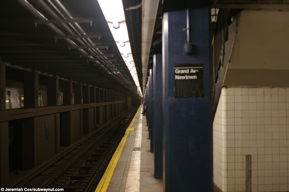
Concrete-clad columns, painted blue, run along both platforms at regular intervals with alternating ones having the standard black name plates in white lettering.[38][31] These piers are located every 15 feet (4.6 m) and support girders above the platforms. The roof girders are also connected to columns in the walls adjoining each platform.[39]: 3
The tunnel is covered by a U-shaped trough that contains utility pipes and wires. The outer walls of this trough are composed of columns, spaced approximately every 5 feet (1.5 m) with concrete infill between them. There is a 1-inch (25 mm) gap between the tunnel wall and the platform wall, which is made of 4-inch (100 mm)-thick brick covered over by a tiled finish. The columns between the tracks are also spaced every 5 feet (1.5 m), with no infill.[39]: 3
Exits
Each side has two sets of street stairs. There is a full-time entrance at Justice Avenue and Broadway on the west end, with staircases to either side of Broadway. There are also exits to either southern corner of Queens Boulevard at 54th Avenue (the southeast-corner staircase being outside the First Presbyterian Church of Newtown complex), and another staircase to the northern side of Queens Boulevard at 54th Avenue.[40]
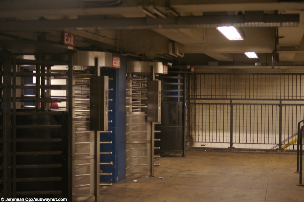
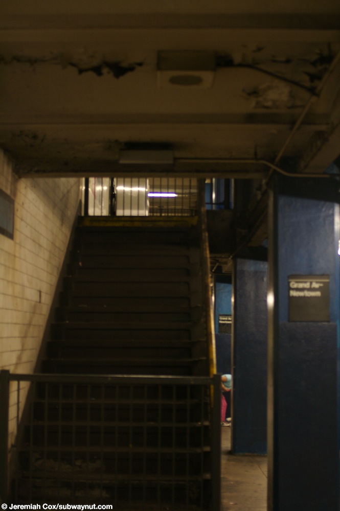
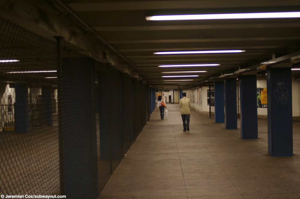
High entry/exit turnstiles at both ends of the mezzanine allow people to exit fare control without having to walk down to the middle of the mezzanine. A free crossover between two platforms exists at this location. Originally, there were two fare control areas at each end, which is clear from the presence of two closed staircases at the Manhattan-bound side.[41][42] The mezzanine narrows to about two-thirds of its width on the southern side of the mezzanine directly to the opposite of the closed staircases. The narrowing of the mezzanine did not allow for staircases on the Queens-bound side in this location like on the Manhattan-bound side.[43] Chain-link fence is used to separate the areas inside and outside fare control. The Manhattan- and Queens-bound paid areas are separated by at this location by the unpaid area, which runs down the center of the mezzanine.[44] In total, this side of the station has four staircases in addition to the two closed ones mentioned, while the other side has five staircases.[45]
- "Borough of Queens, New York City". Government of New York City. Archived from the original on May 20, 2022. Retrieved June 21, 2020.
- "Glossary". Second Avenue Subway Supplemental Draft Environmental Impact Statement (SDEIS) (PDF). Vol. 1. Metropolitan Transportation Authority. March 4, 2003. pp. 1–2. Archived from the original (PDF) on February 26, 2021. Retrieved January 1, 2021.
- "Annual Subway Ridership (2017–2022)". Metropolitan Transportation Authority. 2022. Retrieved November 8, 2023.
- See:
- Duffus, R.L. (September 22, 1929). "Our Great Subway Network Spreads Wider; New Plans of Board of Transportation Involve the Building of More Than One Hundred Miles of Additional Rapid Transit Routes for New York". The New York Times. ISSN 0362-4331. Retrieved August 19, 2015.
- Board of Transportation of the City of New York Engineering Department, Proposed Additional Rapid Transit Lines And Proposed Vehicular Tunnel, dated August 23, 1929
- "Queens Lauded as Best Boro By Chamber Chief". The Brooklyn Daily Eagle. September 23, 1929. p. 40. Retrieved October 4, 2015.
- "New Subway Routes in Hylan Program to Cost $186,046,000" (PDF). The New York Times. March 21, 1925. p. 1. ISSN 0362-4331. Retrieved March 27, 2020.
- "$17,146,500 Voted For New Subways; Estimate Board Appropriates More Than $9,000,000 for Lines in Brooklyn. $6,490,000 For The Bronx Smaller Items for Incidental Work --Approves the Proposed Queens Boulevard Route". The New York Times. October 5, 1928. ISSN 0362-4331. Retrieved August 4, 2016.
- Hirshon, Nicholas; Romano, Foreword by Ray (January 1, 2013). Forest Hills. Arcadia Publishing. ISBN 978-0-7385-9785-0.
- "Two Subway Links Opened In Queens" (PDF). The New York Times. August 19, 1933. p. 13. ISSN 0362-4331. Retrieved December 11, 2016.
- "Unfinished Sections of Subway Lines To Be Completed" (PDF). The New York Sun. December 13, 1933. p. 47. Retrieved July 30, 2016.
- "Trains Testing Jamaica Link Of City Subway". The Brooklyn Daily Eagle. April 10, 1937. p. 3. Retrieved April 24, 2018.
- "Test Trains Running In Queens Subway; Switch and Signal Equipment of New Independent Line Is Being Checked". The New York Times. December 20, 1936. ISSN 0362-4331. Retrieved April 26, 2016.
- Neufeld, Ernest (August 23, 1936). "Men Toil Under Earth to Build Subway" (PDF). Long Island Daily Press. p. 2 (Section 2). Retrieved August 12, 2016.
- See:
- "500 More Quit Subway Work On Boulevard: General Strike Order Issued Today; 72 Walk Out in Jamaica" (PDF). Long Island Daily Press. April 2, 1935. p. 2. Retrieved July 30, 2016.
- "Aldermen Probe Strike on Subway" (PDF). Long Island Daily Press. April 3, 1935. p. 4. Retrieved July 30, 2016.
- Roger P. Roess; Gene Sansone (August 23, 2012). The Wheels That Drove New York: A History of the New York City Transit System. Springer Science & Business Media. pp. 416–417. ISBN 978-3-642-30484-2.
- "City Subway Opens Queens Link Today; Extension Brings Kew Gardens Within 36 Minutes of 42d St. on Frequent Trains". The New York Times. December 31, 1936. ISSN 0362-4331. Retrieved April 26, 2016.
- "Mayor Takes 2,000 for a Ride ln Queens Subway Extension: Heads Civic Leaders in 10-Car Train Over Route to Kew Gardens That Opens at 7 A. M. Today; Warns of 15-Cent Fare if Unity Plan Fails The Mayor Brings Rapid Transit to Kew Gardens". New York Herald Tribune. December 31, 1936. p. 34. ISSN 1941-0646. ProQuest 1222323973.
- "Trains Testing Jamaica Link Of City Subway". The Brooklyn Daily Eagle. April 10, 1937. p. 3. Retrieved April 24, 2018.
- "Jamaica Will Greet Subway" (PDF). The New York Sun. April 23, 1937. p. 8. Retrieved April 24, 2018.
- Seyfried, Vincent F. (1995). Elmhurst : from town seat to mega-suburb. Vincent F. Seyfried.
- Seyfried, Vincent F.; Asadorian, William (1991). Old Queens, N.Y., in Early Photographs. Courier Corporation. ISBN 978-0-486-26358-8.
- "Old St. James Episcopal Church" (PDF). New York City Landmarks Preservation Commission. September 19, 2017. p. 10. Retrieved June 21, 2020.
- "St. James Church" (PDF). National Register of Historic Places, National Park Service. November 12, 1999. p. 15. Retrieved June 21, 2020.[permanent dead link]
- Dougherty, Peter (2006) [2002]. Tracks of the New York City Subway 2006 (3rd ed.). Dougherty. OCLC 49777633 – via Google Books.
- "Late Night Subway Service" (PDF). Metropolitan Transportation Authority. March 23, 2023. Retrieved June 2, 2023.
- "E Subway Timetable, Effective December 4, 2022". Metropolitan Transportation Authority. Retrieved August 26, 2023.
- "F Subway Timetable, Effective August 28, 2023". Metropolitan Transportation Authority. Retrieved August 26, 2023.
- "M Subway Timetable, Effective August 28, 2023". Metropolitan Transportation Authority. Retrieved August 26, 2023.
- "R Subway Timetable, Effective August 28, 2023". Metropolitan Transportation Authority. Retrieved August 26, 2023.
- "Subway Map" (PDF). Metropolitan Transportation Authority. September 2021. Retrieved September 17, 2021.
- E., Bill (July 31, 2007). "Trackway Walls at Grand Avenue". www.nycsubway.org. Retrieved December 13, 2016.
- Cox, Jeremiah (June 5, 2008). "A sign indicating that the crossover to the other platform is at the easternmost end of the platform". subwaynut.com. Archived from the original on December 20, 2016. Retrieved December 13, 2016.
- Cox, Jeremiah (June 5, 2008). "Two High Entrance Turnstiles, and Two High Exit Only turnstiles on the very narrow portion of the mezzanine that serves as an overpass between the two platforms". subwaynut.com. Retrieved December 13, 2016.
- Cox, Jeremiah (June 5, 2008). "Another name tablet at Grand Ave-Newtown this one has a direction pointer for 54th Avenue underneath it". subwaynut.com. Retrieved December 13, 2016.
- "Tile Colors a Guide in the New Subway; Decoration Scheme Changes at Each Express Stop to Tell Riders Where They Are". The New York Times. August 22, 1932. ISSN 0362-4331. Archived from the original on July 1, 2022. Retrieved July 1, 2022.
- Carlson, Jen (February 18, 2016). "Map: These Color Tiles In The Subway System Used To Mean Something". Gothamist. Retrieved May 10, 2023.
- Gleason, Will (February 18, 2016). "The hidden meaning behind the New York subway's colored tiles". Time Out New York. Retrieved May 10, 2023.
- Cox, Jeremiah (June 5, 2008). "Looking down the Manhattan-bound platform at Grand Avenue-Newtown all the station columns look like boring columns of concrete with no forms in them or indentations giving them character". subwaynut.com. Retrieved December 13, 2016.
- "New York MPS Elmhurst Avenue Subway Station (IND)". Records of the National Park Service, 1785 - 2006, Series: National Register of Historic Places and National Historic Landmarks Program Records, 2013 - 2017, Box: National Register of Historic Places and National Historic Landmarks Program Records: New York, ID: 05000672. National Archives.
- "MTA Neighborhood Maps: Grand Av Newtown (M)(R)" (PDF). mta.info. Metropolitan Transportation Authority. 2018. Retrieved September 13, 2018.
- Cox, Jeremiah (June 5, 2008). "hen the station opened their must have been a different staircase. There are two now fenced off staircases leading up from the Manhattan-bound platform up to the mezzanine when it is entirely outside of fare control. There is no place to put Queens-bound platform staircases because the mezzanine is only two thirds the width of the tracks and platforms here". subwaynut.com. Retrieved December 13, 2016.
- Cox, Jeremiah (June 5, 2008). "Looking up a closed staircase from the Manhattan-bound platform that leads directly up to the mezzanine to a portion of it that is now outside of fare control". subwaynut.com. Retrieved December 13, 2016.
- Cox, Jeremiah (June 5, 2008). "The mezzanine gets narrow, and the two separate sections of the mezzanine for trains in each direction ends making the entire 2/3 full width mezzanine outside of fare control". subwaynut.com. Retrieved December 13, 2016.
- Cox, Jeremiah (June 5, 2008). "Looking down the mezzanine outside of fare control with the ugly black chain link fences visible on both sides segregating the area from within fare control". subwaynut.com. Retrieved December 13, 2016.