Gyêgu_Tibetan_Autonomous_Prefecture
Yushu Tibetan Autonomous Prefecture
Autonomous prefecture in Qinghai, China
Yushu Tibetan Autonomous Prefecture (Tibetan: ཡུལ་ཤུལ་བོད་རིགས་རང་སྐྱོང་ཁུལ།, ZYPY: Yüxü Poirig Ranggyong Kü, Chinese: 玉树藏族自治州; pinyin: Yùshù Zàngzú Zìzhìzhōu, retranscribed into Tibetan as ཡུལ་ཤུལ།), also transliterated as Yüxü or Yulshul, is an autonomous prefecture of Southwestern Qinghai Province, China. Largely inhabited by Tibetans, the prefecture has an area of 188,794 square kilometres (72,894 sq mi) and its seat is located in the town of Gyêgu in Yushu County, which is the place of the old Tibetan trade mart of Jyekundo. The official source of the Yellow River lies within the prefecture. Historically, the area belongs to the cultural realm of Kham in Eastern Tibet.
This article includes a list of general references, but it lacks sufficient corresponding inline citations. (May 2021) |
Yushu Prefecture
玉树州 · ཡུལ་ཤུལ་ཁུལ། | |
|---|---|
玉树藏族自治州 · ཡུལ་ཤུལ་བོད་རིགས་རང་སྐྱོང་ཁུལ། Yushu Tibetan Autonomous Prefecture | |
 Location of Yushu Tibetan Autonomous Prefecture in Qinghai | |
| Coordinates (Yushu Prefecture government (Yushu City)): 33.01°N 97.01°E / 33.01; 97.01 | |
| Country | China |
| Province | Qinghai |
| Prefectural seat | Gyêgu, Yushu City |
| Government | |
| • Type | Autonomous prefecture |
| • CCP Secretary | Wu Dejun |
| • Congress Chairman | Zhou Hongyuan |
| • Governor | Cering Tai |
| • CPPCC Chairman | Gaisang |
| Area | |
| • Total | 204,887 km2 (79,107 sq mi) |
| Elevation | 3,689 m (12,103 ft) |
| Population | |
| • Total | 425,000 |
| • Density | 2.1/km2 (5.4/sq mi) |
| GDP[1] | |
| • Total | CN¥ 6.1 billion US$ 1.0 billion |
| • Per capita | CN¥ 15,149 US$ 2,432 |
| Time zone | UTC+8 (China Standard) |
| ISO 3166 code | CN-QH-27 |
| Licence Plate Prefix | 青G |
| Yushu Tibetan Autonomous Prefecture | |||||||||
|---|---|---|---|---|---|---|---|---|---|
| Chinese name | |||||||||
| Simplified Chinese | 玉树藏族自治州 | ||||||||
| Traditional Chinese | 玉樹藏族自治州 | ||||||||
| |||||||||
| Tibetan name | |||||||||
| Tibetan | ཡུལ་ཤུལ་བོད་རིགས་རང་སྐྱོང་ཁུལ། | ||||||||
| |||||||||
On 14 April 2010, an earthquake struck the prefecture, registering a magnitude of 6.9[2][3] (USGS, EMSC) or 7.1[4] (Xinhua). It originated in the Yushu Tibetan Autonomous Prefecture, at 07:49 local time.[5][6]
Monasticism
Yushu prefecture is rich in Tibetan Buddhist monasteries. Being a constituent of the former Nangchen kingdom, the area was, for most of the time, not under domination by the Dalai Lama’s Gelugpa order in Lhasa. The different balance of power in this part of Kham enabled the older Tibetan Buddhist orders to prevail in Yushu. Of the 195 pre-1958 lamaseries only 23 belonged to the Gelugpa.
An overwhelming majority of more than 100 monasteries followed and still follow the teachings of the various Kagyupa schools, with some of their sub-sects only found in this part of Tibet. The Sakyapa were and are also strong in Yushu, with many of their 32 monasteries being among the most significant in Kham. The Nyingmapa’s monastic institutions amount to about the same number, while the Bönpo are only met with in one lamasery they share with the Nyingmapa.
Prior to collectivization in 1958, the entire monastic population of present-day Yushu TAP amounted to more than 25,000 Buddhist monks and nuns, with approximately 300 incarnate lamas among them. On the average about three to five per cent of the population were monastic, with a strikingly higher share in Nangchen county, where monks and nuns made up between 12 and 20% of the community.[7]
Yushu Prefecture occupies most of the southwestern third of Qinghai, with the exception of the province's extreme southwestern corner (Tanggulashan Town), which is an exclave of the Haixi Mongol and Tibetan Autonomous Prefecture. Almost all of the prefecture is located in the uppermost part of the basins of three of Asia's great rivers - the Yellow River, the Yangtze, and the Mekong,[8] although in the remote areas of the far west of the prefecture (the Hoh Xil plateau), and along its northern borders, there are some endorheic basins as well. A significant portion of the prefecture's territory is incorporated into the Sanjiangyuan National Nature Reserve, intended to protect the headwaters of the three great rivers.
Most of the prefecture's population lives in its southeastern part: primarily in the valley of the upper Yangtze (whose section within the prefecture is known in Chinese as the Tongtian River, in Tibetan as Drichu འབྲི་ཆུ།), and some also in the valley of the Mekong (the Dzachu རྫ་ཆུ། (扎曲) River[9]). The highlands away from these two rivers, as well as the western part of the prefecture, have very little population.
Climate
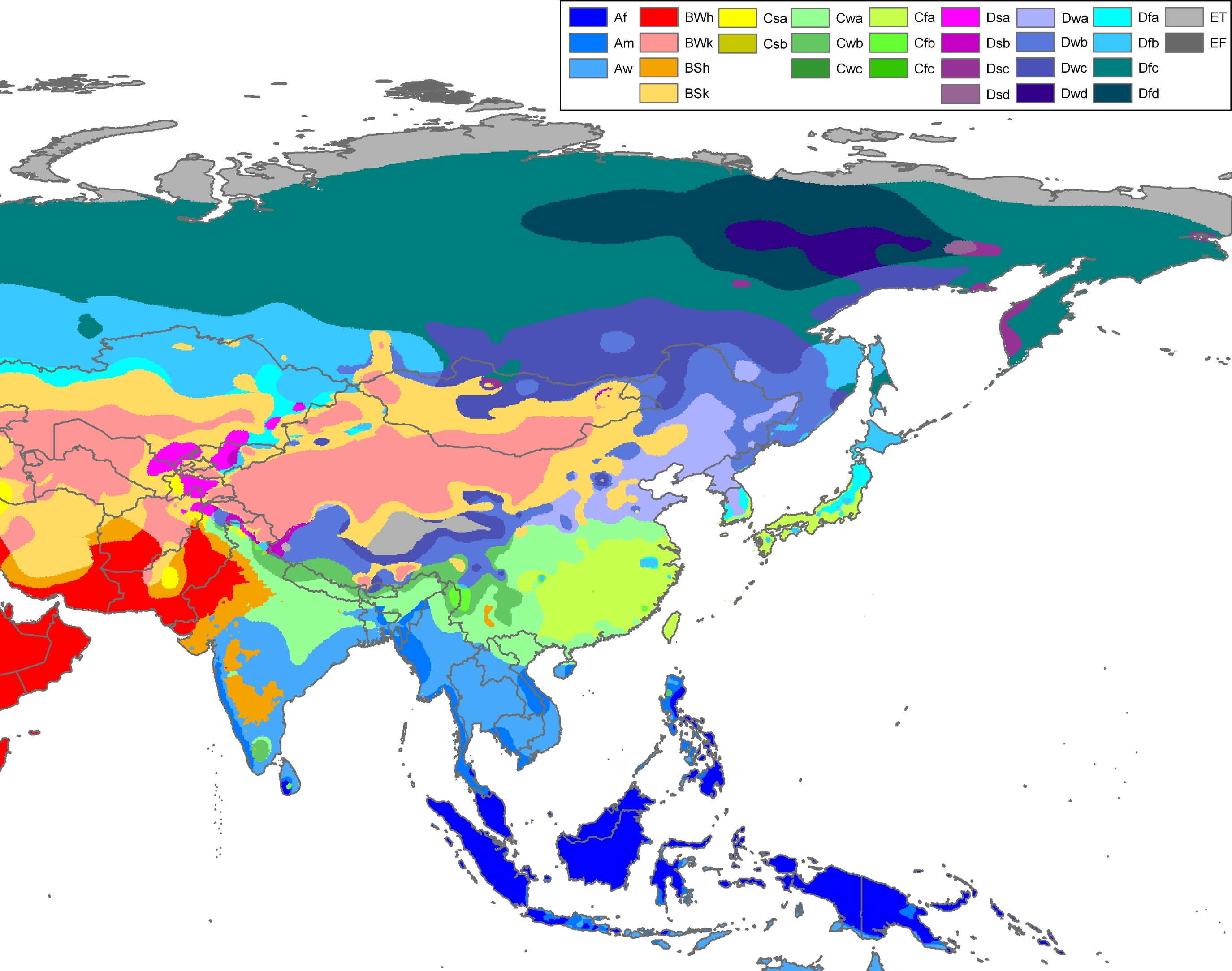
With elevations above 3,600 metres (12,000 ft), the prefecture has a harsh climate, with long, cold winters, and short, rainy, and cool to warm summers. Specifically, in the Köppen system, the prefecture ranges from the alpine variation of the subarctic climate (Köppen Dwc), to a full alpine climate (Köppen EH), to a semi-arid climate (Köppen BSk).[10] Most of the annual precipitation occurs from June to September, when on average, a majority of the days each month has some rainfall. The annual mean temperature in Yushu County, at an elevation of 3,690 metres (12,110 ft), is 3.22 °C (37.8 °F) and in Qumarlêb, in the northeast of the prefecture at 4,190 m (13,750 ft) elevation, −2.13 °C (28.2 °F). Sunshine is generous, ranging from around 2500 hours in the prefecture seat to 2780 hours in Qumarlêb.
| Climate data for Yushu (1991–2020 normals) | |||||||||||||
|---|---|---|---|---|---|---|---|---|---|---|---|---|---|
| Month | Jan | Feb | Mar | Apr | May | Jun | Jul | Aug | Sep | Oct | Nov | Dec | Year |
| Record high °C (°F) | 17.6 (63.7) |
15.6 (60.1) |
23.9 (75.0) |
26.1 (79.0) |
34.1 (93.4) |
35.7 (96.3) |
36.8 (98.2) |
34.4 (93.9) |
33.7 (92.7) |
25.2 (77.4) |
18.5 (65.3) |
15.0 (59.0) |
36.8 (98.2) |
| Mean maximum °C (°F) | 9.5 (49.1) |
11.0 (51.8) |
15.4 (59.7) |
18.9 (66.0) |
22.5 (72.5) |
25.0 (77.0) |
25.8 (78.4) |
25.7 (78.3) |
23.7 (74.7) |
19.9 (67.8) |
12.6 (54.7) |
9.9 (49.8) |
26.9 (80.4) |
| Mean daily maximum °C (°F) | 2.5 (36.5) |
5.2 (41.4) |
8.8 (47.8) |
12.6 (54.7) |
16.0 (60.8) |
18.8 (65.8) |
20.9 (69.6) |
20.8 (69.4) |
18.0 (64.4) |
12.4 (54.3) |
7.8 (46.0) |
4.0 (39.2) |
12.3 (54.2) |
| Daily mean °C (°F) | −6.9 (19.6) |
−3.6 (25.5) |
0.4 (32.7) |
4.4 (39.9) |
8.3 (46.9) |
11.5 (52.7) |
13.5 (56.3) |
12.9 (55.2) |
9.8 (49.6) |
4.0 (39.2) |
−1.7 (28.9) |
−6.0 (21.2) |
3.9 (39.0) |
| Mean daily minimum °C (°F) | −14.5 (5.9) |
−10.9 (12.4) |
−6.4 (20.5) |
−2.2 (28.0) |
2.0 (35.6) |
6.1 (43.0) |
7.7 (45.9) |
6.9 (44.4) |
4.5 (40.1) |
−1.5 (29.3) |
−8.5 (16.7) |
−13.6 (7.5) |
−2.5 (27.4) |
| Mean minimum °C (°F) | −20.9 (−5.6) |
−18.2 (−0.8) |
−13.6 (7.5) |
−7.9 (17.8) |
−3.3 (26.1) |
0.5 (32.9) |
2.2 (36.0) |
1.2 (34.2) |
−1.8 (28.8) |
−8.2 (17.2) |
−14.7 (5.5) |
−19.9 (−3.8) |
−21.7 (−7.1) |
| Record low °C (°F) | −30.0 (−22.0) |
−28.3 (−18.9) |
−19.5 (−3.1) |
−12.8 (9.0) |
−11.6 (11.1) |
−4.8 (23.4) |
−1.9 (28.6) |
−2.3 (27.9) |
−7.9 (17.8) |
−14.3 (6.3) |
−20.6 (−5.1) |
−27.6 (−17.7) |
−30.0 (−22.0) |
| Average precipitation mm (inches) | 4.3 (0.17) |
4.8 (0.19) |
10.3 (0.41) |
19.1 (0.75) |
57.3 (2.26) |
103.2 (4.06) |
93.1 (3.67) |
85.6 (3.37) |
77.7 (3.06) |
32.9 (1.30) |
3.4 (0.13) |
2.3 (0.09) |
494 (19.46) |
| Average precipitation days (≥ 0.1 mm) | 3.9 | 4.4 | 6.4 | 11.5 | 17.8 | 22.3 | 19.7 | 18.6 | 19.6 | 12.9 | 3.5 | 2.2 | 142.8 |
| Average snowy days | 5.9 | 7.3 | 10.0 | 13.4 | 5.4 | 0.7 | 0.1 | 0.1 | 0.5 | 9.6 | 5.8 | 3.9 | 62.7 |
| Average relative humidity (%) | 42 | 40 | 41 | 48 | 55 | 64 | 65 | 65 | 68 | 63 | 48 | 41 | 53 |
| Mean monthly sunshine hours | 185.7 | 182.0 | 215.3 | 224.5 | 222.9 | 194.2 | 218.2 | 213.1 | 188.6 | 187.6 | 198.2 | 194.4 | 2,424.7 |
| Percent possible sunshine | 58 | 58 | 58 | 57 | 52 | 45 | 50 | 52 | 52 | 54 | 64 | 63 | 55 |
| Source: China Meteorological Administration[11][12][13] | |||||||||||||
| Climate data for Qumarlêb (1991–2020 normals, extremes 1971–2010) | |||||||||||||
|---|---|---|---|---|---|---|---|---|---|---|---|---|---|
| Month | Jan | Feb | Mar | Apr | May | Jun | Jul | Aug | Sep | Oct | Nov | Dec | Year |
| Record high °C (°F) | 10.3 (50.5) |
9.9 (49.8) |
13.7 (56.7) |
16.8 (62.2) |
21.6 (70.9) |
24.1 (75.4) |
24.9 (76.8) |
23.6 (74.5) |
20.8 (69.4) |
19.0 (66.2) |
8.4 (47.1) |
8.9 (48.0) |
24.9 (76.8) |
| Mean daily maximum °C (°F) | −3.8 (25.2) |
−1.0 (30.2) |
2.7 (36.9) |
7.1 (44.8) |
10.7 (51.3) |
13.7 (56.7) |
16.4 (61.5) |
16.3 (61.3) |
12.8 (55.0) |
6.9 (44.4) |
1.3 (34.3) |
−2.2 (28.0) |
6.7 (44.1) |
| Daily mean °C (°F) | −12.8 (9.0) |
−9.5 (14.9) |
−5.4 (22.3) |
−0.7 (30.7) |
3.5 (38.3) |
7.2 (45.0) |
9.7 (49.5) |
9.3 (48.7) |
5.7 (42.3) |
−0.9 (30.4) |
−7.8 (18.0) |
−12.1 (10.2) |
−1.2 (29.9) |
| Mean daily minimum °C (°F) | −20.8 (−5.4) |
−17.6 (0.3) |
−13.0 (8.6) |
−7.9 (17.8) |
−2.9 (26.8) |
1.8 (35.2) |
4.0 (39.2) |
3.4 (38.1) |
0.6 (33.1) |
−6.5 (20.3) |
−14.8 (5.4) |
−20.0 (−4.0) |
−7.8 (18.0) |
| Record low °C (°F) | −34.2 (−29.6) |
−31.2 (−24.2) |
−27.1 (−16.8) |
−19.9 (−3.8) |
−14.9 (5.2) |
−6.4 (20.5) |
−4.3 (24.3) |
−9.5 (14.9) |
−10.2 (13.6) |
−24.0 (−11.2) |
−28.4 (−19.1) |
−34.4 (−29.9) |
−34.4 (−29.9) |
| Average precipitation mm (inches) | 4.4 (0.17) |
3.2 (0.13) |
7.8 (0.31) |
14.8 (0.58) |
39.4 (1.55) |
85.8 (3.38) |
96.6 (3.80) |
79.0 (3.11) |
71.3 (2.81) |
20.5 (0.81) |
3.6 (0.14) |
1.7 (0.07) |
428.1 (16.86) |
| Average precipitation days (≥ 0.1 mm) | 4.7 | 5.4 | 7.9 | 10.3 | 17.3 | 21.6 | 19.4 | 17.8 | 19.8 | 11.5 | 3.5 | 2.9 | 142.1 |
| Average snowy days | 6.8 | 7.5 | 11.2 | 13.5 | 19.2 | 7.3 | 1.6 | 1.5 | 7.9 | 13.6 | 5.5 | 4.8 | 100.4 |
| Average relative humidity (%) | 43 | 39 | 42 | 47 | 57 | 66 | 66 | 66 | 70 | 61 | 49 | 42 | 54 |
| Mean monthly sunshine hours | 205.4 | 190.9 | 219.9 | 234.9 | 232.6 | 203.3 | 232.7 | 225.1 | 206.0 | 233.7 | 230.8 | 224.1 | 2,639.4 |
| Percent possible sunshine | 65 | 61 | 59 | 60 | 54 | 47 | 53 | 55 | 56 | 68 | 75 | 73 | 61 |
| Source: China Meteorological Administration[11][14][15] | |||||||||||||
The prefecture is subdivided into six county-level divisions, composing 5 counties and 1 County-level city:
| Map | ||||||||
|---|---|---|---|---|---|---|---|---|
| # | Name | Hanzi | Hanyu Pinyin | Tibetan | Wylie Tibetan Pinyin |
Population (2010 Census) |
Area (km2) | Density (/km2) |
| 1 | Yushu City | 玉树市 | Yùshù Shì | ཡུལ་ཤུལ་གྲོང་ཁྱེར། | yul shul grong khyer Yüxü Chongkyir |
120,447 | 13,462 | 8.94 |
| 2 | Zadoi County (Zaduo County) |
杂多县 | Záduō Xiàn | རྫ་སྟོད་རྫོང་། | rdza stod rdzong Zadoi Zong |
58,268 | 33,333 | 1.74 |
| 3 | Chindu County (Chenduo County) |
称多县 | Chènduō Xiàn | ཁྲི་འདུ་རྫོང་། | khri 'du rdzong Chindu Zong |
55,619 | 13,793 | 4.03 |
| 4 | Zhidoi County (Zhiduo County) |
治多县 | Zhìduō Xiàn | འབྲི་སྟོད་རྫོང་། | 'bri stod rdzong Zhidoi Zong |
30,037 | 66,667 | 0.45 |
| 5 | Nangqên County (Nangqian County) |
囊谦县 | Nángqiān Xiàn | ནང་ཆེན་རྫོང་། | nang chen rdzong Nangqên Zong |
85,825 | 11,539 | 7.43 |
| 6 | Qumarlêb County (Qumalai County) |
曲麻莱县 | Qūmálái Xiàn | ཆུ་དམར་ལེབ་རྫོང་། | chu dmar leb rdzong Qumarlêb Zong |
28,243 | 50,000 | 0.56 |
Agricultural produce of Yushu includes trees[clarification needed], wheat and millet including black Highland barley.
The eastern part of the prefecture, where most of its population lives, is served by the China National Highway 214 and the recently constructed (opened 2009) Yushu Batang Airport. In 2017 the G0613 Xining–Lijiang Expressway was completed, connecting the region to Hainan Tibetan Autonomous Prefecture and Xining.[16]
The far western part of the prefecture, which is hundreds of kilometers away from the prefecture's eastern "core", and has very little population, is crossed by China National Highway 109 and the Qinghai-Tibet Railway.
Ethnic groups in Yushu, according to 2005 Yushu Statistical Yearbook:[17]
| Nationality | Population | Percentage |
|---|---|---|
| Tibetan | 288,829 | 97.25% |
| Han | 7,594 | 2.56% |
| Hui | 295 | 0.1% |
| Tu/Monguor | 138 | <0.1% |
| Salar | 64 | <0.1% |
| Mongol | 50 | <0.1% |
| Manchu | 22 | <0.01% |
| Others | 12 | <0.01% |
This statistics only includes the registered population, not the floating population which is estimated at 50–60,000 for the entire prefecture.
- Citations
- 青海省统计局、国家统计局青海调查总队 (August 2016). 《青海统计年鉴-2016》. 中国统计出版社. ISBN 978-7-5037-7834-6. Archived from the original on 2017-12-28. Retrieved 2017-06-05.
- "Magnitude 6.9 – SOUTHERN QINGHAI, CHINA". earthquake.usgs.gov. 2008-05-12. Archived from the original on 2010-04-17. Retrieved 2010-04-15.
- "EMSC - European-Mediterranean Seismological Centre". Emsc-csem.org. Retrieved 2010-04-15.
- About 400 dead, 10,000 injured in 7.1-magnitude quake in China's Qinghai, xinhuanet.com. Retrieved 14 April 2010.
- 兰州军区和武警部队官兵投入青海玉树抗震救灾 (in Simplified Chinese). Xinhua.net. 14 April 2010. Archived from the original on April 17, 2010. Retrieved 2010-04-15.
- "Magnitude 6.9 – SOUTHERN QINGHAI, CHINA 2010". USGS. 14 April 2010. Archived from the original on 15 April 2010. Retrieved 2010-04-14.
- Gruschke, A. (2005). The Cultural Monuments of Tibet's Outer Provinces: Kham. Vol. 2: The Yushu Part of Kham. Bangkok. p. 36. ISBN 974-480-049-6.
{{cite book}}: CS1 maint: location missing publisher (link) - M. Zhao, O. Schell. "Tibet: Plateau in Peril". World Policy Journal, 2008
- The source of the Mekong River, Qinghai, China. Discovery and First Descent of the Mekong Headwaters. Masayuki Kitamura, Exploration Club of the Tokyo University of Agriculture. Japanese Alpine News, Vol. 1, October 2001.
- Peel, M. C. and Finlayson, B. L. and McMahon, T. A. (2007). "Updated world map of the Köppen-Geiger climate classification". Hydrol. Earth Syst. Sci. 11: 1633–1644. ISSN 1027-5606.
- 中国气象数据网 – WeatherBk Data (in Simplified Chinese). China Meteorological Administration. Retrieved 27 August 2023.
- 中国气象数据网 (in Simplified Chinese). China Meteorological Administration. Retrieved 27 August 2023.
- "Weather extremes for Yushu". Météo Climat. Retrieved 11 November 2019.
- 中国气象数据网 (in Simplified Chinese). China Meteorological Administration. Retrieved 27 August 2023.
- 中国地面国际交换站气候标准值月值数据集(1971-2000年). China Meteorological Administration. Archived from the original on 2013-09-21. Retrieved 2010-05-25.
- "China opens new expressway in Qinghai running on permafrost". Tibetan Review. 2017-08-02. Retrieved 2021-05-12.
- Yushu Zangzu Zizhizhou Tongjiju [Yushu Tibetan Autonomous Prefecture Statistics Bureau]: Yushu Tongjiju Nianjian 2005 [Yushu Statistical Yearbook 2005], Yushu 2006