|
Official name[1] |
Image |
Location |
Parish
/local
authority
area[1] |
Date of registration[1] |
Note |
| 2 |
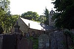
Leodest Methodist Chapel, Leodest Road |
 |
Leodest Road
54.375426°N 4.452840°W / 54.375426; -4.452840 (Leodest Methodist Chapel) |
Andreas |
23 May 1983 |
A Primitive Methodist chapel built in 1835[8][9] |
| 5 |
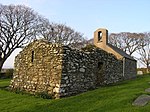
Yn Thie Thooit |
|
Lhen Road, The Lhen
54.381793°N 4.497203°W / 54.381793; -4.497203 (Yn Thie Thooit) |
Andreas |
23 May 1983 |
House with thatched roof.[10] Bequested to Manx National Heritage in 1989.[11]
[12]
Owned by Manx Museum and National Trust, and available for rental.[13][14][15][16][17] |
| 189 |
Close Lake House |
|
Jurby Road
54.333208°N 4.439249°W / 54.333208; -4.439249 (Close Lake House) |
Andreas |
15 May 2001 |
Mid-Victorian double-fronted house, perhaps built around 1703 for Rev. Wm. Bell Christian and his new wife, Charlotte Elizabeth Brine.[18] |
| 247 |
Ballaradcliffe House, Kiondroghad Road |
|
Kiondroghad Road
54.366414°N 4.452920°W / 54.366414; -4.452920 (Ballaradcliffe House) |
Andreas |
23 March 2007 |
Farmhouse on quarterland which has been in the Radcliffe family for 400 years. Built in the 1800s with Georgian-style exterior, on brow of a hill.[19] |
| 255 |
The Old Rectory, Andreas Village |
|
Andreas Village
54.365831°N 4.442509°W / 54.365831; -4.442509 (The Old Rectory, Andreas Village) |
Andreas |
2 May 2009 |
[20] |
| 150 |
Balladoole Farm Buildings |
|
54.083104°N 4.678352°W / 54.083104; -4.678352 (Balladooole Farm Buildings) |
Arbory |
8 February 1994 |
[21] |
| 207 |
The Former Wesleyan Chapel, Earystane Village |
|
Earystane Village
54.115335°N 4.705154°W / 54.115335; -4.705154 (Former Wesleyan Chapel, Earystane Village) |
Arbory |
18 October 2002 |
Church from 1864[22][23] In ruins, unroofed, per 2002 registration. Google and Bing satellite views accessed in 2020 however show a roofed structure now at that location. |
| 235 |
Parville, also known as Parville Place, Ballagawne Road, Ballabeg, IM9 4LF |
|
Ballagawne Road, Ballabeg
54.101247°N 4.682002°W / 54.101247; -4.682002 (Parville Place) |
Arbory |
1 September 2006 |
Prominent, large house set within extensive gardens. Hard to date; original portion believed to be from lifetime of Deemster John Parr, 1651–1713.[24] |
| 11 |
Ballaugh Old Church, The Cronk |
 |
Cronk Rd (A10), The Cronk
54.329941°N 4.553489°W / 54.329941; -4.553489 (Ballaugh Old Church) |
Ballaugh |
21 July 1983 |
History dating to before 1231. "New" parish church built 1832, now known as Ballaugh Old Church.[25] |
| 1 |
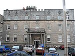
Bishopscourt, together with buildings contiguous therewith |
 |
54.299707°N 4.570821°W / 54.299707; -4.570821 (Bishopscourt) |
Ballaugh |
23 May 1983 |
[26] |
| 12 |
Old Kirk Braddan Church, Saddle Road |
 |
54.160993°N 4.507041°W / 54.160993; -4.507041 (Old Kirk Braddan Church, Saddle Road) |
Braddan |
21 July 1983 |
[note 2] |
| 81 |
Crogga Mill |
|
|
Braddan |
13 May 1985 |
[27] Presumably on east bank of Crogga River which forms border between Braddan and Santon parishes. |
| 92 |
Cronkbourne Village |
|
Ballafletcher Road54.168623°N 4.496635°W / 54.168623; -4.496635 (Cronbourne Village) |
Braddan |
7 July 1987 |
Two dozen cottages in two rows.[28] |
| 130 |
St Luke's Church |
 |
Brandywell Rd.54.209751°N 4.516128°W / 54.209751; -4.516128 (St. Luke's Church) |
Braddan |
16 April 1990 |
[29] |
| 153 |
Cronkbourne House and Cronkbourne Place |
|
54.167172°N 4.495831°W / 54.167172; -4.495831 (Cronkbourne House and Cronkbourne Place) |
Braddan |
6 February 1995 |
[30] |
| 158 |
Cemetery Office, Braddan Church |
|
54.164097°N 4.505620°W / 54.164097; -4.505620 (Cemetery Office, Braddan Church) |
Braddan |
26 January 1996 |
Baillie Scott-designed.[31] |
| 165 |
Oak House, Ballamona |
|
54.17339°N 4.50815°W / 54.17339; -4.50815 (Oak House, Ballamona) |
Braddan |
4 July 1996 |
Oak House within Ballamona Hospital, Strang.[32] (Within the current site of Noble's Hospital) |
| 180 |
Port Soderick railway station |
|
54.126561°N 4.538388°W / 54.126561; -4.538388 (Port Soderick Railway Station) |
Braddan |
18 September 2000 |
1897 built.[33] |
| 229 |
Braddan Lodge, Braddan Road |
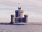
|
54.164604°N 4.505856°W / 54.164604; -4.505856 (Braddan Lodge, Braddan Road) |
Braddan |
22 July 2005 |
[34] |
| 232 |
Former Toll House, (Tollgate House), Old Castletown Road junction, Marine Drive[note 3] |
|
54.134211°N 4.520549°W / 54.134211; -4.520549 (Former Toll House, (Tollgate House), Old Castletown Road junction, Marine Drive) |
Braddan |
6 June 2006 |
[35] |
| 233 |
The Ornamental Gateway, Marine Drive |
 |
54.140669°N 4.470895°W / 54.140669; -4.470895 (The Ornamental Gateway, Marine Drive) |
Braddan |
6 June 2006 |
Romantic, castellated gateway.[36] |
| 3 |
Cranstal Cottage, Cranstal |
|
Cranstal Rd., Cranstal
54.391136°N 4.375384°W / 54.391136; -4.375384 (Cranstal Cottage, Cranstal) |
Bride |
23 May 1983 |
Has thatched roof.[37] |
| 4 |
Bridge Cottage, Cranstal |
 |
Cranstal Rd., Cranstal
54.390473°N 4.376430°W / 54.390473; -4.376430 (Bridge Cottage, Cranstal) |
Bride |
23 May 1983 |
Has thatched roof, 100 yards from Cranstal Cottage.[38] |
| 135 |
Thurot Cottage, Hill Road |
|
Thurot Cottage Road
54.385236°N 4.410019°W / 54.385236; -4.410019 (Thurot Cottage) |
Bride |
17 October 1990 |
[39] |
| 146 |
Thurot Cottage Outbuildings and Gate, Hill Road |
|
54.38449°N 4.41201°W / 54.38449; -4.41201 (Gate to Thurot Cottage)54.38546°N 4.41024°W / 54.38546; -4.41024 (Thurot Cottage outbuilding a)54.38551°N 4.40996°W / 54.38551; -4.40996 (Thurot Cottage outbuilding b)54.38551°N 4.40940°W / 54.38551; -4.40940 (Thurot Cottage outbuilding c) |
Bride |
21 October 1992 |
[40] |
| 147 |
Point of Ayre Lighthouse |
 |
Point of Ayre
54°24′56.7″N 4°22′05.2″W |
Bride |
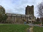
5 November 1993 |
[41] |
| 16 |
Bridge House (main building), Bridge Street |
 |
Bridge Street
54.074042°N 4.651099°W / 54.074042; -4.651099 (Bridge House, Castletown) |
Castletown |
26 September 1983 |
Four-storey building with pitched slate roof masked by parapet.[42] Site of the former Isle of Man Bank (Quayle's Bank). Attached Nautical Museum building is excluded. |
| 17 |
Town Hall (Manannan House) Market Square (the main building) |
|
54.073413°N 4.653934°W / 54.073413; -4.653934 (Town Hall (Manannan House) Market Square (the main building)) |
Castletown |
26 September 1983 |
[43] |
| 24 |
Castle Rushen |
 |
54.073769°N 4.6529°W / 54.073769; -4.6529 (Castle Rushen) |
Castletown |
3 February 1984 |
[44] |
| 25 |
The Castle Arms Hotel (The Glue Pot) |
 |
Castle Street
54.074027°N 4.652380°W / 54.074027; -4.652380 (The Castle Arms Hotel (The Glue Pot)) |
Castletown |
3 February 1984 |
[45] |
| 26 |
The Social Security Offices |
|
54.073998°N 4.652204°W / 54.073998; -4.652204 (The Social Security Offices, Castletown) |
Castletown |
3 February 1984 |
[46] |
| 27 |
The Police Station |
 |
54.073802°N 4.652120°W / 54.073802; -4.652120 (The Police Station, Castletown) |
Castletown |
3 February 1984 |
One-storey stone building with a circular turret, designed by architect Baillie Scott.[47] The status of this site is currently under review in 2018; the old building has been deemed "surplus" and is no longer used by the police, and had been put up for sale. It was possible that Manx Museum National Trust could take ownership.[48] |
| 28 |
The Post Office |
|
54.073683°N 4.652127°W / 54.073683; -4.652127 (The Post Office, Castletown) |
Castletown |
3 February 1984 |
[49] |
| 29 |
The Commissioners' Office (Old House of Keys) Parliament Square |
 |
54.073389°N 4.652083°W / 54.073389; -4.652083 (Old House of Keys) |
Castletown |
3 February 1984 |
[50] |
| 30 |
Barclays Bank, Market Square |
|
Market Square
54.073555°N 4.653614°W / 54.073555; -4.653614 (Barclays Bank, Market Square) |
Castletown |
3 February 1984 |
[51] |
| 31 |
"The Parade Stores" (G & F Collister), 1 Malew Street IM9 1AB |
|
1 Malew St.
54.073628°N 4.653904°W / 54.073628; -4.653904 (The Parade Stores (G & F Collister)) |
Castletown |
3 February 1984 |
[52] Later Lloyds Pharmacy. |
| 32 |
The Manx Co-operative Store, The Parade |
 |
54.073051°N 4.653529°W / 54.073051; -4.653529 (The Manx Co-operative Store, The Parade) |
Castletown |
3 February 1984 |
[53] See The Manx Co-operative Store, Manx Co-operative Store. |
| 33 |
The Smelt Memorial |
 |
54.073200°N 4.653291°W / 54.073200; -4.653291 (Smelt Memorial) |
Castletown |
3 February 1984 |
[54] Built 1836–37. |
| 34 |
No. 5 The Parade |
|
The Parade
54.072803°N 4.653270°W / 54.072803; -4.653270 (No. 5 The Parade) |
Castletown |
3 February 1984 |
[55] |
| 35 |
Balcony House, The Parade |
 |
54°04′22.29″N 4°39′11.5″W |
Castletown |
3 February 1984 |
[56] |
| 36 |
"The Odd Bottle"/Castle Wine Stores, 6A The Parade |
|
54.072923°N 4.653379°W / 54.072923; -4.653379 (The Odd Bottle/Castle Wine Stores, 6A The Parade) |
Castletown |
3 February 1984 |
[57] |
| 37 |
No. 7 (formerly No. 4), The Parade |
|
The Parade
54.072995°N 4.653448°W / 54.072995; -4.653448 (No. 7 (formerly No. 4), The Parade) |
Castletown |
3 February 1984 |
[58] |
| 38 |
The George Hotel, The Parade |
|
The Parade
54.073178°N 4.653635°W / 54.073178; -4.653635 (The George Hotel) |
Castletown |
3 February 1984 |
[59] |
| 39 |
The Isle of Man Bank, The Parade |
 |
The Parade
54.073279°N 4.653726°W / 54.073279; -4.653726 (The Isle of Man Bank, The Parade) |
Castletown |
3 February 1984 |
[60] Branch of the Isle of Man Bank |
| 40 |
The Trustee Savings Bank, The Parade |
|
The Parade
54.073342°N 4.653823°W / 54.073342; -4.653823 (The Trustee Savings Bank, The Parade) |
Castletown |
3 February 1984 |
[61] Former branch of the Trustee Savings Bank. Later Lloyds TSB. |
| 41 |
Ellan Vannin, The Quay |
|
The Quay
54.073772°N 4.651827°W / 54.073772; -4.651827 (Ellan Vannin, The Quay) |
Castletown |
24 February 1984 |
[62] |
| 42 |
Packet House, The Quay |
|
The Quay
54.073680°N 4.651689°W / 54.073680; -4.651689 (Packet House, The Quay) |
Castletown |
24 February 1984 |
[63] |
| 43 |
1 Quay Lane |
|
1 Quay Lane
54.073538°N 4.651797°W / 54.073538; -4.651797 (1 Quay Lane) |
Castletown |
24 February 1984 |
[64] |
| 44 |
2 Quay Lane |
|
2 Quay Lane
54.073577°N 4.651741°W / 54.073577; -4.651741 (2 Quay Lane) |
Castletown |
24 February 1984 |
[65] |
| 45 |
Garage, rear of "Clarksons", 1 Parliament Square |
|
54.073463°N 4.651874°W / 54.073463; -4.651874 (Garage, rear of "Clarksons", 1 Parliament Square) |
Castletown |
24 February 1984 |
[66] Modified extensively to add second storey, or possibly demolished and replaced by two-storey stone building.[note 4] |
| 46 |
1 Parliament Square |
|
1 Parliament Square
54.073551°N 4.652018°W / 54.073551; -4.652018 (1 Parliament Square) |
Castletown |
24 February 1984 |
[67] |
| 47 |
Harbour House, 7 The Quay |
|
7 The Quay
54.073575°N 4.651489°W / 54.073575; -4.651489 (Harbour House, 7 The Quay) |
Castletown |
24 February 1984 |
[68] |
| 48 |
The Granary, The Quay |
|
The Quay
54.073515°N 4.651431°W / 54.073515; -4.651431 (The Granary, The Quay) |
Castletown |
24 February 1984 |
[69] |
| 49 |
5 The Quay |
|
5 The Quay
54.073472°N 4.651357°W / 54.073472; -4.651357 (5 The Quay) |
Castletown |
24 February 1984 |
[70] |
| 50 |
4 The Quay |
|
4 The Quay54.073436°N 4.651282°W / 54.073436; -4.651282 (4 The Quay) |
Castletown |
24 February 1984 |
[71] |
| 51 |
3 The Quay |
|
3 The Quay
54.073397°N 4.651224°W / 54.073397; -4.651224 (3 The Quay) |
Castletown |
24 February 1984 |
[72] |
| 53 |
The Soup Kitchen/The Old Inn, Parliament Lane |
|
Parliament Lane
54.073325°N 4.651379°W / 54.073325; -4.651379 (The Soup Kitchen/The Old Inn, Parliament Lane) |
Castletown |
24 February 1984 |
[73] |
| 54 |
3 Parliament Lane |
|
3 Parliament Lane
54.073418°N 4.651405°W / 54.073418; -4.651405 (3 Parliament Lane) |
Castletown |
24 February 1984 |
[74] |
| 55 |
1 Parliament Lane |
|
1 Parliament Lane
54.073435°N 4.651597°W / 54.073435; -4.651597 (1 Parliament Lane) |
Castletown |
24 February 1984 |
[75] |
| 56 |
Former H M Coastguard Building (now Rocket House), Parliament Square |
|
1 Quay Lane
54.073481°N 4.651645°W / 54.073481; -4.651645 (Former H M Coastguard Building (now Rocket House), Parliament Square) |
Castletown |
24 February 1984 |
[76] |
| 57 |
4 Quay Lane |
|
4 Quay Lane
54.073544°N 4.651564°W / 54.073544; -4.651564 (4 Quay Lane) |
Castletown |
24 February 1984 |
[77] |
| 58 |
2 Parliament Square |
|
2 Parliament Square
54.073337°N 4.651714°W / 54.073337; -4.651714 (2 Parliament Square) |
Castletown |
24 February 1984 |
[78] |
| 59 |
3 The Parade |
|
The Parade
54.072994°N 4.652765°W / 54.072994; -4.652765 (3 The Parade) |
Castletown |
24 February 1984 |
[79] |
| 60 |
The Old Lifeboat House, The Quay |
|
The Quay
54.073057°N 4.651507°W / 54.073057; -4.651507 (The Old Lifeboat House, The Quay) |
Castletown |
24 February 1984 |
[80] |
| 61 |
3 Parliament Square |
|
Parliament Square
54.073327°N 4.651886°W / 54.073327; -4.651886 (3 Parliament Square) |
Castletown |
24 February 1984 |
[81] |
| 62 |
4 Parliament Square |
|
Parliament Square
54.073342°N 4.652005°W / 54.073342; -4.652005 (4 Parliament Square) |
Castletown |
24 February 1984 |
[82] |
| 63 |
Westminster House, Parliament Square |
|
54.073293°N 4.652288°W / 54.073293; -4.652288 (Westminster House, Parliament Square) |
Castletown |
24 February 1984 |
[83] |
| 64 |
5 Parliament Square |
|
Parliament Square
54.073361°N 4.652315°W / 54.073361; -4.652315 (5 Parliament Square) |
Castletown |
24 February 1984 |
[84] |
| 65 |
Compton House, Parliament Square |
|
Parliament Square
54.073388°N 4.652411°W / 54.073388; -4.652411 (Compton House, Parliament Square) |
Castletown |
24 February 1984 |
[85] |
| 66 |
Stanley House, Castle Street |
|
Castle Street
54.073327°N 4.652630°W / 54.073327; -4.652630 (Stanley House, Castle Street) |
Castletown |
24 February 1984 |
[86] Later "Leonardo's Restaurant". |
| 67 |
"Hawtons", 5 Castle Street |
|
Castle Street
54.073273°N 4.652839°W / 54.073273; -4.652839 (Hawtons, 5 Castle Street) |
Castletown |
24 February 1984 |
[87] |
| 68 |
3 Castle Street |
|
Castle Street
54.073230°N 4.652929°W / 54.073230; -4.652929 (3 Castle Street) |
Castletown |
24 February 1984 |
[88] |
| 69 |
24 Castle Street |
|
24 Castle Street
54.073203°N 4.653016°W / 54.073203; -4.653016 (24 Castle Street) |
Castletown |
24 February 1984 |
[89] |
| 70 |
Red House, 1 The Parade |
|
The Parade
54.073112°N 4.652920°W / 54.073112; -4.652920 (Red House, 1 The Parade) |
Castletown |
24 February 1984 |
[90] |
| 71 |
2 The Parade |
|
The Parade
54.073042°N 4.652828°W / 54.073042; -4.652828 (2 The Parade) |
Castletown |
24 February 1984 |
[91] |
| 72 |
St Mary's Church |
 |
54.072815°N 4.652857°W / 54.072815; -4.652857 (St. Mary's Church, Castletown) |
Castletown |
15 March 1984 |
[92] Former church building, now offices. |
| 73 |
St Mary's Chapel/Old Grammar School |
 |
54°04′22.02″N 4°39′07.87″W |
Castletown |
15 March 1984 |
[93] |
| 76 |
The Witches Mill and attached building (part of Mill Court) |
|
54.075257°N 4.662323°W / 54.075257; -4.662323 (The Witches Mill and attached building (part of Mill Court)) |
Castletown |
28 February 1985 |
[94] |
| 185 |
King William's College, Castletown |
 |
54.078967°N 4.635016°W / 54.078967; -4.635016 (King William's College, Castletown) |
Castletown |
6 July 2001 |
[95] |
| 208 |
The Golden Meadow Mill |
|
54.079266°N 4.651585°W / 54.079266; -4.651585 (The Golden Meadow Mill) |
Castletown |
18 October 2002 |
Also known as Meadow Mill or Paradise Meadow Mill.[96] |
| 257 |
Castletown Railway Station, Victoria Road |
 |
54.078670°N 4.648767°W / 54.078670; -4.648767 (Castletown Railway Station) |
Castletown |
8 April 2008 |
Built of local limestone in c.1874. Listing includes two buildings.[97] |
| 259 |
Elderbank, The Crofts, IM9 1LW |
|
54.074310°N 4.656689°W / 54.074310; -4.656689 (Elderbank, The Crofts) |
Castletown |
8 April 2008 |
[98] |
| 260 |
Westwood, The Crofts, IM9 1LW |
|
54.074622°N 4.656682°W / 54.074622; -4.656682 (Westwood, The Crofts) |
Castletown |
8 April 2008 |
Associated with Manx architect Thomas Brine.[99] |
| 261 |
Crofton, The Crofts, IM9 1LW |
|
54.074751°N 4.656306°W / 54.074751; -4.656306 (Crofton, The Crofts) |
Castletown |
8 April 2008 |
[100] |
| 264 |
Royal British Legion Hall, Janet's Corner |
|
Bromet Road |
Castletown |
3 March 2009 |
[101] Possibly has been demolished.[102] |
| 269 |
Lorne House |
|
Bridge Street
54.075021°N 4.651074°W / 54.075021; -4.651074 (Lorne House, Castletown) |
Castletown |
11 November 2015 |
Two-storey stone mansion and gardens. Originally built in the 1700s; rebuilt or extended in 1828 to Georgian design of Thomas Brine.[103] |
| 18 |
20 Church Street |
|
20 Church St.
54.149009°N 4.481214°W / 54.149009; -4.481214 (20 Church Street) |
Douglas |
26 September 1988 |
[104] |
| 19 |
22 Church Street (including that portion of the shop extending under No. 20 Church Street) |
|
22 Church St.
54.149067°N 4.481264°W / 54.149067; -4.481264 (22 Church Street) |
Douglas |
26 September 1983 |
[105] |
| 20 |
24 Church Street |
|
24 Church St.
54.149105°N 4.481296°W / 54.149105; -4.481296 (24 Church St.) |
Douglas |
26 September 1983 |
[106] |
| 21 |
7 John Street |
|
7 John Street
54.148977°N 4.481154°W / 54.148977; -4.481154 (7 John Street) |
Douglas |
26 September 1983 |
[107] |
| 74 |
Douglas Railway Station, together with the Ticket Office, Gateway and boundary walls |
 |
54.147847°N 4.485301°W / 54.147847; -4.485301 (Douglas Railway Station) |
Douglas |
15 March 1984 |
[108] |
| 77 |
The Grand Union Camera Obscura, Douglas Head |
 |
Douglas Head54.143345°N 4.467289°W / 54.143345; -4.467289 (Grand Union Camera Obscura) |
Douglas |
29 March 1985 |
[109] |
| 78 |
Clinch's Brewery Building, North Quay |
|
North Quay
54.147520°N 4.484386°W / 54.147520; -4.484386 (Clinch's Brewery Building, North Quay) |
Douglas |
29 March 1985 |
[110] See Clinch's Brewery |
| 82 |
The Castle Mona Hotel, Central Promenade |
 |
54.161754°N 4.473410°W / 54.161754; -4.473410 (The Castle Mona Hotel) |
Douglas |
3 October 1985 |
[111] |
| 86 |
The Spire of St Andrew's United Reform Church, Finch Road |
|
Finch Road
54.150672°N 4.481073°W / 54.150672; -4.481073 (The Spire of St Andrew's United Reform Church, Finch Road) |
Douglas |
19 February 1986 |
[112] Indeed, 2010 Google Streetview imagery shows spire while church beside has been replaced. St. Andrew's United Reform Church has relocated.[note 5] |
| 93 |
4 Finch Road |
|
4 Finch Road
54.151132°N 4.480974°W / 54.151132; -4.480974 (4 Finch Road) |
Douglas |
27 July 1987 |
[113] |
| 94 |
6 Finch Road |
|
6 Finch Road
54.151691°N 4.480901°W / 54.151691; -4.480901 (6 Finch Road) |
Douglas |
27 July 1987 |
[114] |
| 95 |
8 Finch Road |
|
8 Finch Road
54.151301°N 4.481001°W / 54.151301; -4.481001 (8 Finch Road) |
Douglas |
27 July 1987 |
[115] |
| 96 |
12 Finch Road |
|
|
Douglas |
9 September 1987 |
[116] |
| 97 |
14 Finch Road |
|
14 Finch Road
54.151686°N 4.480901°W / 54.151686; -4.480901 (14 Finch Road) |
Douglas |
9 September 1987 |
[117] |
| 98 |
16 Finch Road |
|
|
Douglas |
27 July 1987 |
It is identified as the British Legion Club in map accompanying registration.[118] |
| 99 |
18 Finch Road |
|
|
Douglas |
27 July 1987 |
[119] |
| 100 |
20 Finch Road |
|
|
Douglas |
27 July 1987 |
[120] |
| 101 |
22 Finch Road |
|
|
Douglas |
27 July 1987 |
[121] |
| 102 |
24 Finch Road |
|
|
Douglas |
27 July 1987 |
[122] |
| 105 |
The Old thatch, Brunswick Road |
|
54.160525°N 4.491505°W / 54.160525; -4.491505 (The Old Thatch, Brunswick Road) |
Douglas |
17 February 1988 |
[123] Has thatched roof. |
| 106 |
St Matthew's Church, North Quay |
|
North Quay
54.147750°N 4.480271°W / 54.147750; -4.480271 (St Matthew's Church, North Quay) |
Douglas |
19 September 1988 |
[124] |
| 107 |
The Rechabite Hall, Allan Street |
|
Allan Street
54.151619°N 4.486733°W / 54.151619; -4.486733 (The Rechabite Hall, Allan Street) |
Douglas |
9 November 1988 |
[125] |
| 112 |
The Falcon Cliff Hotel |
|
Palace Road54.163719°N 4.471314°W / 54.163719; -4.471314 (Falcon Cliff Hotel) |
Douglas |
11 September 1989 |
Built in 1836 to Gothic design of local architect John Robinson.[126] |
| 113 |
The Douglas Head Hotel |
|
Douglas Head
54.142473°N 4.469220°W / 54.142473; -4.469220 (Douglas Head Hotel) |
Douglas |
11 September 1989 |
[127] |
| 114 |
The Salisbury Hotel, Victoria Street |
|
Victoria Street
54.149104°N 4.477342°W / 54.149104; -4.477342 (The Salisbury Hotel, Victoria Street) |
Douglas |
11 September 1989 |
[128] |
| 115 |
The Harbour Swing Bridge Tower and Mechanism |
|
54.146690°N 4.477413°W / 54.146690; -4.477413 (The Harbour Swing Bridge Tower and Mechanism) |
Douglas |
11 September 1989 |
[129] |
| 120 |
The Market Buildings |
|
North Quay
54.147961°N 4.479013°W / 54.147961; -4.479013 (The Market Buildings (Butchers Market))
54.148088°N 4.478624°W / 54.148088; -4.478624 (The Market Buildings (Fish and Butter Market)) |
Douglas |
11 September 1989 |
Iron pavilion buildings, with Butchers Market on west side of Market Hill road and Fish and Butter Market on east.[130] |
| 132 |
Red Pier Complex, King Edward Pier |
|
King Edward Pier
54.147201°N 4.475106°W / 54.147201; -4.475106 (Red Pier Complex, King Edward Pier) |
Douglas |
20 July 1990 |
Last surviving vestige of former Red Pier complex.[131] |
| 134 |
The Coach House, Selbourne Drive |
|
At corner of lanes behind Selbourne Drive and Albany Road
54.158082°N 4.491227°W / 54.158082; -4.491227 (Registered Building No. 134) |
Douglas |
4 October 1990 |
[132] |
| 137 |
The Nook, Quarterbridge Road |
|
Quarterbridge Road
54.155913°N 4.500724°W / 54.155913; -4.500724 (The Nook, Quarterbridge Road) |
Douglas |
15 April 1991 |
[133] |
| 145 |
Okells Brewery, Glen Falcon |
|
54.158197°N 4.480471°W / 54.158197; -4.480471 (Okells Brewery, Glen Falcon) |
Douglas |
17 March 1992 |
[134] See Okells Brewery |
| 149 |
Douglas Head Lighthouse |
 |
54.143428°N 4.465806°W / 54.143428; -4.465806 (Douglas Head Lighthouse) |
Douglas |
5 November 1993 |
[135] |
| 156 |
Facade and Foyer, Strand Cinema |
|
Strand Street54.151376°N 4.479164°W / 54.151376; -4.479164 (Facade and Foyer, Strand Cinema) |
Douglas |
11 July 1995 |
The Strand Theatre, built in 1913, was the first purpose-built cinema in the Isle of Man. Deemed "a strikingly good example of 'People's Palace' architecture".[136] |
| 159 |
"Ivydene", Little Switzerland |
|
54.166629°N 4.467225°W / 54.166629; -4.467225 (Ivydene, Little Switzerland) |
Douglas |
26 January 1996 |
Baillie Scott-designed.[137] |
| 160 |
The Red House, Victoria Road |
|
Victoria Road
54.170321°N 4.469097°W / 54.170321; -4.469097 (The Red House, Victoria Road) |
Douglas |
26 January 1996 |
Baillie Scott-designed.[138] |
| 161 |
"Oakleigh", Glencrutchery Road |
|
Glencrutchery Road (A2)
54.170115°N 4.471931°W / 54.170115; -4.471931 (Oakleigh, Glencrutchery Road) |
Douglas |
26 January 1996 |
Baillie Scott-designed.[139] |
| 162 |
Myrtle Bank, Little Switzerland |
|
54.167576°N 4.469402°W / 54.167576; -4.469402 (Myrtle Bank, Little Switzerland) |
Douglas |
26 January 1996 |
Two-storey Baillie Scott-designed, semi-attached to Hollybank.[140] |
| 163 |
Hollybank, Little Switzerland |
|
54.167576°N 4.469402°W / 54.167576; -4.469402 (Holly Bank, Little Switzerland) |
Douglas |
26 January 1996 |
Baillie Scott-designed, semi-attached to Myrtle Bank.[141] |
| 164 |
Falcon Cliff Terrace, Ivy Cottage, Thie Bannee, Inglenook, Thorn Bank[note 6] |
|
Falcon Cliff Terrace
54.164225°N 4.475923°W / 54.164225; -4.475923 (Falcon Cliff Terrace, Ivy Cottage, Thie Bannee, Inglenook, Thorn Bank) |
Douglas |
26 January 1996 |
A row house designed by Baillie Scott.[142] |
| 166 |
Cadran Cottage, Ballanard Road |
|
Ballanard Road
54.173232°N 4.489752°W / 54.173232; -4.489752 (Cadran Cottage, Ballanard Road) |
Douglas |
15 September 1996 |
Pre-1869 cottage remodelled c.1910 with design by Manx designer Archibald Knox.[143] Labelled with sign "Cadran Cottage".[144] |
| 167 |
Douglas Courthouse and 13 Athol Street |
|
Athol Street
54.149346°N 4.481685°W / 54.149346; -4.481685 (Douglas Courthouse and 13 Athol Street) |
Douglas |
15 April 1997 |
Georgian-style building, probably a work of local architect John Robinson.[145] By 2010, however, the facade of 13 Athol Street, or perhaps its entirety, has been replaced.[146] |
| 169 |
Douglas Town Hall and Public Library, Ridgeway Street |
|
Ridgeway Street
54.148792°N 4.480739°W / 54.148792; -4.480739 (Douglas Town Hall and Public Library, Ridgeway Street) |
Douglas |
22 May 1997 |
Town Hall with 47 by 32 feet (14.3 m × 9.8 m) arched-roof Council Chamber. With adjoining library which effectively served as a national library of the Isle of Man for many years. Built at cost of £25,708, in use by 1900.[147] |
| 173 |
Central Hotel |
|
54.157372°N 4.477268°W / 54.157372; -4.477268 (Central Hotel, Douglas) |
Douglas |
25 June 1998 |
[148] |
| 174 |
1 Albert Terrace |
|
1 Albert Terrace54.154826°N 4.482309°W / 54.154826; -4.482309 (1 Albert Terrace) |
Douglas |
25 June 1998 |
[149] |
| 177 |
Erin Brae, Queen's Promenade |
|
Queen's Promenade
54.165492°N 4.466909°W / 54.165492; -4.466909 (Erin Brae, Queen's Promenade) |
Douglas |
12 October 1998 |
Built c.1822. Has served as private residence and as a hotel.[150] Later Kings Guest House.[144] |
| 178 |
St Thomas Church, Douglas |
|
54.154419°N 4.479574°W / 54.154419; -4.479574 (St. Thomas Church, Douglas) |
Douglas |
14 June 1999 |
Built 1846–49 but soon closed due to dispute over patronage and not reopened until 1872.[151] |
| 179 |
Harold Tower, Douglas Head Road |
|
54.144172°N 4.471322°W / 54.144172; -4.471322 (Harold Tower, Douglas Head Road) |
Douglas |
18 September 2000 |
Castellated octagonal tower/house, screened by trees, built in 1833 originally as a folly.[152] |
| 186 |
Douglas Hotel, North Quay |
|
North Quay
54.147923°N 4.478290°W / 54.147923; -4.478290 (Douglas Hotel, North Quay) |
Douglas |
26 July 2001 |
[153] |
| 187 |
1-12 Victoria Terrace, off Victoria Road |
|
Victoria Terrace
54.159651°N 4.478769°W / 54.159651; -4.478769 (1-12 Victoria Terrace, off Victoria Road) |
Douglas |
15 August 2001 |
[154] |
| 188 |
All Saints Church, Alexander Drive |
 |
54.155965°N 4.48971°W / 54.155965; -4.48971 (All Saints Church, Douglas) |
Douglas |
15 August 2001 |
It includes a mural by local artist Dorothy Nicholson.[155] Relatively modern church built on site of older historic one; closed in 2017. |
| 190 |
Woodlands, Alexander Drive |
|
Alexander Drive
54.157917°N 4.496113°W / 54.157917; -4.496113 (Woodlands, Alexander Drive) |
Douglas |
31 October 2001 |
[156] |
| 191 |
Ravenscourt, Peel Road |
|
Peel Road
54.153965°N 4.499718°W / 54.153965; -4.499718 (Ravenscourt, Peel Road) |
Douglas |
31 October 2001 |
[157] |
| 192 |
Crescent Cinema, Central Promenade |
|
Central Promenade
54.159905°N 4.475184°W / 54.159905; -4.475184 (Crescent Cinema, Central Promenade) |
Douglas |
31 October 2001 |
[158] |
| 193 |
Old Brewer's House, Castle Hill |
|
Castle Hill
54.162870°N 4.475296°W / 54.162870; -4.475296 (Old Brewer's House, Castle Hill) |
Douglas |
31 October 2001 |
[159] |
| 195 |
The National Westminster Bank, Prospect Hill |
|
Prospect Hill
54.149392°N 4.480957°W / 54.149392; -4.480957 (The National Westminster Bank, Prospect Hill) |
Douglas |
20 September 2002 |
It was built in 1891 for George William Dumbbell's bank, which had been founded in 1853. It was expanded with a two-storey extension, adding to the three-storey original building, in 1891. Dumbbell's Bank failed dramatically on 3 February 1900, on what was known as Black Saturday, changing the lives of many.[160] |
| 196 |
Jubilee Clock, Victoria Street |
 |
Victoria Street & Loch Promenade
54.149189°N 4.475991°W / 54.149189; -4.475991 (Jubilee Clock, Victoria Street) |
Douglas |
20 September 2002 |
Cast iron street clock, manufactured in Glasgow, erected for the 1887 Golden Jubilee of Queen Victoria as a gift by George William Dumbbell.[161][160] |
| 197 |
St Mary's of the Isle Catholic Church, Hill Street |
|
Hill Street
54.150655°N 4.482393°W / 54.150655; -4.482393 (St Mary's of the Isle Catholic Church, Hill Street) |
Douglas |
20 September 2002 |
Built 1857–59.[162] |
| 198 |
The former Isle of Man Times Office, 9 Athol Street[note 7] |
|
9 Athol Street
54.149505°N 4.481408°W / 54.149505; -4.481408 (The former Isle of Man Times Office, 9 Athol Street) |
Douglas |
20 September 2002 |
Home from 1870 of the Isle of Man Times newspaper, with red brick facade described as French Chateauesque.[163] |
| 199 |
29-31 Athol Street |
|
29–31 Athol Street
54.148927°N 4.482771°W / 54.148927; -4.482771 (29-31 Athol Street) |
Douglas |
20 September 2002 |
[164] |
| 200 |
The Gaiety Theatre, Harris Promenade |
 |
Harris Promenade
54.155194°N 4.478434°W / 54.155194; -4.478434 (Gaiety Theatre) |
Douglas |
24 September 2002 |
Opened in 1900.[165] |
| 201 |
The Queen's Hotel, Queen's Promenade |
|
Queen's Promenade
54.165343°N 4.467110°W / 54.165343; -4.467110 (The Queen's Hotel, Queen's Promenade) |
Douglas |
20 September 2002 |
Public house which was built before 1826, probably originally as cottages and stables for Castle Mona. Called Queen's Hotel by 1854.[166] |
| 205 |
Tower of Refuge, St. Mary's Rock (also known as Conister Rock) |
 |
St. Mary's Rock, also known as Conister Rock
54.1504°N 4.4687°W / 54.1504; -4.4687 (Tower of Refuge) |
Douglas |
18 October 2002 |
Built in 1832 to mark shoal to avoid shipwrecks. Triangular with three turrets.[167] |
| 210 |
4-11 Harris Terrace |
|
Harris Terrace
54.153399°N 4.483484°W / 54.153399; -4.483484 (4-11 Harris Terrace) |
Douglas |
13 December 2002 |
Built in 1837.[168] |
| 213 |
Raven's Cliff, Fort Anne Road |
|
Fort Anne Road
54.144810°N 4.472227°W / 54.144810; -4.472227 (Raven's Cliff, Fort Anne Road) |
Douglas |
27 January 2003 |
[169] |
| 217 |
Arch Tower House, South Quay |
|
South Quay
54.145934°N 4.483990°W / 54.145934; -4.483990 (Arch Tower House, South Quay) |
Douglas |
27 January 2003 |
Built 1853.[170] |
| 223 |
18a-20 Victoria Street |
|
18a-20 Victoria Street
54.149428°N 4.478645°W / 54.149428; -4.478645 (18a-20 Victoria Street) |
Douglas |
11 April 2005 |
[171] |
| 225 |
26 Victoria Street |
|
26 Victoria Street
54.149352°N 4.479146°W / 54.149352; -4.479146 (26 Victoria Street) |
Douglas |
11 April 2005 |
[172] |
| 226 |
Ridgeway House, Ridgeway Street |
|
Ridgeway Street
54.148868°N 4.480331°W / 54.148868; -4.480331 (Ridgeway House, Ridgeway Street) |
Douglas |
17 January 2005 |
[173] |
| 228 |
St Ninian's Church, Ballaquayle Road |
 |
Ballaquayle Road
54.164894°N 4.483343°W / 54.164894; -4.483343 (St Ninian's Church, Ballaquayle Road) |
Douglas |
22 July 2005 |
[174] |
| 230 |
Buck House Merton Bank |
|
Merton Bank
54.152996°N 4.484621°W / 54.152996; -4.484621 (Buck House Merton Bank) |
Douglas |
20 December 2005 |
Also known as Agriculture House and was formerly a Primitive Methodist chapel.[175] |
| 234 |
Farmhill Manor, Farmhill Lane, IM2 2EF |
|
Farmhill Lane
54.154490°N 4.522767°W / 54.154490; -4.522767 (Farmhill Manor, Farmhill Lane) |
Douglas |
6 June 2006 |
Small mansion originally known as Ballaquirk, converted from a farmhouse during 1780–1825.[176] |
| 244 |
Former Methodist Church aka Red Cross House, Derby Road. IM2 3EN |
|
54.157320°N 4.483781°W / 54.157320; -4.483781 (Former Methodist Church aka Red Cross House, Derby Road. IM2 3EN) |
Douglas |
13 September 2007 |
[177] |
| 258 |
Old School House, Cronkbourne, Douglas, IM4 4QH |
|
54.168641°N 4.497501°W / 54.168641; -4.497501 (Old School House, Cronkbourne) |
Douglas |
3 February 2009 |
[178] |
| 289 |
Former Newson's Trading Building 27-28 North Quay |
|
North Quay
54.147728°N 4.481435°W / 54.147728; -4.481435 (Former Newson's Trading Building 27-28 North Quay) |
Douglas |
13 April 2018 |
[179] |
| 290 |
IOM Bank Buildings 2 Athol Street |
|
2 Athol Street
54.149917°N 4.481107°W / 54.149917; -4.481107 (IOM Bank Buildings 2 Athol Street) |
Douglas |
13 April 2018 |
[180] |
| 83 |
Tynwald Old Mill and original Mill Wheel, Fuller's Hammer and related machinery, St Johns |
|
54.208354°N 4.632642°W / 54.208354; -4.632642 (Tynwald Old Mill) |
St John's, German |
4 November 1985 |
Old mill on River Neb.[181] Included in St John's Village Conservation Area. |
| 268 |
Glyn Moar, Glyn Moar Road, St Johns, IM4 3AQ |
|
Brack a Broom Lane
54.206054°N 4.642113°W / 54.206054; -4.642113 (Glyn Moar) |
St. John's, German |
18 September 2012 |
Manx Gothic Revival-style estate house built c.1845,[182] Included in St John's Village Conservation Area. |
| 237 |
Guard House & Fire Party, 258 Jurby Industrial Estate, IM7 3BD |
|
54.359153°N 4.521534°W / 54.359153; -4.521534 (Guard House & Fire Party) |
Jurby |
26 March 2007 |
[183] Later the Guard House Cafe. |
| 238 |
Jurby Aerodrome Bomb Store, Jurby Industrial Estate |
|
54.353730°N 4.511149°W / 54.353730; -4.511149 (Jurby Aerodrome Bomb Store, Jurby Industrial Estate) |
Jurby |
26 March 2007 |
[184] |
| 239 |
Jurby Terminal Building, Jurby Industrial Estate |
|
54.356371°N 4.521881°W / 54.356371; -4.521881 (Jurby Terminal Building) |
Jurby |
26 March 2007 |
[185] |
| 240 |
Aeroplane & Seaplane Store, 266 Jurby Industrial Estate |
|
54.358479°N 4.522100°W / 54.358479; -4.522100 (Aeroplane & Seaplane Store, 266 Jurby Industrial Estate) |
Jurby |
26 March 2007 |
[186] |
| 241.1 |
Pillbox at Field 211025 |
|
Ballavaran Road
54.349793°N 4.524853°W / 54.349793; -4.524853 (Pillbox at Field 211025) |
Jurby |
26 March 2007 |
[187] |
| 241.2 |
Pillbox at Field 214188, Ballamoar |
|
54.353387°N 4.512758°W / 54.353387; -4.512758 (Pillbox at Field 214188, Ballamoar) |
Jurby |
26 March 2007 |
[188] |
| 241.3 |
Pillbox at Fields 210249 - 210250 & 210251, adjacent to Church Road |
|
54.359478°N 4.533452°W / 54.359478; -4.533452 (Pillbox at Fields 210249 - 210250 & 210251, adjacent to Church Road) |
Jurby |
26 March 2007 |
[189] On Ballathona Farm. |
| 241.4 |
Pillbox at Fields 210356 & 214288, adjacent to Jurby East Road |
|
54.363973°N 4.516406°W / 54.363973; -4.516406 (Pillbox at Fields 210356 & 214288, adjacent to Jurby East Road) |
Jurby |
26 March 2007 |
[190] |
| 241.5 |
Pillbox at Fields 210846 - 210872 & 210873, adjacent to Ballavarran Road |
|
54.349490°N 4.530472°W / 54.349490; -4.530472 (Fields 210846 - 210872 & 210873, adjacent to Ballavarran Road) |
Jurby |
26 March 2007 |
[191] |
| 241.6 |
Pillbox at Fields 211033 - 214136 & Jurby Aerodrome, Ballamoar |
|
54.350822°N 4.518691°W / 54.350822; -4.518691 (Pillbox at Fields 211033 - 214136 & Jurby Aerodrome, Ballamoar) |
Jurby |
26 March 2007 |
[192] |
| 241.7 |
Pillbox at Fields 214191 & 214197, adjacent to Church Road |
|
54.354506°N 4.539802°W / 54.354506; -4.539802 (Pillbox at Fields 214191 & 214197, adjacent to Church Road) |
Jurby |
26 March 2007 |
[193] |
| 241.8 |
Pillbox at fields 214201 & 214286, adjacent to Jurby Road, Sandygate |
|
54.359990°N 4.511418°W / 54.359990; -4.511418 (Pillbox at fields 214201 & 214286, adjacent to Jurby Road, Sandygate) |
Jurby |
26 March 2007 |
[194] |
| 241.9 |
Pillbox between Studio House & Jurby Aerodrome, Ballavarran Road |
|
54.353670°N 4.531657°W / 54.353670; -4.531657 (Pillbox between Studio House & Jurby Aerodrome, Ballavarran Road) |
Jurby |
26 March 2007 |
[195] |
| 85 |
Christ Church |
|
54.231490°N 4.405206°W / 54.231490; -4.405206 (Christ Church, Laxey) |
Laxey |
21 January 1986 |
[196] A Gothic Revival-style Church of England parish church. It was "consecrated in 1856 for the local Lead miners to worship in. It was built to a design by Ewan Christian and construction costs of £950 were paid for by the Mining Company."[197] Was closed for renovations and reopened at Easter, 2014.[198] |
| 227 |
Laxey Working Mens Institute, New Road |
|
17 New Road
54.231365°N 4.406368°W / 54.231365; -4.406368 (Laxey Working Mens Institute) |
Laxey |
17 January 2005 |
Originally opened 1876. Extensively renovations completed in 2011.[199][200] |
| 91 |
Staward Farm, Ballabrooie, Sulby |
|
54.317879°N 4.483505°W / 54.317879; -4.483505 (Staward Farm, Ballabrooie, Sulby) |
Lezayre |
23 February 1987 |
[201] |
| 138 |
Kirk Christ Lezayre Parochial Church |
|
54.318484°N 4.424983°W / 54.318484; -4.424983 (Kirk Christ Lezayre Parochial Church) |
Lezayre |
11 July 1991 |
[202] |
| 168 |
Milntown House, Including the Old Mill, Mill Pond and Mill Race |
|
Glen Auldyn Road
54.319899°N 4.403852°W / 54.319899; -4.403852 (Milntown House, Including the Old Mill, Mill Pond and Mill Race) |
Lezayre |
21 May 1997 |
[203] |
| 170 |
St Stephens Church and former School Room, Sulby |
|
54.319948°N 4.488619°W / 54.319948; -4.488619 (St Stephens Church and former School Room, Sulby) |
Lezayre |
22 April 1998 |
Together with its curtilage. Built in 1838, remodeled in 1880.[204] |
| 171 |
Sulby Old School, Sulby |
|
54.319927°N 4.488974°W / 54.319927; -4.488974 (Sulby Old School, Sulby) |
Lezayre |
22 April 1998 |
Built in 1879.[205] |
| 172 |
Sulby Methodist Church, Sulby |
 |
A14
54.319308°N 4.491399°W / 54.319308; -4.491399 (Sulby Methodist Church) |
Lezayre |
22 April 1998 |
Built in 1912–13, has stained glass reflecting Arts and Crafts movement.[206] |
| 13 |
Old Kirk Lonan (St Adamnan's) Ballamenagh Road, Baldrine |
 |
Ballamenagh Road, Baldrine
54.186026°N 4.411509°W / 54.186026; -4.411509 (Old Kirk Lonan (St Adamnan's)) |
Lonan |
21 July 1983 |
St Adamnan's Church.[207] |
| 141 |
The Lane Mark Tower known as The Herring Tower, Langness |
 |
54.058661°N 4.621654°W / 54.058661; -4.621654 (The Herring Tower) |
Malew |
1 August 1991 |
[208] |
| 142 |
The Powder House, Langness |
|
54.060549°N 4.620529°W / 54.060549; -4.620529 (The Powder House, Langness) |
Malew |
1 August 1991 |
[209] |
| 148 |
Langness Lighthouse |
 |
54.054878°N 4.625078°W / 54.054878; -4.625078 (Langness Lighthouse) |
Malew |
5 November 1993 |
[210] Built in 1880. |
| 181 |
Old School/House, St Mark's |
|
St. Mark's
54.134151°N 4.610225°W / 54.134151; -4.610225 (Old School/House, St. Mark's) |
Malew |
6 December 2000 |
The school and a house for its master were built c.1845 in "Manx vernacular style". The school library had 302 volumes in 1847.[211] |
| 182 |
St Mark's Church, St Mark's |
 |
St. Mark's
54.133836°N 4.610035°W / 54.133836; -4.610035 (St Mark's Church, St Mark's) |
Malew |
9 May 2001 |
Consecrated 1772.[212] |
| 184 |
Church Cottages, St Mark's |
|
St. Mark's
54.133464°N 4.610185°W / 54.133464; -4.610185 (Church Cottages, St Mark's) |
Malew |
9 May 2001 |
Two of the row of cottages were rebuilt from a previous school in 1846; a third was added in 1899.[213] |
| 242 |
Glashen Farmhouse & attached Barn, Ballasalla |
|
Ballasalla
54.101727°N 4.621512°W / 54.101727; -4.621512 (Glashen Farmhouse & attached Barn, Ballasalla) |
Malew |
22 March 2007 |
[214] |
| 256 |
Malew Parish Church, Great Meadow IM9 4EB |
 |
54.09208°N 4.65442°W / 54.09208; -4.65442 (Malew Parish Church) |
Malew |
8 April 2008 |
[215] |
| 267 |
Scarlett House, Castletown, IM9 1TB |
|
54.066647°N 4.663632°W / 54.066647; -4.663632 (Scarlett House, Castletown) |
Malew |
18 September 2012 |
Home of William Sedden. 1717 date stone. c.1900 renovations.[216] |
| 284 |
Ballasalla Gate House |
|
Station Road, Ballasalla
54.095694°N 4.629412°W / 54.095694; -4.629412 (Ballasalla Gate House) |
Malew |
1 March 2017 |
[217] |
| 285 |
Water Tower Ballasalla |
|
Station Road, Ballasalla
54.095694°N 4.629412°W / 54.095694; -4.629412 (Water Tower Ballasalla) |
Malew |
1 March 2017 |
[218] The water tower is gone; perhaps substructure remains? |
| 14 |
St Runius Church, Ellerslie |
 |
Garth Rd.
54.176288°N 4.573153°W / 54.176288; -4.573153 (St Runius Church, Ellerslie) |
Marown |
21 July 1983 |
[219] |
| 110 |
The South, East and West elements of the Courtyard at Ellerslie Farm |
|
54.175206°N 4.569548°W / 54.175206; -4.569548 (The South, East and West elements of the Courtyard at Ellerslie Farm) |
Marown |
16 March 1989 |
[220] |
| 131 |
Ballaglass Power Station |
|
54.279971°N 4.368505°W / 54.279971; -4.368505 (Ballaglass Power Station) |
Maughold |
11 May 1989 |
[221] Not included in Maughold Conservation Area. |
| 202 |
School House (former Parochial or Central School) |
|
School House Road
54.292325°N 4.353301°W / 54.292325; -4.353301 (School House (former Parochial or Central School)) |
Maughold |
20 September 2002 |
[222] Not included in Maughold Conservation Area. |
| 22 |
The Cottage, Bishopscourt |
|
Main Rd.
54.298354°N 4.571961°W / 54.298354; -4.571961 (The Cottage, Bishopscourt) |
Michael |
26 September 1983 |
[223] |
| 23 |
The Refectory, Bishopscourt |
|
Main Rd.
54.298308°N 4.572147°W / 54.298308; -4.572147 (The Refectory, Bishopscourt) |
Michael |
26 September 1983 |
Refectory[224] |
| 136 |
The Old Court House, Kirk Michael |
|
Main Rd.
54.282242°N 4.587798°W / 54.282242; -4.587798 (The Old Court House, Kirk Michael) |
Michael |
14 February 1991 |
[225] |
| 143 |
Orrisdale Limekiln, Glentrunk, Michael |
|
54.298616°N 4.583609°W / 54.298616; -4.583609 (Orrisdale Limekiln, Glentrunk, Michael) |
Michael |
15 October 1991 |
[226] |
| 245 |
Greystones Cottage, Main Road, Kirk Michael |
|
54.284670°N 4.585986°W / 54.284670; -4.585986 (Greystones Cottage, Main Road, Kirk Michael) |
Michael |
31 July 2007 |
[227] |
| 248 |
St Michael's Church aka Kirk Michael and All Angels Church, Main Road |
|
54.285246°N 4.586280°W / 54.285246; -4.586280 (St Michael's Church aka Kirk Michael and All Angels Church, Main Road) |
Michael |
8 May 2009 |
[228] |
| 249 |
Orrisdale House, Orrisdale, Michael |
|
54.305385°N 4.574813°W / 54.305385; -4.574813 (Orrisdale House, Orrisdale, Michael) |
Michael |
3 December 2007 |
Seat of the Crellin family.[229] |
| 250 |
The Whitehouse, Main Road, Kirk Michael |
|
Main Road (A3)
54.286273°N 4.576804°W / 54.286273; -4.576804 (The Whitehouse, Main Road, Kirk Michael) |
Michael |
22 November 2007 |
Landmark set back from low wall along A3. Dates from before 1688, but present house built in the 1700s.[230] |
| 251 |
Church View House, Main Road, Kirk Michael |
|
54.284902°N 4.585642°W / 54.284902; -4.585642 (Church View House, Main Road, Kirk Michael) |
Michael |
3 December 2007 |
[231] |
| 252 |
Spooyt Vane Sunday School, Ballaleigh Road, Kirk Michael |
|
54.269282°N 4.598120°W / 54.269282; -4.598120 (Spooyt Vane Sunday School, Ballaleigh Road, Kirk Michael) |
Michael |
3 December 2007 |
Built c. 1860 at cost of £100.[232] |
| 117 |
Kate's Cottage, Keppel Gate |
 |
54.211235°N 4.477083°W / 54.211235; -4.477083 (Kate's Cottage) |
Onchan |
11 September 1989 |
[233] |
| 118 |
St Peter's Church Hall, Royal Avenue |
|
Royal Ave.
54.174399°N 4.454041°W / 54.174399; -4.454041 (St Peter's Church Hall, Royal Avenue) |
Onchan |
11 September 1989 |
Also known as Onchan Parish Hall.[234] |
| 119 |
St Peter's Parish Church |
 |
Church Road
54.174067°N 4.452009°W / 54.174067; -4.452009 (St Peter's Parish Church, Onchan) |
Onchan |
11 September 1989 |
Construction began in 1830, replacing previous church. Designed by Hanson and Welch. Modified in 1863 and 1913.[235] |
| 121 |
St Catherine's, St Catherine's Terrace |
|
St Catherine's Terrace & Avondale Road
54.174723°N 4.456192°W / 54.174723; -4.456192 (St Catherine's, St Catherine's Terrace) |
Onchan |
11 September 1989 |
[236] |
| 122 |
Welch House, Church Road |
|
Church Road54.174654°N 4.452999°W / 54.174654; -4.452999 (Welch House, Church Road) |
Onchan |
11 September 1989 |
[237] |
| 123 |
Braeside, King Edward Road |
|
King Edward Road
54.170491°N 4.439295°W / 54.170491; -4.439295 (Braeside, King Edward Road) |
Onchan |
11 September 1989 |
Adjacent to Leafield. Baillie Scott-designed.[238] |
| 124 |
Leafield, King Edward Road |
|
King Edward Road
54.170449°N 4.439060°W / 54.170449; -4.439060 (Leafield, King Edward Road) |
Onchan |
11 September 1989 |
Adjacent to Braefield. Baillie Scott-designed.[239] |
| 125 |
19 Governor's Road |
|
19 Governor's Road
54.173105°N 4.459640°W / 54.173105; -4.459640 (19 Governor's Road) |
Onchan |
11 September 1989 |
[240] |
| 126 |
21 Governor's Road |
|
21 Governor's Road
54.173119°N 4.459560°W / 54.173119; -4.459560 (21 Governor's Road) |
Onchan |
11 September 1989 |
[241] |
| 127 |
23 Governor's Road |
|
23 Governor's Road
54.173135°N 4.459488°W / 54.173135; -4.459488 (23 Governor's Road) |
Onchan |
11 September 1989 |
[242] |
| 128 |
25 Governor's Road |
|
25 Governor's Road
54.173142°N 4.459396°W / 54.173142; -4.459396 (25 Governor's Road) |
Onchan |
11 September 1989 |
[243] |
| 129 |
27 Governor's Road |
|
27 Governor's Road
54.173158°N 4.459324°W / 54.173158; -4.459324 (27 Governor's Road) |
Onchan |
11 September 1989 |
[244] |
| 133 |
Woodlands Towers, Ashley Road |
|
54.184665°N 4.459014°W / 54.184665; -4.459014 (Woodlands Towers, Ashley Road) |
Onchan |
20 July 1991 |
[245] |
| 222 |
Clucas Laundry Old Engine Room, Chimneys and Sluices, Tromode |
|
Carrs Lane, Tromode Industrial Estate
54.170668°N 4.495733°W / 54.170668; -4.495733 (Clucas Laundry Old Engine Room, Chimneys and Sluices, Tromode) |
Onchan |
13 May 2004 |
[246] |
| 8 |
Thatched house at Niarbyl Beach |
 |
Niarbyl Rd.54.163386°N 4.740459°W / 54.163386; -4.740459 (Thatched house at Niarbyl Beach) |
Patrick |
23 May 1983 |
Cottage with thatched roof.[247] |
| 157 |
The Village House, Foxdale |
|
A3, Foxdale54.169277°N 4.638730°W / 54.169277; -4.638730 (The Village House, Foxdale) |
Patrick |
31 October 1995 |
[248] |
| 263 |
The Banqueting Hall, Ballamoar Farm, Patrick Road, Patrick |
|
Patrick Road
54.206113°N 4.685481°W / 54.206113; -4.685481 (The Banqueting Hall, Ballamoar Farm, Patrick Road, Patrick) |
Patrick |
19 January 2009 |
Two-storey building within Ballamoar Farm.[249] Rented out as The Coach House at Ballmoar Farm.[250] |
| 286 |
Clock Tower Foxdale |
|
54.169258°N 4.633375°W / 54.169258; -4.633375 (Clock Tower Foxdale) |
Patrick |
1 February 2017 |
[251] |
| 89 |
Philip Christian Centre, Christian Street |
|
Christian Street
P54.222863°N 4.690955°W / 54.222863; -4.690955 (Philip Christian Centre, Christian Street) |
Peel |
6 May 1986 |
[252] |
| 104 |
The Foundry, East Quay |
|
East Quay
54.223830°N 4.697492°W / 54.223830; -4.697492 (The Foundry, East Quay) |
Peel |
21 September 1987 |
[253] |
| 108 |
8 Dwellings, numbered 5-9 Charles Street and 1-11 Queen Street |
|
54.223888°N 4.695131°W / 54.223888; -4.695131 (8 Dwellings, numbered 5-9 Charles Street and 1-11 Queen Street) |
Peel |
1 January 2002 |
[note 8] |
| 111 |
The former premises of T Moore & Sons, Mill Road, Peel (The Kipperyard) |
|
Mill Road
54.220401°N 4.699556°W / 54.220401; -4.699556 (The former premises of T Moore & Sons, Mill Road, Peel (The Kipperyard)) |
Peel |
23 August 1989 |
[254] Now Moore's Traditional Museum. |
| 194 |
Primitive Methodist Chapel |
|
54.222841°N 4.690546°W / 54.222841; -4.690546 (Primitive Methodist Chapel, Peel) |
Peel |
31 October 2001 |
Opened in 1878, a Primitive Methodist chapel.[255] |
| 204 |
St. German's Cathedral |
 |
54.221667°N 4.691111°W / 54.221667; -4.691111 (St. German's Cathedral (Peel Cathedral)) |
Peel |
18 October 2002 |
Red sandstone and slate cruciform cathedral built 1879–83.[256] Also known as Peel Cathedral. |
| 266 |
Peel Police Station (formerly Peel Court House), Derby Road, Peel |
|
Derby Rd.
54.222053°N 4.689979°W / 54.222053; -4.689979 (Peel Police Station (formerly Peel Court House), Derby Road, Peel) With photos. |
Peel |
20 October 2014 |
[257] Built in 1892 to 1893 to the designs of architect Langton Dennis. |
| 270 |
Peel Harbour Masters Office |
|
East Quay
54.224372°N 4.697427°W / 54.224372; -4.697427 (Peel Harbour Masters Office) |
Peel |
17 February 2017 |
[258] Peel Coastguard Museum now. |
| 6 |
Primrose Thatched Cottage, St Marys Road |
|
St. Mary's Road
54.081534°N 4.760060°W / 54.081534; -4.760060 (Primrose Thatched Cottage, St Marys Road) |
Port Erin |
23 May 1983 |
Early farm workers cottage with thatched roof.[259] |
| 7 |
Cott Ny Greiney, Beach Road |
|
Beach Road
54.081890°N 4.731990°W / 54.081890; -4.731990 (Cott Ny Greiney, Beach Road) |
Port St Mary |
23 May 1983 |
Cottage with thatched roof with traditional two-room plan.[260] |
| 183 |
The West Wing of the Bay Queen Hotel, The Promenade |
|
The Promenade
54.079218°N 4.734838°W / 54.079218; -4.734838 (The West Wing of the Bay Queen Hotel, The Promenade) |
Port St Mary |
9 May 2001 |
1935 building extension designed by Douglas architect Alexander J. Davidson, supposedly in Art Deco style.[261] |
| 203 |
The Old Sail Loft, Shore Road |
|
The Underway
54.073019°N 4.738083°W / 54.073019; -4.738083 (The Old Sail Loft, Shore Road) |
Port St Mary |
20 September 2002 |
Sail maker's loft building and adjacent cottage.[262] |
| 10 |
Mysore Cottages, 37, 39, 41 & 43 Waterloo Road |
|
54.319912°N 4.379155°W / 54.319912; -4.379155 (Mysore Cottages, 37, 39, 41 & 43 Waterloo Road) |
Ramsey |
19 July 1983 |
One-storey stone cottages, semi-detached.[263] |
| 79 |
Ramsey Court House, Parliament Street |
 |
54.321354°N 4.380937°W / 54.321354; -4.380937 (Ramsey Court House) |
Ramsey |
26 April 1985 |
[264] |
| 80 |
Our Lady of the Star and Sea St Maughold's Roman Catholic Church, Queens Promenade |
|
Queens Promenade54.321929°N 4.378350°W / 54.321929; -4.378350 (Our Lady of the Star and Sea St Maughold's Roman Catholic Church, Queens Promenade) |
Ramsey |
26 April 1985 |
[265] |
| 84 |
St Paul's Church, Market Square |
 |
Market Square
54.321161°N 4.379401°W / 54.321161; -4.379401 (St Paul's Church, Market Square) |
Ramsey |
27 November 1985 |
[266] |
| 87 |
Ramsey Youth Centre, Waterloo Road |
|
Waterloo Road
54.319720°N 4.378898°W / 54.319720; -4.378898 (Ramsey Youth Centre, Waterloo Road) |
Ramsey |
19 February 1986 |
[267] |
| 88 |
Lough House, Approach Road |
|
Approach Road
54.319711°N 4.378139°W / 54.319711; -4.378139 (Lough House, Approach Road) |
Ramsey |
18 April 1986 |
[268] |
| 90 |
Ballure Church |
|
54.315764°N 4.376650°W / 54.315764; -4.376650 (Ballure Church) |
Ramsey |
8 May 1986 |
Church apparently also known as St. Mary's Church, per identification in map in the registration document.[269] |
| 139 |
Warehouse building at 26 West Quay |
|
26 West Quay
54.322700°N 4.384341°W / 54.322700; -4.384341 (Warehouse building at 26 West Quay) |
Ramsey |
1 August 1991 |
[270] |
| 144 |
The Saddle Hotel, Parliament Street |
|
54.321556°N 4.380215°W / 54.321556; -4.380215 (The Saddle Hotel, Parliament Street) |
Ramsey |
1 January 1991 |
[271] Has facades facing west upon Parliament Street and east upon Market Place. |
| 151 |
2, 4, 6, 8, 10, 12, 14, 16, & 18, Albion Terrace |
|
Lezayre Road (A3)
54.321970°N 4.388196°W / 54.321970; -4.388196 (2, 4, 6, 8, 10, 12, 14, 16, & 18, Albion Terrace) |
Ramsey |
24 August 1994 |
[272] |
| 152 |
3, 4, 5, 6, 7, 8, 9 & 10 Auckland Terrace & West House |
|
54.322389°N 4.385319°W / 54.322389; -4.385319 (3, 4, 5, 6, 7, 8, 9 & 10 Auckland Terrace & West House) |
Ramsey |
24 August 1994 |
[273] |
| 154 |
Queen's Pier, Ramsey |
 |
54.319444°N 4.370507°W / 54.319444; -4.370507 (Queen's Pier) |
Ramsey |
6 February 1995 |
[274] |
| 155 |
Ballure Inn |
|
7 Ballure Road (A2)
54.316672°N 4.374530°W / 54.316672; -4.374530 (Ballure Inn) |
Ramsey |
12 July 1995 |
Originally a farmhouse, later an inn.[275] Also known as Snowdrop Cottage. Listing includes barn/garage of 8 Ballure Road.[276] |
| 176 |
The Central Hotel |
|
54.322207°N 4.386941°W / 54.322207; -4.386941 (Central Hotel) |
Ramsey |
30 September 1998 |
Also known as the Old High Bailiff's Residence, was home of Frederick Tellet, longest-serving High Bailiff. Probably built as residence for Thomas Mylrea around 1797.[277] |
| 206 |
May Hill House (formerly Cronk Brae), May Hill |
|
A18
54.319080°N 4.382259°W / 54.319080; -4.382259 (May Hill House (formerly Cronk Brae), May Hill) |
Ramsey |
18 October 2002 |
[278] |
| 211 |
Beach Cottage, Ballure Road |
|
54.317053°N 4.374655°W / 54.317053; -4.374655 (Beach Cottage, Ballure Road) |
Ramsey |
27 January 2003 |
Merchant's home with private route down cliff to beach used for trading, built by 1700, pre-dates Ramsey harbour. Two houses converted into one.[275] |
| 212 |
Ballure Cottage, Ballure Road |
|
Ballure Road (A2)
54.313855°N 4.373849°W / 54.313855; -4.373849 (Ballure Cottage, Ballure Road) |
Ramsey |
27 January 2003 |
[279] |
| 214 |
The Albert Tower |
 |
54.312937°N 4.379684°W / 54.312937; -4.379684 (The Albert Tower) |
Maughold[note 9] |
27 January 2003 |
[280] Built in 1848 to commemorate 1847 visit by Albert, Prince Consort. |
| 215 |
Dunluce, Ballure Road |
|
Ballure Road
54.314830°N 4.373551°W / 54.314830; -4.373551 (Dunluce, Ballure Road) |
Ramsey |
27 January 2003 |
[281] |
| 216 |
Sea Cliff, Ballure Road[note 10] |
|
Ballure Road
54.316914°N 4.374557°W / 54.316914; -4.374557 (Sea Cliff, Ballure Road) |
Ramsey |
27 January 2003 |
[282] |
| 218 |
Riverside Cottage, Bridge Lane |
|
Bridge Lane
54.325139°N 4.389508°W / 54.325139; -4.389508 (Riverside Cottage, Bridge Lane) |
Ramsey |
9 May 2003 |
Two-storey Manx vernacular stone cottage, with no river view.[283] |
| 219 |
15 Riverside Cottages, Bridge Lane |
|
54.325010°N 4.388687°W / 54.325010; -4.388687 (15 Riverside Cottages, Bridge Lane) |
Ramsey |
9 May 2003 |
Built before 1755 probably as a farm-worker cottage.[284] |
| 220 |
17 Riverside Cottages, Bridge Lane |
|
54.324976°N 4.388731°W / 54.324976; -4.388731 (17 Riverside Cottages, Bridge Lane) |
Ramsey |
9 May 2003 |
[285] |
| 221 |
Bridge Inn, Bowring Road |
|
Bowring Road54.324785°N 4.388584°W / 54.324785; -4.388584 (Bridge Inn, Bowring Road) |
Ramsey |
9 May 2003 |
[286] |
| 246 |
Beaconsfield Towers, Jurby Road, Ramsey |
|
54.328548°N 4.392275°W / 54.328548; -4.392275 (Beaconsfield Towers, Jurby Road, Ramsey) |
Ramsey |
31 July 2007 |
Known also as Monk's Mill and as Lezayre Steam and Wind Mills. Two-storey tall base of a windmill formerly 64 feet (20 m) tall, and associated corn mill and saw mill and other buildings.[287] |
| 9 |
Rose Cottage, Surby Road, Surby[note 11] |
|
Greenway Road[288]54.101391°N 4.741596°W / 54.101391; -4.741596 (Rose Cottage) |
Rushen |
23 May 1983 |
Has thatched roof.[289] Appears not to be one of houses rethatched by "Master Thatchers, although they report they did thatch a roof in Surby.[290] |
| 279 |
Colby Level Gate Hut, Colby |
 |
Croit-E-Caley
54.091636°N 4.721173°W / 54.091636; -4.721173 (Colby Level Gate Hut, Colby) |
Rushen |
21 October 2014 |
Stone house for railway gatekeeper, 15 by 10 feet (4.6 m × 3.0 m) in plan.[291] |
| 280 |
Ballagawne Gate House, Mount Gawne Road, Colby |
|
Mount Gawne Rd.
54.088490°N 4.731339°W / 54.088490; -4.731339 (Ballagawne Gate House, Mount Gawne Road, Colby) |
Rushen |
21 October 2014 |
[292] |
| 15 |
Santon Parish Church (St Sanctain's), Church Road |
|
Arragon Veg Rd.
54.108422°N 4.585653°W / 54.108422; -4.585653 (Santon Parish Church) |
Santon |
21 July 1983 |
The church was rebuilt most recently in 1774, perhaps after a fire. It was previously rebuilt c.1720–1730.[293]
[294] |
| 209 |
Mullinaragher |
|
Mullinaragher Rd.
54.128221°N 4.590570°W / 54.128221; -4.590570 (Mullinaragher) |
Santon |
11 December 2002 |
Farm complex.[295] |
| 278 |
Railway Station, Main Road, Santon, IM4 1EH |
 |
54.118206°N 4.584157°W / 54.118206; -4.584157 (Railway Station, Main Road, Santon) |
Santon |
21 October 2014 |
Wooden station building built in 1875. Was at risk of being lost in the 1980s; a railway society stepped in to pay for repairs.[296] |


_Castletown_-_geograph.org.uk_-_1711118.jpg)


_church_-_geograph.org.uk_-_32559.jpg)


