Jejudo
Jeju Island
Island of South Korea
Jeju Island (Jeju/Korean: 제주도; IPA: [tɕeːdʑudo]) is South Korea's largest island, covering an area of 1,833.2 km2 (707.8 sq mi), which is 1.83 percent of the total area of the country. Alongside outlying islands, it is part of Jeju Province.
Nickname: Sammudo, Samdado ("Island of Three Lacks and Three Abundances") | |
|---|---|
Satellite image of Jeju Island | |
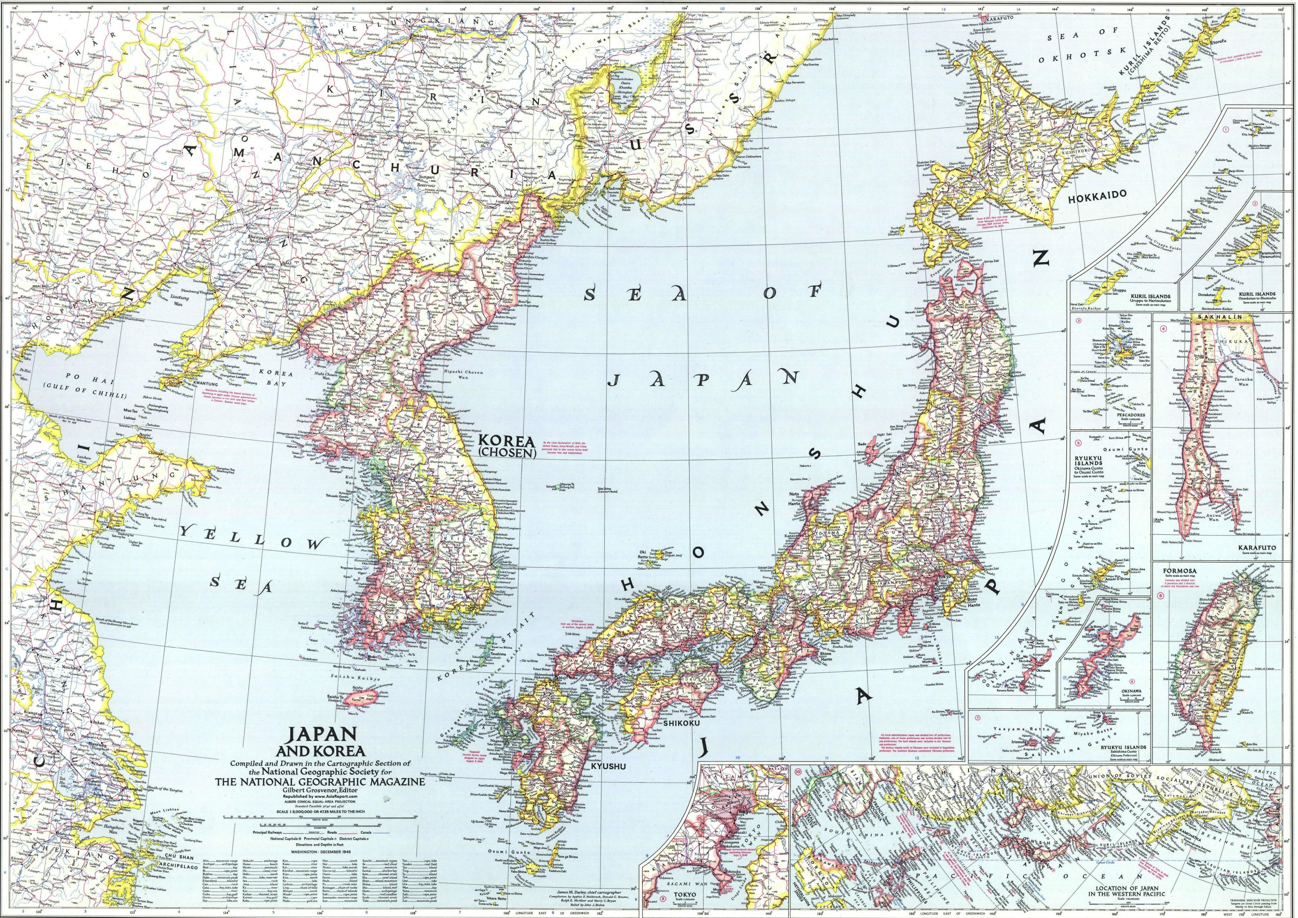
Map of Jeju Island | |
| Geography | |
| Location | East Asia |
| Coordinates | 33.38°N 126.53°E / 33.38; 126.53 |
| Archipelago | Jeju |
| Area | 1,826[1] km2 (705 sq mi) |
| Length | 73 km (45.4 mi) |
| Width | 31 km (19.3 mi) |
| Highest elevation | 1,950 m (6400 ft) |
| Highest point | Hallasan |
| Administration | |
South Korea | |
| Special Self-Governing Province | Jeju Special Self-Governing Province |
| Largest settlement | Jeju City (pop. 501,791) |
North Korea (claimed) | |
| Province | South Chŏlla Province |
| County-level division | Cheju Island (further divided into 1 ŭp and 12 myŏn) |
| Demographics | |
| Population | 678,324 (October 2022) |
| Pop. density | 316/km2 (818/sq mi) |
| Languages | Jeju, Korean |
| Ethnic groups | Jejuans, Korean |
| Korean name | |
| Hangul | 제주도 |
| Hanja | 濟州島 |
| Revised Romanization | Jejudo |
| McCune–Reischauer | Chejudo |
The island lies in the Korea Strait, south of the Korean Peninsula, and South Jeolla Province. It is located 82.8 km (51.4 mi) off the nearest point on the peninsula.[2] Jeju is one of two special self-governing provinces in South Korea, meaning that the province is run by local politicians. The Jeju people are indigenous to the island, and it has been populated by modern humans since the early Neolithic period. The Jeju language is considered critically endangered by UNESCO. It is also one of the regions of Korea where Shamanism is most intact.[3]
Jeju Island has an oval shape of 73 km (45 mi) east–west and 31 km (19 mi) north–south, with a gentle slope around Mt. Halla in the center. The length of the main road is 181 km (112 mi) and the coastline is 258 km (160 mi). On the northern end of Jeju Island is Kimnyeong Beach, on the southern end Songak Mountain, the western end Suwol Peak, and the eastern end Seongsan Ilchulbong.
The island was formed by the eruption of an underwater volcano approximately 2 million years ago.[4] It contains a natural World Heritage Site, the Jeju Volcanic Island and Lava Tubes.[5] Jeju Island has a temperate climate which is moderate; even in winter, the temperature rarely falls below 0 °C (32 °F). Jeju is a popular holiday destination and a sizable portion of the economy relies on tourism and related economic activity.
Historically, the island has been called by many different names including:
- Doi (도이; 島夷; lit. Island barbarian)
- Dongyeongju (동영주; 東瀛州)
- Juho (주호; 州胡)
- Tammora (탐모라; 耽牟羅)
- Seomna (섭라; 涉羅)
- Tangna (탁나; 乇羅)
- Tamna (탐나; 耽羅)
- Quelpart,[6][7][8] Quelparte[9] or Quelpaert Island[10]
- Junweonhado (준원하도; 준원下島 meaning "southern part of peninsula")
- Taekseungnido (택승니도, meaning "the peaceful hot island in Joseon")
- Samdado (삼다도; 三多島) meaning "Island of Three Abundances")[11]
- Sammudo (삼무도; 三無島)
- Cheju (spelling until 7 July 2000)
Before the Japanese annexation in 1910, the island was usually known as Quelpart (Quelpaërt, Quelpaert) to Europeans;[12] during the occupation it was known by the Japanese name Saishū. The name Quelpart coming from French language is attested in Dutch no later than 1648 and may have denoted the first Dutch ship to spot the island, the quelpaert de Brack around 1642, or rather some visual similarity of the island from some angle to this class of ships (a small dispatch vessel, also called a galiot).
The first European explorers to sight the island, the Portuguese, called it Ilha de Ladrones (Island of Thieves).[13]
The name "Fungma island" appeared in the "Atlas of China" of M. Martini who arrived in China as a missionary in 1655.[14]
Jeju Island has been inhabited by modern humans since the early Neolithic period. There is no discovered historical record of the founding or early history of Tamna. One legend tells that the three divine founders of the country—Go (고), Yang (양), and Bu (부)—emerged from three holes in the ground in the 24th century BC. These holes, known as the Samseonghyeol (삼성혈), are still preserved in Jeju City.[15][16] Until 938 AD, the island was an independent kingdom called Tamna (which means 'island country') when it became a vassal state of Korea under the Goryeo dynasty. In April 1330, in the midst of political purges of the Yuan dynasty, Toghon tomor had been sent in Exile on this remote island, which was then part of the vassal Korean Goguryeo.[17] In 1404, Taejong of Joseon placed the island under firm central control and brought the Tamna kingdom to an end.
In April 1948, it was the site of the Jeju uprising.
- Baengnokdam in Hallasan
- Mountains in Jeju
- Daepo Jusangjeolli Cliff
- Detailed map of Jeju Island
.jpg)
.jpg)
Jeju is a volcanic island, dominated by Hallasan: a volcano 1,950 metres (6,400 ft) high and the highest mountain in South Korea. The island measures approximately 73 kilometres (45 mi) across, east to west, and 41 kilometres (25 mi) from north to south.[18]
The island formed by volcanic eruptions approximately two million years ago, during the Pleistocene epoch.[19] The island consists chiefly of basalt and lava.
An area covering about 12% (224 square kilometres or 86 square miles) of Jejudo is known as Gotjawal Forest.[20] This area remained uncultivated until the 21st century, as its base of 'a'a lava made it difficult to develop for agriculture. Because this forest remained pristine for so long, it has a unique ecology.[21]
The forest is the main source of groundwater and thus the main water source for the half million people of the island, because rainwater penetrates directly into the aquifer through the cracks of the 'a'a lava under the forest. Gotjawal forest is considered an internationally important wetland under the Ramsar Convention by some researchers[22] because it is the habitat of unique species of plants and is the main source of water for the residents, although to date it has not been declared a Ramsar site.[23]
- About 2 million years ago, the island of Jeju was formed through volcanic activity.[19]
- About 1.2 million years ago, a magma chamber formed under the sea floor and began to erupt.
- About 700 thousand years ago, the island had been formed through volcanic activity. Volcanic activity then stopped for approximately 100 thousand years.
- About 300 thousand years ago, volcanic activity restarted along the coastline.
- About 100 thousand years ago, volcanic activity formed Halla Mountain.
- About 25 thousand years ago, lateral eruptions around Halla Mountain left multiple oreum (smaller 'parasitic' cones on the flanks of the primary cone).
- Volcanic activity stopped and prolonged weathering and erosion helped shape the island.[24]
Most of Jeju Island has a humid subtropical climate (Cfa in the Köppen climate classification). Four distinct seasons are experienced in Jeju; winters are cool with moderate rainfall, while summers are hot and humid with very high rainfall.
Jeju City, the northern part of the island, tends to be colder in winter than the southern part due to the influence of continental seasonal winds. Gosan-ri, located on the west side of the island, has the lowest annual average precipitation on the island, but unlike most parts of mainland Korea, the seasonal precipitation is even. The Chuja Islands, which belong to Jeju City, are an archipelago located between mainland Korea and Jeju Island and also have a humid subtropical climate (Cfa).
| Climate data for Ildo 1-dong, Jeju City (1991–2020 normals, extremes 1923–present) | |||||||||||||
|---|---|---|---|---|---|---|---|---|---|---|---|---|---|
| Month | Jan | Feb | Mar | Apr | May | Jun | Jul | Aug | Sep | Oct | Nov | Dec | Year |
| Record high °C (°F) | 23.6 (74.5) |
24.5 (76.1) |
28.1 (82.6) |
30.9 (87.6) |
33.1 (91.6) |
34.5 (94.1) |
37.5 (99.5) |
37.5 (99.5) |
34.4 (93.9) |
32.1 (89.8) |
26.7 (80.1) |
23.3 (73.9) |
37.5 (99.5) |
| Mean daily maximum °C (°F) | 8.6 (47.5) |
9.9 (49.8) |
13.3 (55.9) |
18.0 (64.4) |
22.1 (71.8) |
24.9 (76.8) |
29.3 (84.7) |
30.1 (86.2) |
26.1 (79.0) |
21.6 (70.9) |
16.4 (61.5) |
11.0 (51.8) |
19.3 (66.7) |
| Daily mean °C (°F) | 6.1 (43.0) |
6.8 (44.2) |
9.8 (49.6) |
14.2 (57.6) |
18.3 (64.9) |
21.7 (71.1) |
26.2 (79.2) |
27.2 (81.0) |
23.3 (73.9) |
18.6 (65.5) |
13.3 (55.9) |
8.3 (46.9) |
16.2 (61.2) |
| Mean daily minimum °C (°F) | 3.7 (38.7) |
4.0 (39.2) |
6.6 (43.9) |
10.8 (51.4) |
15.0 (59.0) |
19.1 (66.4) |
23.7 (74.7) |
24.8 (76.6) |
20.9 (69.6) |
15.7 (60.3) |
10.4 (50.7) |
5.6 (42.1) |
13.4 (56.1) |
| Record low °C (°F) | −5.8 (21.6) |
−6.0 (21.2) |
−4.1 (24.6) |
−0.2 (31.6) |
4.0 (39.2) |
9.2 (48.6) |
15.0 (59.0) |
15.8 (60.4) |
9.8 (49.6) |
5.5 (41.9) |
0.5 (32.9) |
−3.6 (25.5) |
−6.0 (21.2) |
| Average precipitation mm (inches) | 67.5 (2.66) |
57.2 (2.25) |
90.6 (3.57) |
89.7 (3.53) |
95.6 (3.76) |
171.2 (6.74) |
210.2 (8.28) |
272.3 (10.72) |
227.8 (8.97) |
95.1 (3.74) |
69.5 (2.74) |
55.6 (2.19) |
1,502.3 (59.15) |
| Average precipitation days (≥ 0.1 mm) | 12.2 | 10.2 | 10.3 | 9.4 | 9.8 | 11.7 | 11.8 | 13.2 | 11.2 | 6.7 | 9.8 | 11.5 | 127.8 |
| Average snowy days | 7.2 | 4.2 | 1.0 | 0.0 | 0.0 | 0.0 | 0.0 | 0.0 | 0.0 | 0.0 | 0.4 | 5.3 | 18.1 |
| Average relative humidity (%) | 64.0 | 63.3 | 63.2 | 64.8 | 68.4 | 77.9 | 78.3 | 76.2 | 73.7 | 66.4 | 65.0 | 64.1 | 68.8 |
| Mean monthly sunshine hours | 70.2 | 110.0 | 166.0 | 196.5 | 212.2 | 159.7 | 189.8 | 195.1 | 158.9 | 173.3 | 123.7 | 79.1 | 1,834.5 |
| Percent possible sunshine | 22.2 | 34.0 | 42.8 | 49.8 | 49.2 | 39.7 | 44.7 | 47.2 | 43.5 | 50.7 | 40.2 | 27.4 | 41.7 |
| Source: Korea Meteorological Administration (percent sunshine 1981–2010)[25][26][27] | |||||||||||||
| Climate data for Gosan-ri, Hangyeong-myeon, Jeju City (1991–2020 normals, extremes 1988–present) | |||||||||||||
|---|---|---|---|---|---|---|---|---|---|---|---|---|---|
| Month | Jan | Feb | Mar | Apr | May | Jun | Jul | Aug | Sep | Oct | Nov | Dec | Year |
| Record high °C (°F) | 18.8 (65.8) |
20.1 (68.2) |
21.4 (70.5) |
27.3 (81.1) |
27.5 (81.5) |
29.6 (85.3) |
34.3 (93.7) |
35.5 (95.9) |
32.5 (90.5) |
30.3 (86.5) |
26.8 (80.2) |
21.9 (71.4) |
35.5 (95.9) |
| Mean daily maximum °C (°F) | 8.4 (47.1) |
9.4 (48.9) |
12.5 (54.5) |
16.7 (62.1) |
20.4 (68.7) |
23.7 (74.7) |
27.4 (81.3) |
29.3 (84.7) |
26.1 (79.0) |
21.4 (70.5) |
16.4 (61.5) |
11.0 (51.8) |
18.6 (65.5) |
| Daily mean °C (°F) | 6.1 (43.0) |
6.6 (43.9) |
9.4 (48.9) |
13.4 (56.1) |
17.1 (62.8) |
20.7 (69.3) |
24.9 (76.8) |
26.4 (79.5) |
23.0 (73.4) |
18.5 (65.3) |
13.5 (56.3) |
8.5 (47.3) |
15.7 (60.3) |
| Mean daily minimum °C (°F) | 3.8 (38.8) |
4.1 (39.4) |
6.5 (43.7) |
10.5 (50.9) |
14.3 (57.7) |
18.4 (65.1) |
22.9 (73.2) |
24.1 (75.4) |
20.6 (69.1) |
15.9 (60.6) |
10.9 (51.6) |
5.9 (42.6) |
13.2 (55.8) |
| Record low °C (°F) | −6.2 (20.8) |
−3.0 (26.6) |
−2.3 (27.9) |
3.3 (37.9) |
9.2 (48.6) |
12.7 (54.9) |
16.8 (62.2) |
17.1 (62.8) |
14.8 (58.6) |
7.3 (45.1) |
0.8 (33.4) |
−2.0 (28.4) |
−6.2 (20.8) |
| Average precipitation mm (inches) | 40.6 (1.60) |
47.8 (1.88) |
76.2 (3.00) |
94.7 (3.73) |
117.7 (4.63) |
158.1 (6.22) |
167.7 (6.60) |
201.9 (7.95) |
120.4 (4.74) |
56.9 (2.24) |
60.2 (2.37) |
40.7 (1.60) |
1,182.9 (46.57) |
| Average precipitation days (≥ 0.1 mm) | 10.6 | 9.0 | 10.2 | 9.0 | 9.6 | 11.3 | 11.3 | 13.1 | 9.6 | 6.3 | 8.6 | 10.4 | 119 |
| Average snowy days | 5.9 | 3.0 | 1.3 | 0.0 | 0.0 | 0.0 | 0.0 | 0.0 | 0.0 | 0.0 | 0.3 | 4.0 | 14.5 |
| Average relative humidity (%) | 66.9 | 68.0 | 69.9 | 74.2 | 80.2 | 86.2 | 89.2 | 83.9 | 77.8 | 69.7 | 67.9 | 66.5 | 75.0 |
| Mean monthly sunshine hours | 95.4 | 131.0 | 175.4 | 196.3 | 205.3 | 156.0 | 172.6 | 219.7 | 187.4 | 206.6 | 150.7 | 106.3 | 2,002.7 |
| Percent possible sunshine | 28.7 | 40.7 | 45.0 | 50.3 | 46.9 | 36.8 | 40.4 | 52.0 | 50.5 | 58.8 | 48.9 | 34.9 | 44.7 |
| Source: Korea Meteorological Administration (snow and percent sunshine 1981–2010)[25][26][27] | |||||||||||||
| Climate data for Chuja Islands, Jeju City (1993–2020 normals) | |||||||||||||
|---|---|---|---|---|---|---|---|---|---|---|---|---|---|
| Month | Jan | Feb | Mar | Apr | May | Jun | Jul | Aug | Sep | Oct | Nov | Dec | Year |
| Mean daily maximum °C (°F) | 7.2 (45.0) |
8.4 (47.1) |
11.5 (52.7) |
15.6 (60.1) |
19.4 (66.9) |
22.8 (73.0) |
26.8 (80.2) |
28.9 (84.0) |
25.5 (77.9) |
21.0 (69.8) |
15.3 (59.5) |
9.7 (49.5) |
17.7 (63.9) |
| Daily mean °C (°F) | 5.0 (41.0) |
5.7 (42.3) |
8.6 (47.5) |
12.5 (54.5) |
16.3 (61.3) |
19.9 (67.8) |
24.3 (75.7) |
26.2 (79.2) |
22.9 (73.2) |
18.4 (65.1) |
12.8 (55.0) |
7.5 (45.5) |
15.0 (59.0) |
| Mean daily minimum °C (°F) | 2.8 (37.0) |
3.3 (37.9) |
6.0 (42.8) |
10.0 (50.0) |
13.9 (57.0) |
17.8 (64.0) |
22.2 (72.0) |
24.2 (75.6) |
21.1 (70.0) |
16.4 (61.5) |
10.6 (51.1) |
5.1 (41.2) |
12.8 (55.0) |
| Average precipitation mm (inches) | 27.2 (1.07) |
40.3 (1.59) |
73.0 (2.87) |
79.6 (3.13) |
92.5 (3.64) |
152.7 (6.01) |
190.3 (7.49) |
201.8 (7.94) |
132.9 (5.23) |
57.9 (2.28) |
46.6 (1.83) |
32.9 (1.30) |
1,127.7 (44.40) |
| Average precipitation days (≥ 0.1 mm) | 5.9 | 5.5 | 7.0 | 7.7 | 7.8 | 8.8 | 9.1 | 8.5 | 6.9 | 4.6 | 5.9 | 7.4 | 85.1 |
| Source: Korea Meteorological Administration[25] | |||||||||||||
Seogwipo, the southern part of the island, is relatively warmer in winter than Jeju City because Hallasan in the middle of the island prevents continental seasonal winds. The downtown of Seogwipo has the highest average temperature in January in Korea, including mainland Korea. Seongsan-eup, the southeastern side of the island, is directly affected by both the East Asian monsoon and the Tsushima Current, so annual precipitation is very high. Seogwipo is one of the regions with the highest annual precipitation in Korea.
| Climate data for Jeongbang-dong, Seogwipo (1991–2020 normals, extremes 1961–present) | |||||||||||||
|---|---|---|---|---|---|---|---|---|---|---|---|---|---|
| Month | Jan | Feb | Mar | Apr | May | Jun | Jul | Aug | Sep | Oct | Nov | Dec | Year |
| Record high °C (°F) | 20.7 (69.3) |
23.6 (74.5) |
23.8 (74.8) |
28.5 (83.3) |
30.4 (86.7) |
31.5 (88.7) |
35.8 (96.4) |
35.9 (96.6) |
34.8 (94.6) |
30.9 (87.6) |
28.0 (82.4) |
21.9 (71.4) |
35.9 (96.6) |
| Mean daily maximum °C (°F) | 10.8 (51.4) |
11.8 (53.2) |
14.7 (58.5) |
18.6 (65.5) |
22.3 (72.1) |
24.7 (76.5) |
28.3 (82.9) |
30.1 (86.2) |
27.4 (81.3) |
23.5 (74.3) |
18.4 (65.1) |
13.1 (55.6) |
20.3 (68.5) |
| Daily mean °C (°F) | 7.2 (45.0) |
8.2 (46.8) |
11.0 (51.8) |
15.0 (59.0) |
18.8 (65.8) |
21.8 (71.2) |
25.7 (78.3) |
27.2 (81.0) |
24.1 (75.4) |
19.6 (67.3) |
14.6 (58.3) |
9.4 (48.9) |
16.9 (62.4) |
| Mean daily minimum °C (°F) | 4.1 (39.4) |
4.8 (40.6) |
7.5 (45.5) |
11.6 (52.9) |
15.8 (60.4) |
19.5 (67.1) |
23.8 (74.8) |
24.9 (76.8) |
21.5 (70.7) |
16.4 (61.5) |
11.2 (52.2) |
6.2 (43.2) |
13.9 (57.0) |
| Record low °C (°F) | −6.4 (20.5) |
−6.3 (20.7) |
−4.4 (24.1) |
0.2 (32.4) |
7.2 (45.0) |
11.9 (53.4) |
14.8 (58.6) |
16.8 (62.2) |
12.2 (54.0) |
6.8 (44.2) |
0.0 (32.0) |
−4.1 (24.6) |
−6.4 (20.5) |
| Average precipitation mm (inches) | 60.7 (2.39) |
77.9 (3.07) |
130.3 (5.13) |
187.0 (7.36) |
223.6 (8.80) |
267.6 (10.54) |
275.8 (10.86) |
315.7 (12.43) |
208.8 (8.22) |
100.4 (3.95) |
86.2 (3.39) |
55.6 (2.19) |
1,989.6 (78.33) |
| Average precipitation days (≥ 0.1 mm) | 9.8 | 9.6 | 10.5 | 10.1 | 10.7 | 12.8 | 13.8 | 14.3 | 10.9 | 5.8 | 8.1 | 8.9 | 125.3 |
| Average snowy days | 3.8 | 2.4 | 0.8 | 0.0 | 0.0 | 0.0 | 0.0 | 0.0 | 0.0 | 0.0 | 0.1 | 3.1 | 10.2 |
| Average relative humidity (%) | 63.0 | 62.5 | 62.4 | 65.2 | 70.6 | 80.7 | 86.1 | 80.9 | 73.6 | 64.8 | 64.7 | 63.2 | 69.8 |
| Mean monthly sunshine hours | 153.5 | 157.4 | 185.8 | 196.5 | 203.5 | 136.3 | 144.8 | 187.7 | 174.7 | 208.8 | 166.8 | 158.8 | 2,074.6 |
| Percent possible sunshine | 48.0 | 49.2 | 46.9 | 48.9 | 46.3 | 33.6 | 32.5 | 44.5 | 47.4 | 58.8 | 54.3 | 52.1 | 46.2 |
| Source: Korea Meteorological Administration (percent sunshine 1981–2010)[25][26][27] | |||||||||||||
| Climate data for Seongsan-eup, Seogwipo (1991–2020 normals, extremes 1971–present) | |||||||||||||
|---|---|---|---|---|---|---|---|---|---|---|---|---|---|
| Month | Jan | Feb | Mar | Apr | May | Jun | Jul | Aug | Sep | Oct | Nov | Dec | Year |
| Record high °C (°F) | 20.9 (69.6) |
22.3 (72.1) |
22.7 (72.9) |
28.1 (82.6) |
30.6 (87.1) |
31.8 (89.2) |
36.2 (97.2) |
35.5 (95.9) |
33.3 (91.9) |
30.1 (86.2) |
25.7 (78.3) |
22.1 (71.8) |
36.2 (97.2) |
| Mean daily maximum °C (°F) | 8.9 (48.0) |
10.1 (50.2) |
13.6 (56.5) |
18.0 (64.4) |
21.9 (71.4) |
24.2 (75.6) |
28.1 (82.6) |
29.7 (85.5) |
26.5 (79.7) |
22.0 (71.6) |
16.7 (62.1) |
11.2 (52.2) |
19.2 (66.6) |
| Daily mean °C (°F) | 5.4 (41.7) |
6.3 (43.3) |
9.5 (49.1) |
13.8 (56.8) |
17.7 (63.9) |
20.9 (69.6) |
25.1 (77.2) |
26.5 (79.7) |
23.2 (73.8) |
18.2 (64.8) |
12.7 (54.9) |
7.5 (45.5) |
15.6 (60.1) |
| Mean daily minimum °C (°F) | 2.1 (35.8) |
2.5 (36.5) |
5.2 (41.4) |
9.4 (48.9) |
13.7 (56.7) |
17.9 (64.2) |
22.6 (72.7) |
23.9 (75.0) |
20.2 (68.4) |
14.5 (58.1) |
8.8 (47.8) |
3.9 (39.0) |
12.1 (53.8) |
| Record low °C (°F) | −7.0 (19.4) |
−6.4 (20.5) |
−4.7 (23.5) |
−1.3 (29.7) |
1.7 (35.1) |
8.2 (46.8) |
13.7 (56.7) |
16.2 (61.2) |
10.4 (50.7) |
3.2 (37.8) |
−0.6 (30.9) |
−4.0 (24.8) |
−7.0 (19.4) |
| Average precipitation mm (inches) | 77.5 (3.05) |
83.2 (3.28) |
139.4 (5.49) |
161.3 (6.35) |
178.0 (7.01) |
231.9 (9.13) |
271.3 (10.68) |
343.2 (13.51) |
248.6 (9.79) |
114.0 (4.49) |
102.8 (4.05) |
78.8 (3.10) |
2,030 (79.92) |
| Average precipitation days (≥ 0.1 mm) | 11.0 | 9.8 | 10.4 | 9.4 | 9.8 | 12.8 | 12.7 | 13.3 | 10.8 | 6.3 | 9.0 | 10.1 | 125.4 |
| Average snowy days | 6.1 | 3.7 | 0.7 | 0.1 | 0.0 | 0.0 | 0.0 | 0.0 | 0.0 | 0.0 | 0.2 | 3.8 | 14.6 |
| Average relative humidity (%) | 67.4 | 65.5 | 65.4 | 67.4 | 72.2 | 82.6 | 85.6 | 81.5 | 76.3 | 69.4 | 68.7 | 67.7 | 72.5 |
| Mean monthly sunshine hours | 128.6 | 145.5 | 181.5 | 198.0 | 208.7 | 141.1 | 160.3 | 192.6 | 167.2 | 192.0 | 156.7 | 134.7 | 2,006.9 |
| Percent possible sunshine | 38.7 | 47.3 | 45.8 | 49.4 | 47.7 | 33.8 | 35.9 | 44.0 | 44.5 | 55.0 | 49.6 | 42.1 | 44.2 |
| Source: Korea Meteorological Administration (snow and percent sunshine 1981–2010)[25][26][27] | |||||||||||||
The climate of the highlands in the middle of the island where Hallasan is located is quite different from those of the rest of the island. The higher the altitude, the lower the average temperature and the colder the climate. The highlands of Jeju Island have the highest annual precipitation in Korea.
| Climate data for Seongpanak, Hallasan (elevation 760 m (2,490 ft), 1999–2020 normals) | |||||||||||||
|---|---|---|---|---|---|---|---|---|---|---|---|---|---|
| Month | Jan | Feb | Mar | Apr | May | Jun | Jul | Aug | Sep | Oct | Nov | Dec | Year |
| Mean daily maximum °C (°F) | 2.8 (37.0) |
4.7 (40.5) |
9.0 (48.2) |
14.5 (58.1) |
18.9 (66.0) |
21.4 (70.5) |
24.7 (76.5) |
24.7 (76.5) |
21.1 (70.0) |
16.6 (61.9) |
11.2 (52.2) |
5.2 (41.4) |
14.6 (58.3) |
| Daily mean °C (°F) | −0.4 (31.3) |
1.0 (33.8) |
4.9 (40.8) |
10.2 (50.4) |
14.7 (58.5) |
17.7 (63.9) |
21.4 (70.5) |
21.6 (70.9) |
17.8 (64.0) |
12.8 (55.0) |
7.4 (45.3) |
1.9 (35.4) |
10.9 (51.6) |
| Mean daily minimum °C (°F) | −3.1 (26.4) |
−2.3 (27.9) |
0.9 (33.6) |
5.9 (42.6) |
10.6 (51.1) |
14.3 (57.7) |
18.5 (65.3) |
18.9 (66.0) |
15.0 (59.0) |
9.3 (48.7) |
4.0 (39.2) |
−1.0 (30.2) |
7.6 (45.7) |
| Average precipitation mm (inches) | 137.1 (5.40) |
182.4 (7.18) |
258.8 (10.19) |
414.9 (16.33) |
465.9 (18.34) |
451.7 (17.78) |
583.9 (22.99) |
717.0 (28.23) |
581.1 (22.88) |
237.2 (9.34) |
197.5 (7.78) |
153.5 (6.04) |
4,381 (172.48) |
| Average precipitation days (≥ 0.1 mm) | 13.0 | 11.5 | 11.0 | 10.8 | 11.1 | 14.1 | 17.8 | 18.7 | 15.6 | 9.2 | 11.6 | 13.4 | 157.8 |
| Source: Korea Meteorological Administration[25] | |||||||||||||
| Climate data for Witse Oreum, Hallasan (elevation 1,673 m (5,489 ft), 2003–2009 normals) | |||||||||||||
|---|---|---|---|---|---|---|---|---|---|---|---|---|---|
| Month | Jan | Feb | Mar | Apr | May | Jun | Jul | Aug | Sep | Oct | Nov | Dec | Year |
| Mean daily maximum °C (°F) | −1.6 (29.1) |
0.9 (33.6) |
3.4 (38.1) |
10.0 (50.0) |
14.9 (58.8) |
18.1 (64.6) |
20.3 (68.5) |
20.6 (69.1) |
18.1 (64.6) |
13.2 (55.8) |
6.8 (44.2) |
0.0 (32.0) |
10.4 (50.7) |
| Daily mean °C (°F) | −5.9 (21.4) |
−3.5 (25.7) |
−0.8 (30.6) |
5.2 (41.4) |
10.3 (50.5) |
14.0 (57.2) |
17.4 (63.3) |
17.4 (63.3) |
14.2 (57.6) |
8.2 (46.8) |
2.2 (36.0) |
−3.5 (25.7) |
6.4 (43.5) |
| Mean daily minimum °C (°F) | −9.1 (15.6) |
−7.5 (18.5) |
−5.1 (22.8) |
0.7 (33.3) |
5.7 (42.3) |
10.4 (50.7) |
14.7 (58.5) |
14.5 (58.1) |
11.0 (51.8) |
4.3 (39.7) |
−0.9 (30.4) |
−6.6 (20.1) |
2.7 (36.9) |
| Average precipitation mm (inches) | 46.9 (1.85) |
128.0 (5.04) |
301.2 (11.86) |
426.1 (16.78) |
653.1 (25.71) |
651.9 (25.67) |
742.3 (29.22) |
836.4 (32.93) |
526.7 (20.74) |
126.5 (4.98) |
165.8 (6.53) |
64.6 (2.54) |
4,669.4 (183.83) |
| Source: Jeju Regional Meteorological Administration[28] | |||||||||||||
In January 2016, a cold wave affected Jeju Island. Snow and frigid weather forced the cancellation of 1,200 flights on Jejudo, stranding approximately 90,300 passengers.[29]
- Jeju Black, indigenous cattle breed
- Jeju horse, indigenous horse breed
- Jeju Volcanic Island and Lava Tubes
- Dave the Diver (2023), an award-winning game inspired by a fish restaurant on Jeju Island
- "Joshua Calder's World Island Info - Largest Islands of Selected Countries". Worldislandinfo.com. Retrieved 2016-01-30.
- Landsat/Copernicus; Data SIO; NOAA; United States Navy; NGA; GEBCO; TMap Mobility; TerraMetrics (2022). "Korea Strait" (Map). Google Earth. Alphabet. Retrieved 15 May 2022.
- Choi, Joon-sik (2006). Folk-Religion: The Customs in Korea. Ewha Womans University Press. Ewha Womans University Press. ISBN 978-8973006281.
- "Jeju Island". Business Traveller. February 2011.
- "Unesco names World Heritage sites". BBC News. June 28, 2007. Retrieved May 6, 2010.
- Hulbert, H. B (1905). "The Island of Quelpart". Bulletin of the American Geographical Society. 37 (7): 396–408. doi:10.2307/198722. JSTOR 198722.
- "Photographic image of map". Archived from the original (JPG) on 6 April 2017. Retrieved 26 June 2022.
- Hall, R. Burnett (1926). "Quelpart Island and Its People". Geographical Review. 16 (1): 60–72. Bibcode:1926GeoRv..16...60H. doi:10.2307/208503. JSTOR 208503.
- Hulbert, Archer Butler (1902). "The Queen of Quelparte".
- Sokol, A. E (1948). "The Name of Quelpaert Island". Isis. 38 (3/4): 231–235. doi:10.1086/348077. S2CID 144230819.
- "Jeju Island Facts". Softschools.com.
- "The Island of Quelpart" (PDF). Fs.unm.edu.
- Sokol, A. E. (February 1948). "The Name Of Quelpaert Island". Isis. 38 (3/4): 231–235. doi:10.1086/348077. S2CID 144230819. Retrieved July 8, 2021.
- "The memory and traces of marine exchange:Jeju Island in eastern and western antique maps" (PDF). eastsea1994.org. Archived from the original (PDF) on 2021-08-31. Retrieved 2021-01-03.
- "Jeju (Cheju) Island Travel Information: Samseonghyeol". Retrieved 30 July 2014.
- Sources of Korean tradition. 2: From the sixteenth to the twentieth centuries / ed by Yong-ho Ch'oe ... with the collaboration of Donald Baker ... and contributions by Martina Deuchler. New York Chichester: Columbia University Press. 2001. ISBN 978-0-231-10566-8.
- Kyung Moon Hwang A History of Korea, London: Palgrave, 2010 p. 56.
- Map of Korea: Cheju Island Archived 2016-03-04 at the Wayback Machine The People's Korea. Accessed 8 July 2012
- Woo, Kyung; Sohn, Young; Ahn, Ung; Spate, Andy (January 2013), "Geology of Jeju Island", Jeju Island Geopark - A Volcanic Wonder of Korea, Geoparks of the World (closed), vol. 1, pp. 13–14, doi:10.1007/978-3-642-20564-4_5, ISBN 978-3-642-20563-7
- "RISS 통합검색 - 국내학술지논문 상세보기". Riss4u.net.
- "RISS 통합검색 - 학위논문 상세보기". Riss4u.net.
- Jang, Yong-chang and Chanwon Lee, 2009, "Gotjawal Forest as an internationally important wetland," Journal of Korean Wetlands Studies, 2009, Vol 1.
- "Ramsar site list" (PDF). Archived from the original (PDF) on January 14, 2009. Retrieved 2007-06-20. Accessed June 2009
- "제주특별자치도 자연환경생태정보시스템". nature.jeju.go.kr. Archived from the original on 2016-07-12. Retrieved 2016-03-14.
- "Climatological Normals of Korea (1991 ~ 2020)" (PDF) (in Korean). Korea Meteorological Administration. Archived from the original (PDF) on 29 January 2022. Retrieved 4 April 2022.
- 순위값 - 구역별조회 (in Korean). Korea Meteorological Administration. Retrieved 4 April 2022.
- "Climatological Normals of Korea" (PDF). Korea Meteorological Administration. 2011. Archived from the original (PDF) on 7 December 2016. Retrieved 8 December 2016.
- "제주도상세기후특성집(2010) 윗세오름(871)" (PDF). Jeju Regional Meteorological Administration. Archived from the original (PDF) on 1 October 2021. Retrieved 24 May 2023.
- Ap, Tiffany (January 25, 2016). "Deaths, travel disruption as bitter cold grips Asia". CNN. Retrieved January 25, 2016.
- Jeju Volcanic Island and Lava Tubes World Heritage site on Google Arts and Culture
 Geographic data related to Jeju Island at OpenStreetMap