Katon-Karagay

Katonkaragay District

Katonkaragay District

District in East Kazakhstan Region, Kazakhstan


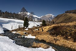
Katonkaragay, also spelled Katon-Karagay (Kazakh: Қатонқарағай ауданы, romanized: Qatonqarağai audany) is a district of East Kazakhstan Region in eastern Kazakhstan. The administrative center of the district is the selo of Katonkaragay.[4] It is the easternmost district in Kazakhstan. Population: 28,008 (2013 estimate);[2] 30,056 (2009 Census results);[5] 45,149 (1999 Census results).[5]
Quick Facts Country, Region ...

Berel burial mound

Near the selo of Berel (49°22′24″N 86°26′17″E[6]) excavations of ancient burial mounds have revealed artefacts the sophistication of which are encouraging a revaluation of the nomadic cultures of the 3rd and 4th centuries BC.[7]


References

  1. "Акимат Катон-Карагайского района". www.gov.kz.
  2. "Население Республики Казахстан" (in Russian). Департамент социальной и демографической статистики. Retrieved 27 December 2013.
  3. "Subdivisions of Kazakhstan in local languages". Geonames.de. Archived from the original on 2016-03-03. Retrieved 2014-02-28.
  4. "Население Республики Казахстан" [Population of the Republic of Kazakhstan] (in Russian). Департамент социальной и демографической статистики. Retrieved 8 December 2013.
  5. Archived June 23, 2007, at the Wayback Machine
  6. Wilford, John Noble (12 March 2012). "Artifacts Show Sophistication of Ancient Nomads". The New York Times. Retrieved 2014-03-01.


Share this article:

This article uses material from the Wikipedia article Katon-Karagay, and is written by contributors. Text is available under a CC BY-SA 4.0 International License; additional terms may apply. Images, videos and audio are available under their respective licenses.