List_of_Japanese_prefectures_by_highest_mountain
The table shows the highest mountains by prefectures of Japan. Where the highest point of a prefecture is not a peak, it will be separately described.
More information Prefecture, Mountain ...
| Prefecture | Mountain | Elevation (m) | Cordillera | Note | Image |
|---|---|---|---|---|---|
| Hokkaido | Daisetsuzan (Asahi-dake) | 2,291 | Ishikari Mountains | 100 Famous Japanese Mountains |  |
| Aomori | Mount Iwaki | 1,625 | Standalone | 100 Famous Japanese Mountains |  |
| Iwate | Mount Iwate | 2,038 | Ōu Mountains | 100 Famous Japanese Mountains | 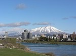 |
| Miyagi | Mount Byōbu | 1,825 | Mount Zaō | 100 Famous Japanese Mountains |  |
| Akita[1] | Mount Akita-Komagatake (Onagadake) | 1,637 | Ōu Mountains | 200 Famous Japanese Mountains |  |
| Yamagata | Mount Chōkai (Shinzan) | 2,236 | Hinotodake Mountains | 100 Famous Japanese Mountains | 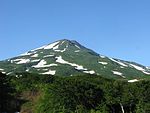 |
| Fukushima | Mount Hiuchigatake (Shibayasugura) | 2,356 | Standalone | 100 Famous Japanese Mountains |  |
| Ibaraki | Mount Yamizo | 1,022 | Yamizo Mountains | 300 Famous Japanese Mountains | link |
| Tochigi | Mount Nikkō-Shirane | 2,578 | Nikkō Mountains | 100 Famous Japanese Mountains |  |
| Gunma | Mount Nikkō-Shirane | 2,578 | Nikkō Mountains | 100 Famous Japanese Mountains |  |
| Saitama | Mount Sanpō | 2,483 | Okuchichibu Mountains |  | |
| Chiba | Mount Atago | 408 | Bōsō Hill Range | JASDF Mineokayama Sub Base[2] |  |
| Tokyo | Mount Kumotori | 2,017 | Okutama | 100 Famous Japanese Mountains |  |
| Kanagawa | Mount Hiru | 1,673 | Tanzawa Mountains | 100 Famous Japanese Mountains |  |
| Niigata | Mount Korenge | 2,766[3] | Northern Alps |  | |
| Toyama | Mount Tate (Mount Ōnanji) | 3,015 | Northern Alps | 100 Famous Japanese Mountains |  |
| Ishikawa | Mount Haku (Gozengamine) | 2,702 | Ryōhaku Mountains | 100 Famous Japanese Mountains |  |
| Fukui | Mount Sannomine | 2,095 | Ryōhaku Mountains | Southern peak of Mount Sannomine |  |
| Yamanashi | Mount Fuji (Kengamine) | 3,776 | Standalone | 100 Famous Japanese Mountains |  |
| Nagano | Mount Hotakadake | 3,190 | Northern Alps | 100 Famous Japanese Mountains |  |
| Gifu | Mount Hotakadake | 3,190 | Northern Alps | 100 Famous Japanese Mountains |  |
| Shizuoka | Mount Fuji (Kengamine) | 3,776 | Standalone | 100 Famous Japanese Mountains |  |
| Aichi | Mount Chausu | 1,415 | Minomikawa Highland |  | |
| Mie | Mount Ōdaigahara (Hinodegatake) | 1,695 | Kii Mountains | 100 Famous Japanese Mountains |  |
| Shiga | Mount Ibuki | 1,377 | Ibuki Mountains | 100 Famous Japanese Mountains |  |
| Kyoto | Mount Minago | 972 | Tamba Mountains |  | |
| Osaka[4] | Mount Yamato Katsuragi | 959 | Kongō Range | 300 Famous Japanese Mountains |  |
| Hyogo | Mount Hyōno | 1,510 | Chūgoku Mountains | 200 Famous Japanese Mountains | 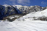 |
| Nara Prefecture | Mount Hakkyō (Mount Hakken) | 1,915 | Kii Mountains | 100 Famous Japanese Mountains |  |
| Wakayama[5] | Mount Ryūjin | 1,382 | Kii Mountains |  | |
| Tottori | Mount Daisen (Kengamine) | 1,729 | Daisen Mountains | 100 Famous Japanese Mountains |  |
| Shimane | Mount Osorakan | 1,346 | Kanmuri Mountains |  | |
| Okayama | Mount Ushiro | 1,345 | Chūgoku Mountains | link | |
| Hiroshima | Mount Osorakan | 1,346 | Kanmuri Mountains |  | |
| Yamaguchi | Mount Jakuchi | 1,337 | Kanmuri Mountains |  | |
| Tokushima | Mount Tsurugi | 1,955 | Shikoku Mountains | 100 Famous Japanese Mountains | link |
| Kagawa | Mount Ryūō | 1,060 | Sanuki Mountains |  | |
| Ehime | Mount Ishizuchi (Tengadake) | 1,982 | Shikoku Mountains | 100 Famous Japanese Mountains | link |
| Kochi | Mount Miune | 1,893 | Shikoku Mountains | 200 Famous Japanese Mountains |  |
| Fukuoka[6] | Mount Shaka | 1,230 | Tsue Cordillera (Shakagatake) |  | |
| Saga | Mount Kyō | 1,076 | Tara Mountains | 300 Famous Japanese Mountains |  |
| Nagasaki | Mount Unzen (Heisei Shizan) | 1,486 | Unzen Mountains | 200 Famous Japanese Mountains | 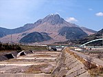 |
| Kumamoto | Mount Kunimi | 1,739 | Kyushu Mountains | 300 Famous Japanese Mountains | |
| Ōita | Mount Kujū (Nakadake) | 1,791 | Kyushu Mountains | 100 Famous Japanese Mountains | 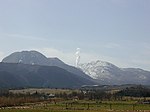 |
| Miyazaki | Mount Sobo | 1,756 | Kyushu Mountains | 100 Famous Japanese Mountains | 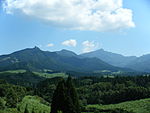 |
| Kagoshima | Mount Miyanoura | 1,936 | Yakushima | 100 Famous Japanese Mountains |  |
| Okinawa | Mount Omoto | 526 | Ishigaki Island |  |
Close
For details of administrative divisions of Japan, see Prefectures of Japan.
- 田代博、藤本一美、清水長正、高田将志 『山の地図と地形』 山と渓谷社、1996年
- 日本の主な山岳標高 都道府県別最高地点の一覧(国土地理院)
- 『山の便利手帳2001』山と渓谷2001年1月号第786号付録、山と渓谷社、2001年、P350
- The highest point of Akita Prefecture is mountainside of Mount Chōkai at elevation 1,775m.
- Mount Atago is within the range of a sub base of the Japan Air Self-Defense Force, therefore it is the only highest peaks by prefecture that requires permission for entry.
- The summit of Mount Korenge collpased in June 2007 and the triangular point was lost. When a new triangular point was set up by the Geospatial Information Authority, the new elevation was measured to be 2,766m, or 3 metres lower than before.
- The highest point of Osaka Prefecture is mountainside of Mount Kongō at elevation 1,056m.
- In the past, Mount Gomadan was considered the highest peak, but a mountain about 700 metres east of that was found to be about 10 meters higher in November 2000. That mountain was named Mount Ryūjin by popular vote of the residents of Tanabe City.
- The elevation used here is that of Hon-Shaka on the border of Fukuoka and Ota Prefectures. The summit of the same mountain is Fugendake (1,231m) on the Ōita side.