Municipalities_of_Chiapas
Municipalities of Chiapas
List of municipalities of Chiapas
Chiapas is a state in Southwest Mexico. According to the 2020 Mexican census, it has the eighth largest population of all states with 5,543,828 inhabitants and the 10th largest by land area spanning 73,560.47 square kilometres (28,401.86 sq mi).[1][2] Chiapas is officially divided into 124 municipalities,[3][4] although the establishment of municipal authorities in Belisario Domínguez was suspended in 2015 pending the resolution of a territorial dispute between Chiapas and the neighbouring state of Oaxaca.[5] In 2021, the Mexican Supreme Court resolved this dispute in Oaxaca's favour,[6] and annulled the 2011 decree that had created Belisario Domínguez.[7]
Municipalities in Chiapas are administratively autonomous of the state according to the 115th article of the 1917 Constitution of Mexico.[8] Every three years, citizens elect a municipal president (Spanish: presidente municipal) by a plurality voting system who heads a concurrently elected municipal council (ayuntamiento) responsible for providing all the public services for their constituents. The municipal council consists of a variable number of trustees and councillors (regidores y síndicos).[9] Municipalities are responsible for public services (such as water and sewerage), street lighting, public safety, traffic, and the maintenance of public parks, gardens and cemeteries.[10] They may also assist the state and federal governments in education, emergency fire and medical services, environmental protection and maintenance of monuments and historical landmarks. Since 1984, they have had the power to collect property taxes and user fees, although more funds are obtained from the state and federal governments than from their own income.[10]
The largest municipality by population is the state capital Tuxtla Gutiérrez, with 604,147 residents while the smallest is Sunuapa with 2,308 residents.[1] The largest municipality by land area is Ocosingo which spans 9,520.12 km2 (3,675.74 sq mi), and the smallest is Santiago el Pinar which spans 16.59 km2 (6.41 sq mi).[2] The newest municipality is Honduras de la Sierra, incorporated on July 15, 2018.[11]
- Largest municipalities in Chiapas by population
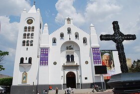 Tuxtla Gutiérrez, capital and largest municipality by population in Chiapas.
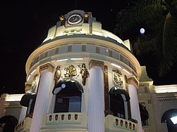 Tapachula, second largest municipality by population in Chiapas.
 Ocosingo, third largest municipality by population in Chiapas.
 San Cristóbal de las Casas, fourth largest municipality by population in Chiapas.
 Comitán, fifth largest municipality by population in Chiapas.


.svg)
| Name | Municipal seat | Population (2020)[1] |
Population (2010)[12] |
Change | Land area[2] | Population density (2020) |
Incorporation date[13] | |
|---|---|---|---|---|---|---|---|---|
| km2 | sq mi | |||||||
| Acacoyagua | Acacoyagua | 17,994 | 16,814 | +7.0% | 248.92 | 96.11 | 72.3/km2 (187.2/sq mi) | December 11, 1882 |
| Acala[lower-alpha 1] | Acala | 21,187 | 28,947 | −26.8% | 295.60 | 114.13 | 71.7/km2 (185.6/sq mi) | December 11, 1882 |
| Acapetahua | Acapetahua | 26,899 | 27,580 | −2.5% | 561.81 | 216.91 | 47.9/km2 (124.0/sq mi) | December 11, 1882 |
| Aldama[lower-alpha 2] | Aldama | 8,480 | 5,072 | +67.2% | 26.90 | 10.39 | 315.3/km2 (816.5/sq mi) | July 28, 1999[14] |
| Altamirano[lower-alpha 3] | Altamirano | 36,160 | 29,865 | +21.1% | 958.34 | 370.02 | 34.3/km2 (88.8/sq mi) | December 11, 1882 |
| Amatán | Amatán | 24,512 | 21,275 | +15.2% | 316.97 | 122.38 | 77.3/km2 (200.3/sq mi) | December 11, 1882 |
| Amatenango de la Frontera | Amatenango de la Frontera | 31,735 | 29,547 | +7.4% | 254.46 | 98.25 | 124.7/km2 (323.0/sq mi) | August 16, 1884 |
| Amatenango del Valle | Amatenango del Valle | 11,283 | 8,728 | +29.3% | 152.64 | 58.93 | 73.9/km2 (191.5/sq mi) | December 11, 1882 |
| Angel Albino Corzo | Jaltenango de la Paz | 31,947 | 26,628 | +20.0% | 583.54 | 225.31 | 48.3/km2 (125.0/sq mi) | March 1, 1933 |
| Arriaga | Arriaga | 41,135 | 40,042 | +2.7% | 810.52 | 312.94 | 50.8/km2 (131.4/sq mi) | May 28, 1910 |
| Bejucal de Ocampo | Bejucal de Ocampo | 7,365 | 7,623 | −3.4% | 79.00 | 30.50 | 93.2/km2 (241.5/sq mi) | May 4, 1912 |
| Belisario Domínguez[lower-alpha 4] | Rodulfo Figueroa | |||||||
| Bella Vista[lower-alpha 5] | Bella Vista | 20,157 | 19,281 | +4.5% | 214.47 | 82.81 | 94.0/km2 (243.4/sq mi) | June 10, 1925 |
| Benemérito de las Américas | Benemérito de las Américas | 23,603 | 17,282 | +36.6% | 1,096.70 | 423.44 | 21.5/km2 (55.7/sq mi) | July 28, 1999 |
| Berriozábal | Berriozábal | 64,632 | 43,179 | +49.7% | 353.15 | 136.35 | 183.0/km2 (474.0/sq mi) | May 30, 1898 |
| Bochil | Bochil | 37,263 | 30,642 | +21.6% | 366.42 | 141.48 | 101.7/km2 (263.4/sq mi) | August 28, 1929 |
| Cacahoatán | Cacahoatán | 50,112 | 43,811 | +14.4% | 174.80 | 67.49 | 286.7/km2 (742.5/sq mi) | December 11, 1882 |
| Capitán Luis Ángel Vidal | Capitán Luis Ángel Vidal | 4,315 | 3,653 | +18.1% | 225.24 | 86.97 | 19.2/km2 (49.6/sq mi) | September 6, 2017 |
| Catazajá | Catazajá | 17,619 | 17,140 | +2.8% | 631.76 | 243.93 | 27.9/km2 (72.2/sq mi) | December 11, 1882 |
| Chalchihuitán | Chalchihuitán | 21,915 | 14,027 | +56.2% | 185.91 | 71.78 | 117.9/km2 (305.3/sq mi) | December 11, 1882 |
| Chamula | Chamula | 101,967 | 76,941 | +32.5% | 345.67 | 133.46 | 295.0/km2 (764.0/sq mi) | December 11, 1882 |
| Chanal | Chanal | 13,678 | 10,817 | +26.4% | 408.07 | 157.56 | 33.5/km2 (86.8/sq mi) | December 11, 1882 |
| Chapultenango | Chapultenango | 7,472 | 7,332 | +1.9% | 182.02 | 70.28 | 41.0/km2 (106.3/sq mi) | December 11, 1882 |
| Chenalhó | Chenalhó | 47,371 | 36,111 | +31.2% | 252.23 | 97.39 | 187.8/km2 (486.4/sq mi) | December 11, 1882 |
| Chiapa de Corzo | Chiapa de Corzo | 112,075 | 87,603 | +27.9% | 833.39 | 321.77 | 134.5/km2 (348.3/sq mi) | March 31, 1849 |
| Chiapilla | Chiapilla | 6,156 | 5,405 | +13.9% | 51.58 | 19.91 | 119.4/km2 (309.1/sq mi) | December 11, 1882 |
| Chicoasén | Chicoasén | 5,402 | 5,018 | +7.7% | 115.72 | 44.68 | 46.7/km2 (120.9/sq mi) | December 11, 1882 |
| Chicomuselo | Chicomuselo | 36,785 | 31,515 | +16.7% | 999.91 | 386.07 | 36.8/km2 (95.3/sq mi) | December 11, 1882 |
| Chilón | Chilón | 137,262 | 111,554 | +23.0% | 1,685.16 | 650.65 | 81.5/km2 (211.0/sq mi) | March 31, 1849 |
| Cintalapa | Cintalapa de Figueroa | 88,106 | 78,114 | +12.8% | 2,448.75 | 945.47 | 36.0/km2 (93.2/sq mi) | December 11, 1882 |
| Coapilla | Coapilla | 9,900 | 8,444 | +17.2% | 155.53 | 60.05 | 63.7/km2 (164.9/sq mi) | December 11, 1882 |
| Comitán de Domínguez | Comitán de Domínguez | 166,178 | 141,013 | +17.8% | 981.19 | 378.84 | 169.4/km2 (438.6/sq mi) | March 31, 1849 |
| Copainalá | Copainalá | 22,192 | 21,050 | +5.4% | 347.56 | 134.20 | 63.8/km2 (165.4/sq mi) | December 11, 1882 |
| El Bosque[lower-alpha 6] | El Bosque | 24,273 | 18,559 | +30.8% | 159.69 | 61.65 | 152.0/km2 (393.7/sq mi) | December 11, 1882 |
| El Parral | El Parral | 15,587 | 14,171 | +10.0% | 365.50 | 141.12 | 42.6/km2 (110.5/sq mi) | November 23, 2011 |
| El Porvenir | El Porvenir | 12,263 | 13,201 | −7.1% | 82.95 | 32.03 | 147.8/km2 (382.9/sq mi) | November 23, 1922 |
| Emiliano Zapata | 20 de Noviembre | 10,783 | 9,915 | +8.8% | 179.14 | 69.17 | 60.2/km2 (155.9/sq mi) | November 23, 2011 |
| Escuintla | Escuintla | 30,896 | 30,068 | +2.8% | 418.36 | 161.53 | 73.9/km2 (191.3/sq mi) | December 11, 1882 |
| Francisco León[lower-alpha 7] | Rivera el Viejo Carmen | 7,245 | 7,000 | +3.5% | 210.79 | 81.39 | 34.4/km2 (89.0/sq mi) | December 11, 1882 |
| Frontera Comalapa | Frontera Comalapa | 80,897 | 67,012 | +20.7% | 767.14 | 296.19 | 105.5/km2 (273.1/sq mi) | February 28, 1930 |
| Frontera Hidalgo | Frontera Hidalgo | 14,556 | 12,665 | +14.9% | 94.38 | 36.44 | 154.2/km2 (399.4/sq mi) | August 28, 1929 |
| Honduras de la Sierra | Honduras de la Sierra | 11,650 | 10,989 | +6.0% | 200.00 | 77.22 | 58.3/km2 (150.9/sq mi) | July 15, 2018 |
| Huehuetán | Huehuetán | 36,333 | 33,444 | +8.6% | 304.26 | 117.48 | 119.4/km2 (309.3/sq mi) | December 11, 1882 |
| Huitiupán | Huitiupán | 27,893 | 22,536 | +23.8% | 340.23 | 131.36 | 82.0/km2 (212.3/sq mi) | December 11, 1882 |
| Huixtán | Huixtán | 22,975 | 21,507 | +6.8% | 311.82 | 120.40 | 73.7/km2 (190.8/sq mi) | December 11, 1882 |
| Huixtla | Huixtla | 53,242 | 51,359 | +3.7% | 397.55 | 153.50 | 133.9/km2 (346.9/sq mi) | December 11, 1882 |
| Ixhuatán | Ixhuatan | 11,377 | 10,239 | +11.1% | 94.68 | 36.55 | 120.2/km2 (311.2/sq mi) | December 11, 1882 |
| Ixtacomitán | Ixtacomitán | 10,961 | 10,176 | +7.7% | 125.66 | 48.52 | 87.2/km2 (225.9/sq mi) | December 11, 1882 |
| Ixtapa | Ixtapa | 28,999 | 24,517 | +18.3% | 280.02 | 108.12 | 103.6/km2 (268.2/sq mi) | December 11, 1882 |
| Ixtapangajoya | Ixtapangajoya | 6,284 | 5,478 | +14.7% | 107.60 | 41.54 | 58.4/km2 (151.3/sq mi) | December 11, 1882 |
| Jiquipilas | Jiquipilas | 41,063 | 37,818 | +8.6% | 1,305.75 | 504.15 | 31.4/km2 (81.4/sq mi) | December 11, 1882 |
| Jitotol | Jitotol | 24,966 | 18,683 | +33.6% | 236.37 | 91.26 | 105.6/km2 (273.6/sq mi) | December 11, 1882 |
| Juárez | Juárez | 21,807 | 21,084 | +3.4% | 745.21 | 287.73 | 29.3/km2 (75.8/sq mi) | December 11, 1882 |
| La Concordia | La Concordia | 49,920 | 44,082 | +13.2% | 2,580.75 | 996.43 | 19.3/km2 (50.1/sq mi) | December 11, 1882 |
| La Grandeza | La Grandeza | 7,701 | 7,272 | +5.9% | 48.86 | 18.87 | 157.6/km2 (408.2/sq mi) | February 5, 1921 |
| La Independencia | La Independencia | 46,409 | 41,266 | +12.5% | 516.08 | 199.26 | 89.9/km2 (232.9/sq mi) | February 28, 1930 |
| La Libertad | La Libertad | 5,232 | 4,974 | +5.2% | 458.10 | 176.87 | 11.4/km2 (29.6/sq mi) | December 11, 1882 |
| La Trinitaria[lower-alpha 8] | La Trinitaria | 83,111 | 72,769 | +14.2% | 1,608.38 | 621.00 | 51.7/km2 (133.8/sq mi) | December 11, 1882 |
| Larráinzar[lower-alpha 9] | San Andrés Larráinzar | 31,259 | 20,349 | +53.6% | 149.29 | 57.64 | 209.4/km2 (542.3/sq mi) | December 11, 1882 |
| Las Margaritas | Las Margaritas | 141,027 | 111,484 | +26.5% | 3,025.71 | 1,168.23 | 46.6/km2 (120.7/sq mi) | December 11, 1882 |
| Las Rosas[lower-alpha 10] | Las Rosas | 28,829 | 25,530 | +12.9% | 235.61 | 90.97 | 122.4/km2 (316.9/sq mi) | December 11, 1882 |
| Mapastepec | Mapastepec | 46,130 | 43,913 | +5.0% | 1,223.87 | 472.54 | 37.7/km2 (97.6/sq mi) | December 11, 1882 |
| Maravilla Tenejapa | Maravilla Tenejapa | 14,714 | 11,451 | +28.5% | 637.12 | 245.99 | 23.1/km2 (59.8/sq mi) | July 28, 1999 |
| Marqués de Comillas | Zamora Pico de Oro | 12,892 | 9,856 | +30.8% | 912.40 | 352.28 | 14.1/km2 (36.6/sq mi) | July 28, 1999 |
| Mazapa de Madero | Mazapa de Madero | 7,901 | 7,793 | +1.4% | 110.69 | 42.74 | 71.4/km2 (184.9/sq mi) | February 5, 1921 |
| Mazatán | Mazatán | 28,250 | 26,573 | +6.3% | 383.99 | 148.26 | 73.6/km2 (190.5/sq mi) | December 11, 1882 |
| Metapa | Metapa de Domínguez | 5,876 | 5,033 | +16.7% | 27.33 | 10.55 | 215.0/km2 (557.0/sq mi) | December 11, 1882 |
| Mezcalapa | Raudales Malpaso | 23,847 | 20,950 | +13.8% | 847.31 | 327.15 | 28.1/km2 (72.9/sq mi) | November 14, 2011[16] |
| Mitontic | Mitontic | 13,755 | 11,157 | +23.3% | 36.69 | 14.17 | 374.9/km2 (971.0/sq mi) | December 11, 1882 |
| Montecristo de Guerrero | Montecristo de Guerrero | 8,412 | 6,900 | +21.9% | 198.59 | 76.68 | 42.4/km2 (109.7/sq mi) | July 28, 1999 |
| Motozintla | Motozintla de Mendoza | 76,398 | 69,119 | +10.5% | 586.39 | 226.41 | 130.3/km2 (337.4/sq mi) | February 5, 1921 |
| Nicolás Ruíz[lower-alpha 11] | Nicolás Ruíz | 4,765 | 4,317 | +10.4% | 29.63 | 11.44 | 160.8/km2 (416.5/sq mi) | November 23, 1922 |
| Ocosingo | Ocosingo | 234,661 | 198,877 | +18.0% | 9,520.12 | 3,675.74 | 24.6/km2 (63.8/sq mi) | December 11, 1882 |
| Ocotepec | Ocotepec | 14,088 | 11,878 | +18.6% | 61.34 | 23.68 | 229.7/km2 (594.8/sq mi) | December 11, 1882 |
| Ocozocoautla de Espinosa | Ocozocoautla de Espinosa | 97,397 | 82,059 | +18.7% | 2,102.52 | 811.79 | 46.3/km2 (120.0/sq mi) | December 11, 1882 |
| Ostuacán | Ostuacán | 18,469 | 17,067 | +8.2% | 600.46 | 231.84 | 30.8/km2 (79.7/sq mi) | December 11, 1882 |
| Osumacinta | Osumacinta | 3,983 | 3,792 | +5.0% | 92.61 | 35.76 | 43.0/km2 (111.4/sq mi) | December 11, 1882 |
| Oxchuc | Oxchuc | 54,932 | 43,350 | +26.7% | 417.85 | 161.33 | 131.5/km2 (340.5/sq mi) | December 11, 1882 |
| Palenque | Palenque | 132,265 | 110,918 | +19.2% | 2,897.44 | 1,118.71 | 45.6/km2 (118.2/sq mi) | March 31, 1849 |
| Pantelhó | Pantelhó | 26,391 | 20,589 | +28.2% | 193.18 | 74.59 | 136.6/km2 (353.8/sq mi) | December 11, 1882 |
| Pantepec | Pantepec | 12,266 | 10,870 | +12.8% | 106.03 | 40.94 | 115.7/km2 (299.6/sq mi) | December 11, 1882 |
| Pichucalco | Pichucalco | 31,919 | 29,813 | +7.1% | 595.09 | 229.76 | 53.6/km2 (138.9/sq mi) | March 31, 1849 |
| Pijijiapan | Pijijiapan | 51,193 | 50,079 | +2.2% | 1,762.77 | 680.61 | 29.0/km2 (75.2/sq mi) | December 11, 1882 |
| Pueblo Nuevo Solistahuacán[lower-alpha 12] | Pueblo Nuevo Solistahuacán | 29,636 | 31,075 | −4.6% | 248.25 | 95.85 | 119.4/km2 (309.2/sq mi) | December 11, 1882 |
| Rayón[lower-alpha 13] | Rayón | 10,866 | 9,002 | +20.7% | 67.90 | 26.22 | 160.0/km2 (414.5/sq mi) | December 11, 1882 |
| Reforma | Reforma | 44,829 | 40,711 | +10.1% | 436.30 | 168.46 | 102.7/km2 (266.1/sq mi) | December 27, 1933 |
| Rincón Chamula San Pedro | Rincón Chamula | 8,718 | 7,244 | +20.3% | 77.93 | 30.09 | 111.9/km2 (289.7/sq mi) | September 6, 2017 |
| Sabanilla | Sabanilla | 29,889 | 25,187 | +18.7% | 250.78 | 96.83 | 119.2/km2 (308.7/sq mi) | December 11, 1882 |
| Salto de Agua | Salto de Agua | 64,251 | 57,253 | +12.2% | 1,232.27 | 475.78 | 52.1/km2 (135.0/sq mi) | December 11, 1882 |
| San Andrés Duraznal | San Andrés Duraznal | 5,163 | 4,545 | +13.6% | 38.46 | 14.85 | 134.2/km2 (347.7/sq mi) | July 28, 1999 |
| San Cristóbal de las Casas[lower-alpha 14] | San Cristóbal de las Casas | 215,874 | 185,917 | +16.1% | 395.50 | 152.70 | 545.8/km2 (1,413.7/sq mi) | March 31, 1849 |
| San Fernando | San Fernando | 41,793 | 33,060 | +26.4% | 360.74 | 139.28 | 115.9/km2 (300.1/sq mi) | December 11, 1882 |
| San Juan Cancuc | San Juan Cancuc | 37,948 | 29,016 | +30.8% | 173.62 | 67.04 | 218.6/km2 (566.1/sq mi) | August 30, 1989 |
| San Lucas[lower-alpha 15] | San Lucas | 7,202 | 6,734 | +6.9% | 94.35 | 36.43 | 76.3/km2 (197.7/sq mi) | May 8, 1935 |
| Santiago el Pinar | Santiago el Pinar | 4,959 | 3,245 | +52.8% | 16.59 | 6.41 | 298.9/km2 (774.1/sq mi) | July 28, 1999 |
| Siltepec[lower-alpha 16] | Siltepec | 25,937 | 38,143 | −32.0% | 264.50 | 102.12 | 98.1/km2 (254.0/sq mi) | February 5, 1921 |
| Simojovel | Simojovel de Allende | 52,935 | 40,297 | +31.4% | 314.99 | 121.62 | 168.1/km2 (435.3/sq mi) | March 31, 1849 |
| Sitalá | Sitalá | 15,518 | 12,269 | +26.5% | 105.75 | 40.83 | 146.7/km2 (380.0/sq mi) | December 11, 1882 |
| Socoltenango | Socoltenango | 19,092 | 17,125 | +11.5% | 634.91 | 245.14 | 30.1/km2 (77.9/sq mi) | December 11, 1882 |
| Solosuchiapa | Solosuchiapa | 8,561 | 8,065 | +6.2% | 156.84 | 60.56 | 54.6/km2 (141.4/sq mi) | December 11, 1882 |
| Soyaló | Soyaló | 10,890 | 9,740 | +11.8% | 96.41 | 37.22 | 113.0/km2 (292.6/sq mi) | December 11, 1882 |
| Suchiapa | Suchiapa | 25,627 | 21,045 | +21.8% | 284.85 | 109.98 | 90.0/km2 (233.0/sq mi) | December 11, 1882 |
| Suchiate | Ciudad Hidalgo | 41,672 | 35,056 | +18.9% | 236.98 | 91.50 | 175.8/km2 (455.4/sq mi) | July 8, 1925 |
| Sunuapa | Sunuapa | 2,308 | 2,235 | +3.3% | 78.59 | 30.34 | 29.4/km2 (76.1/sq mi) | February 5, 1921 |
| Tapachula | Tapachula | 353,706 | 320,451 | +10.4% | 983.65 | 379.79 | 359.6/km2 (931.3/sq mi) | March 31, 1849 |
| Tapalapa | Tapalapa | 4,547 | 4,121 | +10.3% | 66.32 | 25.61 | 68.6/km2 (177.6/sq mi) | December 11, 1882 |
| Tapilula | Tapilula | 13,592 | 12,170 | +11.7% | 42.74 | 16.50 | 318.1/km2 (823.8/sq mi) | December 11, 1882 |
| Tecpatán[lower-alpha 17] | Tecpatán | 21,426 | 41,045 | −47.8% | 770.60 | 297.53 | 27.8/km2 (72.0/sq mi) | December 11, 1882 |
| Tenejapa | Tenejapa | 48,162 | 40,268 | +19.6% | 193.12 | 74.57 | 249.4/km2 (645.9/sq mi) | December 11, 1882 |
| Teopisca | Teopisca | 49,499 | 37,607 | +31.6% | 284.44 | 109.82 | 174.0/km2 (450.7/sq mi) | December 11, 1882 |
| Tila | Tila | 83,505 | 71,432 | +16.9% | 803.89 | 310.38 | 103.9/km2 (269.0/sq mi) | December 11, 1882 |
| Tonalá | Tonala | 91,913 | 84,594 | +8.7% | 1,858.92 | 717.73 | 49.4/km2 (128.1/sq mi) | March 31, 1849 |
| Totolapa | Totolapa | 7,211 | 6,375 | +13.1% | 169.10 | 65.29 | 42.6/km2 (110.4/sq mi) | December 11, 1882 |
| Tumbalá | Tumbalá | 38,025 | 31,723 | +19.9% | 403.52 | 155.80 | 94.2/km2 (244.1/sq mi) | December 11, 1882 |
| Tuxtla Chico | Tuxtla Chico | 41,024 | 37,737 | +8.7% | 161.95 | 62.53 | 253.3/km2 (656.1/sq mi) | December 11, 1882 |
| Tuxtla Gutiérrez | Tuxtla Gutiérrez† | 604,147 | 553,374 | +9.2% | 336.07 | 129.76 | 1,797.7/km2 (4,656.0/sq mi) | March 31, 1849 |
| Tuzantán | Tuzantán | 30,302 | 28,137 | +7.7% | 174.87 | 67.52 | 173.3/km2 (448.8/sq mi) | December 11, 1882 |
| Tzimol | Tzimol | 16,560 | 14,009 | +18.2% | 359.44 | 138.78 | 46.1/km2 (119.3/sq mi) | April 1, 1931 |
| Unión Juárez | Unión Juárez | 16,008 | 14,089 | +13.6% | 62.26 | 24.04 | 257.1/km2 (665.9/sq mi) | December 11, 1882 |
| Venustiano Carranza[lower-alpha 18] | Venustiano Carranza | 67,292 | 61,341 | +9.7% | 1,364.65 | 526.89 | 49.3/km2 (127.7/sq mi) | March 31, 1849 |
| Villa Comaltitlán[lower-alpha 19] | Villa Comaltitlán | 29,636 | 27,899 | +6.2% | 447.05 | 172.61 | 66.3/km2 (171.7/sq mi) | December 11, 1882 |
| Villa Corzo[lower-alpha 20][lower-alpha 21] | Villa Corzo | 65,643 | 74,477 | −11.9% | 2,764.48 | 1,067.37 | 23.7/km2 (61.5/sq mi) | December 11, 1882 |
| Villaflores[lower-alpha 22] | Villaflores | 109,536 | 98,618 | +11.1% | 1,907.90 | 736.64 | 57.4/km2 (148.7/sq mi) | December 11, 1882 |
| Yajalón | Yajalón | 40,285 | 34,028 | +18.4% | 209.96 | 81.07 | 191.9/km2 (496.9/sq mi) | December 11, 1882 |
| Zinacantán | Zinacantán | 45,373 | 36,489 | +24.3% | 195.26 | 75.39 | 232.4/km2 (601.8/sq mi) | December 11, 1882 |
| Chiapas | — | 5,543,828 | 4,796,580 | +15.6% | 73,560.47 | 28,401.86 | 75.4/km2 (195.2/sq mi) | — |
| Mexico[17] | — | 126,014,024 | 112,336,538 | +12.2% | 1,972,550 | 761,606 | 63.9/km2 (165.5/sq mi) | — |
- Aldama was originally incorporated as Santa María Magdalena, changing its name on February 28, 1934.[13]
- Altamirano was originally incorporated as San Carlos, changing its name on January 30, 1935.[13]
- Gazetted in 2011, municipal authorities elected in 2015 were rejected by the Supreme Court of Justice of the Nation as contrary to its 2012 order prohibiting the naming of municipal authorities in the area, which is disputed by Oaxaca. INEGI does not include it within its National Geostatistical Framework.[15]
- Bella Vista was originally incorporated as San Pedro Remate, changing its name on February 13, 1934.[13]
- El Bosque was originally incorporated as San Juan Bautista, changing its name on February 13, 1934.[13]
- Francisco León was originally incorporated as Santa María Magdalena, changing its name on February 28, 1934.[13]
- La Trinitaria was originally incorporated as Zapaluta, changing its name on October 5, 1912.[13]
- Larráinzar was originally incorporated as San Andrés, changing its name on February 28, 1934.[13]
- Las Rosas was originally incorporated as Pinola, changing its name on October 5, 1912.[13]
- Nicolás Ruiz was originally incorporated as San Diego La Reforma, changing its name on February 28, 1934.[13]
- Rayón was originally incorporated as San Bartolomé Solistaguacán, changing its name on February 28, 1934.[13]
- San Cristóbal was originally incorporated as Ciudad Real, changing its name on July 27, 1829.[13]
- Venustiano Carranza was originally incorporated as San Bartolomé de los Llanos, changing its name on February 28, 1934.[13]
- Villa Comaltitlán was originally incorporated as Pueblo Nuevo Comaltitlán, changing its name on June 15, 1960.[13]
- Villa Corzo was originally incorporated as Trinidad de la Ley, changing its name on November 3, 1893.[13]
- Villaflores was originally incorporated as Catarina la Grande, changing its name on November 3, 1893.[13]
- "Censo de Población y Vivienda 2020 - SCITEL" (in Spanish). INEGI. Retrieved 2021-01-27.
- "Unidad de Microrregiones Cedulas de Informacion Municipal (SCIM)" (in Spanish). Secretara de Desarrollo Social. Retrieved November 18, 2017.
- "Constitución Política del Estado Libre y Soberano de Chiapas". Article 2, Act of September 6, 2017 (PDF) (in Spanish). Retrieved January 5, 2018.
- "En 2018 sí habrá elecciones en nuevos municipios de Chiapas: SGG". El Estado (in Spanish). September 21, 2017. Archived from the original on January 6, 2018. Retrieved January 5, 2018.
- "Desaparecen Concejo Municipal por controversia constitucional" (in Spanish). MuralChiapas. April 20, 2016. Retrieved March 25, 2018.
- Briseño, Patricia (November 11, 2021). "SCJN ratifica límites históricos entre Oaxaca y Chiapas". Excélsior (in Spanish). Retrieved January 9, 2022.
- López, Isaí (November 11, 2021). "SCJN deja sin efecto decreto del Congreso de Chiapas que creó municipio Belisario Domínguez". El Heraldo de Chiapas (in Spanish). Retrieved January 9, 2022.
- "Constitución Política de los Estados Unidos Mexicanos". Article 115, Act of 1917 (in Spanish). Retrieved September 27, 2017.
- OECD (November 12, 2004). New Forms of Governance for Economic Development. OECD Publishing. p. 121. ISBN 9264015329.
- International Business Publications (2009). Mexico Company Laws and Regulations Handbook. p. 42. ISBN 978-1-4330-7030-3.
{{cite book}}:|last=has generic name (help) - López, Isaí (4 October 2019). "Honduras de la Sierra, el nuevo municipio". El Heraldo de Chiapas (in Spanish). Retrieved 24 October 2020.
- "Localidades y su población por municipio segun tamaño de localidad" (PDF) (in Spanish). INEGI. Archived from the original (PDF) on August 31, 2018. Retrieved March 11, 2018.
- Estado de Chiapas División Territorial de 1810 a 1995 (PDF) (in Spanish). Mexico: INEGI. 1996. pp. 79–95. ISBN 970-13-1486-7.
- "Enciclopedia de los Municipios" (in Spanish). INAFED.
- "Catálogo Único de Claves de Áreas Geoestadísticas Estatales, Municipales y Localidades". INEGI. November 2017. Retrieved 9 February 2018.
- "Mezcalapa - Gobierno de Chiapas". Chiapas.gob.mx. Retrieved 26 July 2018.
- "Población" (in Spanish). INEGI. Retrieved January 20, 2018.