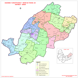
Neem-Ka-Thana

Neem Ka Thana

Neem Ka Thana

Municipal Council and District Headquarter in Rajasthan, India


Neem Ka Thana is a city and administrative headquarter of Neem Ka Thana district located 73 km from Sikar City in the Dhundhar region in the Rajasthan state of India.[1] Sikar, Khandela, Sri Madhopur, Kotputli, Khetri, and Narnaul are some major cities and towns near Neem Ka Thana. It is located at a distance of 119 kilometers from Jaipur and 241 kilometers from Delhi. Neem Ka Thana is well connected with others cities in the region with roads and Indian Railways.

Quick Facts Country, State ...

Demographics

As of 2011 Indian census,[2] Neem-Ka-Thana had a population 36,000 males constituting 53% of the population and females 47%.16% of the population is under 6 years of age. It has an average literacy rate of 67%, higher than the national average of 59.5%. Male literacy is 77%, and female literacy is 56%. Neem ka thana is an important commercial center of Shekhawati region of Rajasthan. The total area of the current Neem Ka Thana station district in 1016 hectares (as of 2015, when it was a municipality).


References

  1. "सीकर अब जिला नहीं संभाग हुआ:नीमकाथाना अब अलग जिला,बजट पास में CM की सीकर के लिए 2 बड़ी घोषणा". Dainik Bhaskar.
  2. "Census of India 2011: Data from the 2011 Census, including cities, villages and towns (Provisional)". Census Commission of India. Archived from the original on 16 June 2004. Retrieved 1 November 2008.

2. https://www.bhaskar.com/amp/news/vishnu-chetani-becomes-bjp-district-president-0868534.doc


Share this article:

This article uses material from the Wikipedia article Neem-Ka-Thana, and is written by contributors. Text is available under a CC BY-SA 4.0 International License; additional terms may apply. Images, videos and audio are available under their respective licenses.