Río_Pilcomayo

Pilcomayo River

Pilcomayo River

River of Argentina


Pilcomayo (in Hispanicized spelling)[2] (Quechua Pillkumayu or Pillku Mayu, pillku red, mayu river,[3] "red river", Guarani Ysyry Araguay [ʔɨsɨˈɾɨ ʔaɾaɰʷaˈɨ]) is a river in central South America. At 1,100 kilometres (680 mi) long,[4] it is the longest western tributary of the Paraguay River. Its drainage basin is 270,000 square kilometres (100,000 sq mi) in area, and its mean discharge is 200 cubic metres per second (7,100 cu ft/s).[4]

Quick Facts Pilcomayo Ysyry Araguay, Etymology ...

Along its course, the Pilcomayo silts up and splits into two main branches, North and South. After some distance, these branches rejoin to form the Lower Pilcomayo.[4]

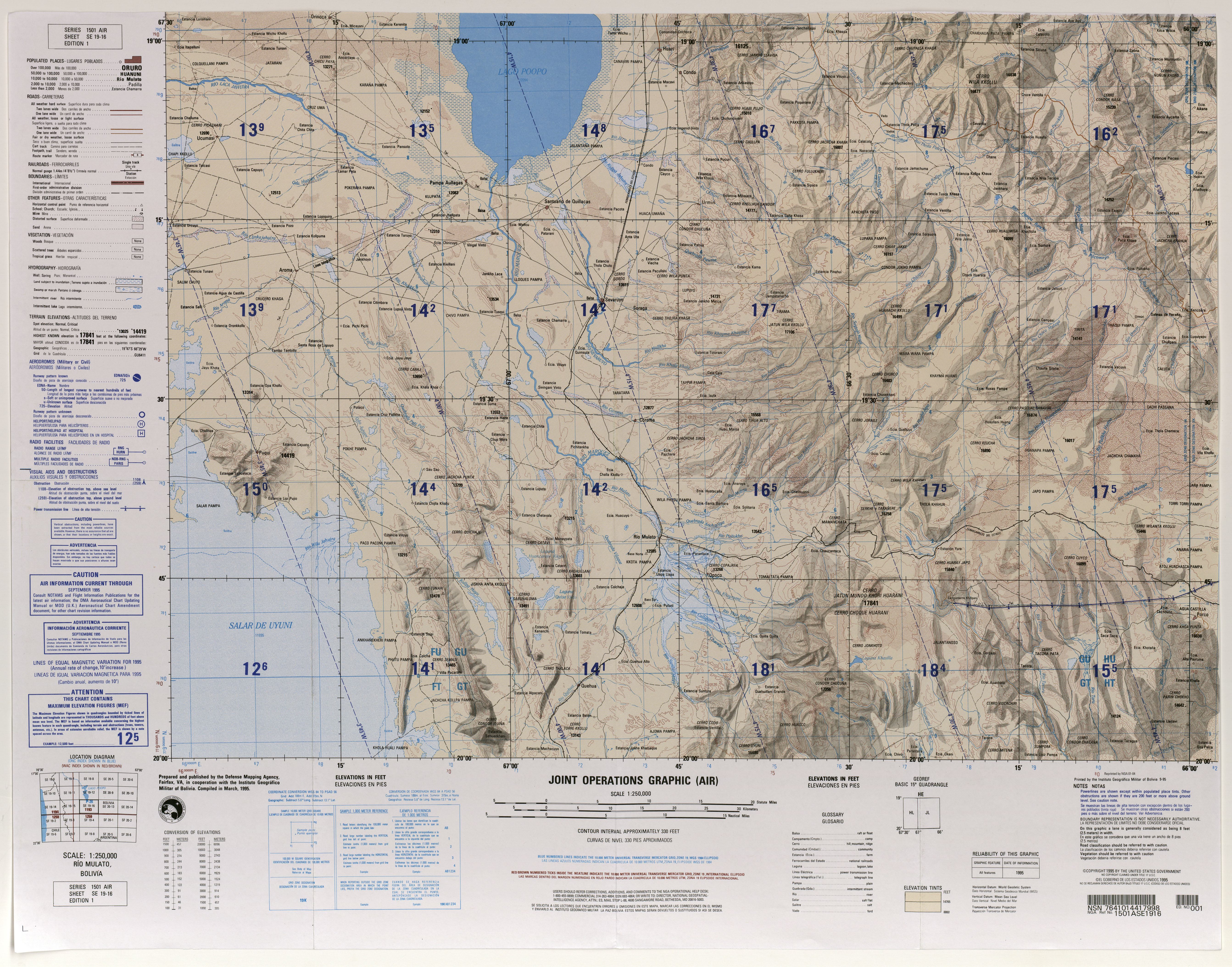
The Pilcomayo rises in the foothills of the Andes mountain range in the Oruro Department in Bolivia, east of Lake Poopó. The Jach'a Juqhu River is considered the origin of the Pilcomayo.[5] Upstream the Jach'a Juqhu River successively receives the names Aguas Calientes and Kachi Mayu. From the confluence with the Chillawa (Chillahua), the river is called Pilcomayo.[6][7] From there, it flows in a southeasterly direction through Chuquisaca and Tarija departments, passes through the Argentine province of Formosa and the Gran Chaco plains of Paraguay, forming most of the border between these two countries before it joins the Paraguay River near Asunción. The Río Pilcomayo National Park is located on the Argentine side of the border. It also forms a short part of the boundary between Argentina and Bolivia, just prior to the ArgentinaBoliviaParaguay tripoint.

Human settlement

The river basin is home to approximately 1.5 million people: one million in Bolivia, 300,000 in Argentina, and 200,000 in Paraguay.

The Nakotoi Indian Tribe resides in the southern region of the Pilcomayo, a region located along the river in central Paraguay.[8] The aborigines of this tribe are descendants of the highly renowned Redskin Tribe.[8] The Natokoi treated all neighbors as enemies, but none more so than the Tobas Tribe and the Nimká Tribe, their respective neighbors to the southwest and northeast.[8] Guerrilla warfare has long existed between the tribes, isolating the tribe from direct intercourse with the European settlers in the late 19th century.[8] Men of this tribe are generally tall and skinny, built like hunters or warriors, whereas women are short in size.[9] The Natokoi dress in a rug, fastened around the waist-line.[9]

See also


References

  1. "Rio Pilcomayo". Ramsar Sites Information Service. Retrieved 25 April 2018.
  2. Teofilo Laime Ajacopa, Diccionario Bilingüe, Quechua-Castellano, Castellano Quechua, La Paz, 2007: mayu - s. Río. pillku - adj. Rojo (sínón.: Puka).
  3. Varis, Olli; Tortajada, Cecilia; Biswas, Asit K. (2008). Management of Transboundary Rivers and Lakes. Springer. p. 271. ISBN 978-3-540-74926-4.
  4. Jorge Molina Carpio, Daniel Espinoza Romero, Balance hídrico superficial de la cuenca alta del río Pilcomayo, La Paz 2005 (Spanish)
  5. lib.utexas.edu Map showing Jach'a Juqhu River from the origin
  6. Santiago de Huari Municipality: Archived 2014-10-16 at the Wayback Machine population data and map showing Jach'a Juqhu River
  7. Kerr, p. 116
  8. Kerr, p. 117

Sources

25°21′S 57°40′W


Share this article:

This article uses material from the Wikipedia article Río_Pilcomayo, and is written by contributors. Text is available under a CC BY-SA 4.0 International License; additional terms may apply. Images, videos and audio are available under their respective licenses.