Sakae_Station_(Aichi)

Sakae Station (Nagoya)

Sakae Station (Nagoya)

Metro station in Nagoya, Japan


Sakae Station (栄駅, Sakae-eki) is an underground metro station located in Naka-ku, Nagoya, Aichi Prefecture, Japan operated by the Nagoya Municipal Subway.[3] It is an interchange station between the Higashiyama Line and the Meijō Line and is located 9.0 rail kilometers from the terminus of the Higashiyama Line at Takabata Station and 3.0 rail kilometers from the terminus of the Meijō Line at Kanayama Station. This station is located in part of the upper class district of Nagoya.

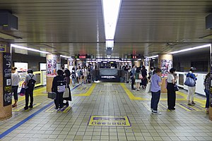
Quick Facts M05 H10Sakae Station栄駅, General information ...
Sakae Station Meijō Line Platform

History

Sakae Station was opened on 15 November 1957 as Sakaemachi Station (栄町駅, Sakaemachi-eki) as a terminal station on the No. 1 Line, later renamed the Higashiyama Line. The new subway system replaced the electric tram which had run above ground. The No. 2 Line (later named the Meijō Line) connected to the station on 15 October 1965. The station was renamed to its present name on 1 June 1966.[4]

Lines

Layout

Sakae Station has one underground island platform for use by the Higashiyama Line and two underground opposed side platforms for use by the Meijō Line.

Platforms

1  Higashiyama Line For Higashiyama Kōen and Fujigaoka
2  Higashiyama Line For Nagoya and Takabata
3  Meijō Line For Kanayama, Aratama-bashi, and Nagoyakō
4  Meijō Line For Shiyakusho and Ōzone

The station is rather large and contains many businesses such as restaurants and shops. There are three sets of gates corresponding to three exits: the Central Exit, the East Exit, and the West Exit. Past the West Exit are exits 1, 2, 7, and 8. Exit 3 and Exit 6 are between the Central Exit and the West Exit. Past the East Exit are exits 4, 4A, and 5.[5]


References

  1. 佐藤, 信之 (19 June 2004), "高度経済成長期の鉄道整備―昭和30~40年代", 地下鉄の歴史首都圏・中部・近畿圏 (in Japanese), グランプリ出版, p. 71, ISBN 4-87687-260-0
  2. 平成21年版名古屋市統計年鑑 11.運輸・通信 [Nagoya Statistics for Year 21 of the Heisei Era, 11 Transportation and Communication] (in Japanese). Nagoya City. Retrieved 1 December 2010.
  3. [Sakae] (in Japanese). Transportation Bureau City of Nagoya. Retrieved 19 November 2010.
  4. 佐藤, 信之 (19 June 2004), 地下鉄の歴史首都圏・中部・近畿圏 (in Japanese), グランプリ出版, ISBN 4-87687-260-0
  5. 駅構内図 [Diagram of Station Interior] (in Japanese). Transportation Bureau City of Nagoya. Retrieved 18 November 2010.

35.169989°N 136.908177°E / 35.169989; 136.908177


Share this article:

This article uses material from the Wikipedia article Sakae_Station_(Aichi), and is written by contributors. Text is available under a CC BY-SA 4.0 International License; additional terms may apply. Images, videos and audio are available under their respective licenses.