South_Frontenac
South Frontenac
Township in Ontario, Canada
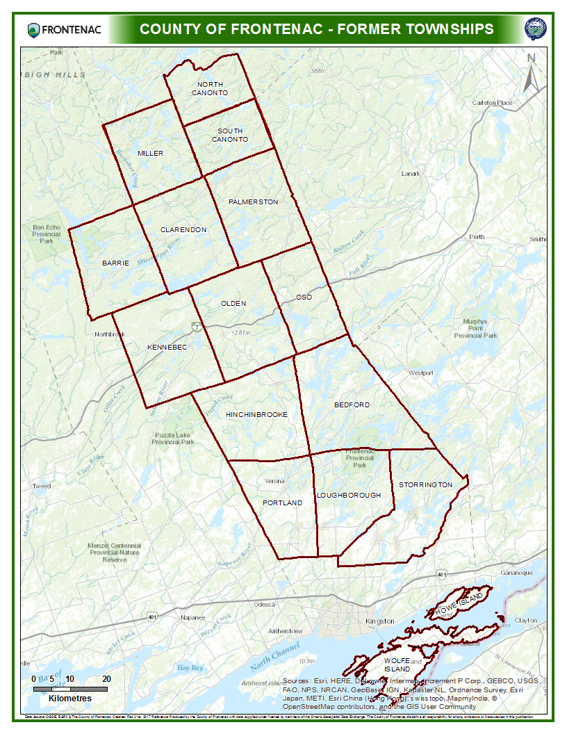
South Frontenac is a township in Frontenac County in eastern Ontario, Canada.[1] It was amalgamated in 1998 from the former townships of Bedford, Loughborough, Portland, and Storrington.[4]
South Frontenac | |
|---|---|
| Township of South Frontenac | |
County Road 5 between Harrowsmith and Sydenham | |
| Coordinates: 44°30′29″N 76°29′38″W[1] | |
| Country | Canada |
| Province | Ontario |
| County | Frontenac |
| Incorporated | 1998 |
| Government | |
| • Type | Township |
| • Mayor | Ron Vandewal [2] |
| • Councillors | List
|
| • Fed. & Prov. riding | Lanark—Frontenac—Lennox and Addington |
| Area | |
| • Land | 948.05 km2 (366.04 sq mi) |
| Population (2021)[3] | |
| • Total | 20,188 |
| • Density | 19.2/km2 (50/sq mi) |
| Time zone | UTC-5 (EST) |
| • Summer (DST) | UTC-4 (EDT) |
| Postal Code | K0H |
| Area code(s) | 613, 343 |
| Website | www |
The Holleford crater is located in the township near the community of Holleford.
- Battersea
- Bedford
- Bedford Mills
- Bellrock
- Bobs Lake
- Bradshaw
- Brewer Lake
- Buck Lake
- Burnt Hills
- Burridge
- Cedar Lake
- Cranstons Beach
- Davidsons Beach
- Desert Lake
- Fermoy 44°38′26″N 76°31′10″W
- Forest
- Glendower
- Harrowsmith
- Hartington
- Holleford 44.448°N 76.624°W / 44.448; -76.624
- Ida Hill 44.375°N 76.396°W / 44.375; -76.396
- Inverary
- Keelerville 44.471°N 76.348°W / 44.471; -76.348
- Lake Opinicon 44.536°N 76.366°W / 44.536; -76.366
- Latimer
- Lower Holleford
- Maple Hill 44.400°N 76.339°W / 44.400; -76.339
- Milburn
- Missouri
- Moons Corners
- Murvale
- Murvale Station
- Perth Road
- Petworth
- Railton 44.382°N 76.571°W / 44.382; -76.571
- Raymonds Corners 44.480°N 76.484°W / 44.480; -76.484
- Rosedale
- Salem
- Spaffordton
- Star Corners
- Sunbury
- Sydenham
- Verona 44°29′N 76°41′W
- Wilmer
In the 2021 Census of Population conducted by Statistics Canada, South Frontenac had a population of 20,188 living in 7,937 of its 9,503 total private dwellings, a change of 8.3% from its 2016 population of 18,646. With a land area of 948.05 km2 (366.04 sq mi), it had a population density of 21.3/km2 (55.2/sq mi) in 2021.[5]
| 2021 | 2016 | 2011 | |
|---|---|---|---|
| Population | 20,188 (+8.3% from 2016) | 18,646 (+2.9% from 2011) | 18,113 (-0.6% from 2006) |
| Land area | 984.05 km2 (379.94 sq mi) | 971.56 km2 (375.12 sq mi) | 971.68 km2 (375.17 sq mi) |
| Population density | 21.3/km2 (55/sq mi) | 19.2/km2 (50/sq mi) | 18.6/km2 (48/sq mi) |
| Median age | 48.8 (M: 48.4, F: 49.2) | 46.9 (M: 46.9, F: 46.9) | 44.7 (M: 44.6, F: 44.8) |
| Private dwellings | 9,503 (total) | 9,213 (total) | 8,836 (total) |
| Median household income | $104,000 | $89,457 | $81,664 |
According to the Canada 2021 Census:[11]
- Mother tongue:
- English as first language: 97.89%
- French as first language: 1.93%
- Other as first language: 0.18%
- John Babcock, the last Canadian World War I veteran, was born in South Frontenac.
- Mike Smith, professional goalie in the National Hockey League.
South Frontenac, along with Central Frontenac, North Frontenac and the Frontenac Islands, send students to schools part of the Limestone District School Board, based in neighbouring Kingston.
A village named Portland is located in Township of Rideau Lakes approximately 60 kilometres east of the former Portland township. It is unknown if the township and the village had any connections with the same name due to its close proximity. In 1998, Portland Township was amalgamated into South Frontenac.[14][15]
- "South Frontenac". Geographical Names Data Base. Natural Resources Canada. Retrieved 2016-12-19.
- "Township of South Frontenac Declaration of Election Results" (PDF). Township of South Frontenac. Retrieved 2018-12-17.
- "Census Profile, 2021 Census: South Frontenac, Township". 9 February 2022. Retrieved March 15, 2023.
- Restructured municipalities - Ontario map #5 (Map). Restructuring Maps of Ontario. Ontario Ministry of Municipal Affairs and Housing. 2006. Retrieved 2016-12-19.
- "Population and dwelling counts: Canada, provinces and territories, census divisions and census subdivisions (municipalities), Ontario". Statistics Canada. February 9, 2022. Retrieved April 2, 2022.
- "2021 Community Profiles". 2021 Canadian Census. Statistics Canada. February 4, 2022. Retrieved 2023-03-15.
- "2016 Community Profiles". 2016 Canadian Census. Statistics Canada. August 12, 2021. Retrieved 2019-06-13.
- "2011 Community Profiles". 2011 Canadian Census. Statistics Canada. March 21, 2019. Retrieved 2012-02-13.
- "2006 Community Profiles". 2006 Canadian Census. Statistics Canada. August 20, 2019.
- "2001 Community Profiles". 2001 Canadian Census. Statistics Canada. July 18, 2021.
- Statistics Canada 2021 Census - (accessed March 15, 2023)
- "South Frontenac census profile". 2011 Census of Population. Statistics Canada. Retrieved 2012-02-13.
Other map sources:
- Map 6 (PDF) (Map). 1 : 700,000. Official road map of Ontario. Ministry of Transportation of Ontario. 2016-01-01. Retrieved 2016-12-19.