2014_Cattle_grid_Swaledale.jpg

Size of this preview:
800 × 533 pixels
.
Other resolutions:
320 × 213 pixels
|
640 × 427 pixels
|
1,024 × 683 pixels
|
1,280 × 853 pixels
|
2,560 × 1,707 pixels
|
4,132 × 2,755 pixels
.
| Description |
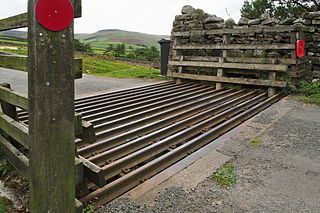
English:
Cattle grid in a country road in Swaledale
Deutsch:
Viehgitter auf einer Landstraße in Swaledale
|
|||||||||
| Date | ||||||||||
| Source | Own work | |||||||||
| Author | Kreuzschnabel | |||||||||
|
Permission
( Reusing this file ) |
I, the copyright holder of this work, hereby publish it under the following license:
This file is licensed under the
Creative Commons
Attribution-Share Alike 3.0 Unported
license.
|


| Camera location |
|
View this and other nearby images on: OpenStreetMap |
|
|---|
|
|
This image has been assessed using the
Quality image guidelines
and is considered a
Quality image
.
|