A_new_accurate_map_of_the_provinces_of_North_&_South_Carolina,_Georgia,_Florida,_and_Louisiana_in_1752.jpg

Size of this preview:
743 × 600 pixels
.
Other resolutions:
298 × 240 pixels
|
595 × 480 pixels
|
952 × 768 pixels
|
1,269 × 1,024 pixels
|
1,466 × 1,183 pixels
.
Summary
| Description |
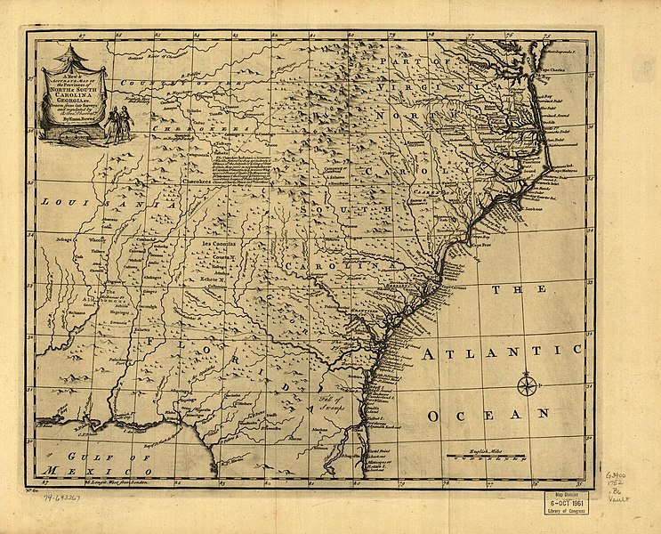
English:
Scale ca. 1:2,900,000. Relief shown pictorially. "No. 60." From the author (Bowen, Emanuel, -1767): A complete atlas or distinct view of the known world. [London, 1752]
|
| Date | |
| Source |
U.S. Library of Congress https://www.loc.gov/resource/g3900.np000148/?r=0.065,0.271,0.574,0.202,0 |
| Author |
Bowen, Emanuel, -1767. Courtesy of Library of Congress, Geography and Map Division. |
Licensing
|
|
This work is in the public domain in its country of origin and other countries and areas where the copyright term is the author's life plus 70 years or fewer . This work is in the public domain in the United States because it was published (or registered with the U.S. Copyright Office ) before January 1, 1929. |
| This file has been identified as being free of known restrictions under copyright law, including all related and neighboring rights. | |