AbombOperationSandstoneApril1948.png
Size of this preview:
377 × 599 pixels
.
Other resolutions:
151 × 240 pixels
|
453 × 720 pixels
.
Summary
| Description |
English:
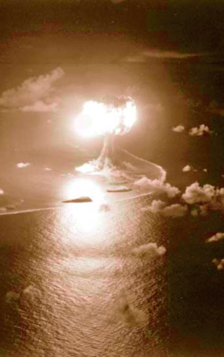
A-bomb-test Operation Sandstone, Event X-Ray detonation, April 15, 1948, Engebi, Eniwetok-Atoll
Deutsch:
Operation Sandstone - X-Ray (Explosionshöhe: 61 Meter; 37 kt) Das Luftbild wurde aus etwa 500 Metern Höhe aufgenommen, der gekrümmte Rand der Lagune ist vor der Insel Engebi zu erkennen
|
| Date | |
| Source | Former Defenses Nuclear Agency (DNA) |
| Author | U.S. Air Force 1352nd Photographic Group, Lookout Mountain Station |
Licensing
|
|
This image is a work of a
U.S. military
or
Department of Defense
employee, taken or made as part of that person's official duties. As a
work
of the
U.S. federal government
, the image is in the
public domain
in the United States.
|

|