Arabische_Eroberung_2.jpg

Size of this preview:
800 × 506 pixels
.
Other resolutions:
320 × 202 pixels
|
640 × 404 pixels
|
1,024 × 647 pixels
|
1,280 × 809 pixels
|
2,560 × 1,618 pixels
|
4,496 × 2,841 pixels
.
Summary
| Description |
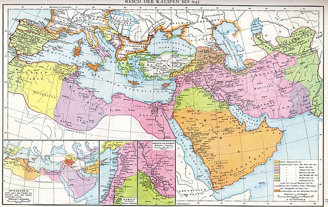
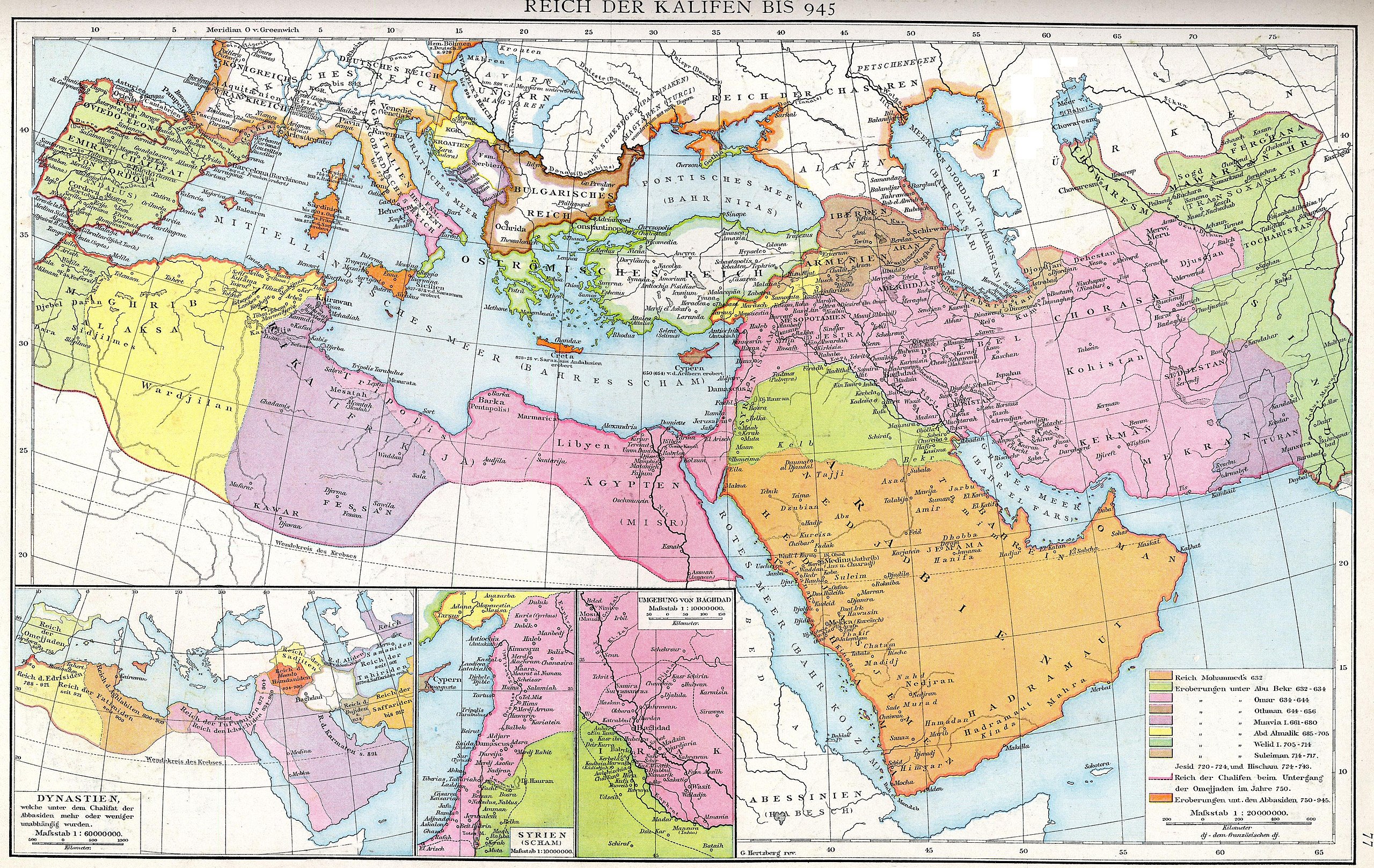
Deutsch:
Das Reich der Kalifen bis 945. Karte aus dem Historischen Handatlas von Gustav Droysen, 1886
English:
The empire of the Caliphs to 945. Map of the Historical Atlas of Gustav Droysen, 1886
|
| Date | |
| Source | Gustav Droysens Allgemeiner historischer Handatlas in 96 Karten mit erläuterndem Text Bielefeld [u.a.]: Velhagen & Klasing 1886, S. 77. |
| Author | Johann Gustav Droysen (6 July 1808 – 19 June 1884) |
| Other versions |
Derivative works of this file: |
.jpg)
Licensing
|
|
This work is in the public domain in its country of origin and other countries and areas where the copyright term is the author's life plus 100 years or fewer . This work is in the public domain in the United States because it was published (or registered with the U.S. Copyright Office ) before January 1, 1929. |
| This file has been identified as being free of known restrictions under copyright law, including all related and neighboring rights. | |