Arctic.svg

Size of this PNG preview of this SVG file:
478 × 599 pixels
.
Other resolutions:
191 × 240 pixels
|
383 × 480 pixels
|
613 × 768 pixels
|
817 × 1,024 pixels
|
1,634 × 2,048 pixels
|
505 × 633 pixels
.
Summary
| Description |
English:
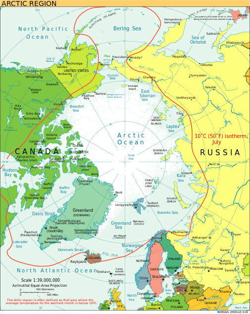
A view of the Arctic. The 10 °C (50 °F) mean isotherm in July line, displayed red, is commonly used to define the border of the Arctic region.
|
| Date | February 2013 (original upload date) |
| Source | CIA World Factbook |
| Author | CIA World Factbook |
| Other versions |
[
]
|


.svg)


|
This SVG file contains embedded text that can be translated into your language, using any capable SVG editor, text editor or the SVG Translate tool . For more information see: About translating SVG files . |
Licensing
|
|
This image is in the
public domain
because it contains materials that originally came from the United States
Central Intelligence Agency
's
World Factbook
.
|

|